Isla Tenglo: boat crossing from Angelmó
Odhod: Caleta Angelmó pier, in Puerto Montt Local fishermen's boat and hike Približno 2 uri Dopoldne ali popoldne easy to moderate (steep ascent)
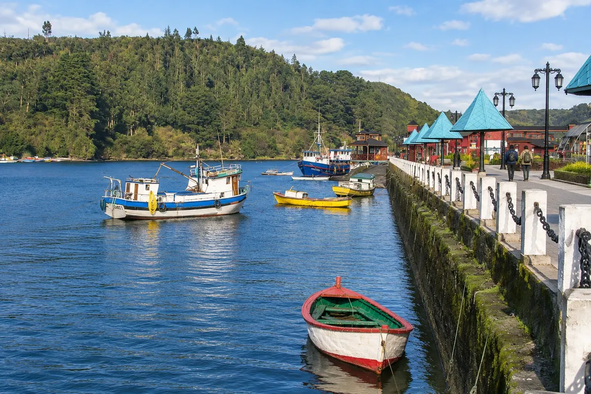
Isla Tenglo lies opposite Puerto Montt, across the channel that shelters Caleta Angelmó. Boats depart from a small pier at the entrance to the Angelmó market: wooden chalanas, many rowed, used by island residents and visitors, and the crossing takes about 8 minutes. From the boat you can see the port, the waterfront road and the stilted restaurants of Angelmó. On the island, the path along the channel leads to La Puntilla, a sheltered volcanic-sand beach with a small fishing community and colorful boats. The highlight is the hill crowned by a large cross, lit at night and visible from the city. The trail up is steep and takes about 20 minutes. From the top, on a clear day, you can see the Osorno, Puntiagudo and Calbuco volcanoes on the horizon, with Puerto Montt’s waterfront buildings in the foreground. The island’s south coast has rougher trails for experienced visitors.
Kraji na poti: Caleta Angelmó, Isla Tenglo, La Puntilla, Cross of Isla Tenglo.
Vključuje: The boat crossing is paid separately, directly to the boatmen. There are no services on the island.
Nasvet: Go during the day and bring water and a snack. Wear shoes with good grip for the climb to the cross. Arrange your return time with the boatman before disembarking.
Najboljši čas za obisk: From October to April, with less rain and longer days. Avoid days with strong wind.
Alerce Andino National Park: trails among millenary alerces
Odhod: Puerto Montt Rental car or tour; rural buses to the entrances Približno 6 ur Ves dan Lahka do srednje zahtevna pot
Alerce Andino National Park, created in 1982, protects 393 km² of mountains, about 50 lakes and lagoons, and alerce forests—the native tree of southern Chile that can live more than 3,000 years and exceed 50 m in height. The park has two entrances. The northern one, at the Correntoso sector, is about 46 km from Puerto Montt: take Ruta 7 toward Chamiza and then the V-65 road, beside Lago Chapo. From there an internal road continues to the Sargazo sector, where the most popular trails are located: Los Ulmos, a short loop of about 30 minutes; Laguna Sargazo, roughly 1.5 hours round trip to a mountain lagoon; and Alerce Milenario, about 50 minutes round trip to an alerce of around 2,500 years. In Correntoso is the Huillifoten trail, about 1 hour. The southern entrance, at the Chaica sector, leaves from Lenca on the Carretera Austral, about 36 km from Puerto Montt, with a final unpaved stretch. There are the El Encanto, Los Canelos and Salto Río Chaica trails, which lead to a waterfall and to alerces nearly 3,000 years old. The trail to the Chaiquenes and Triángulo lagoons, the longest, opens only in summer and requires crossing the Río La Plata on foot, without a bridge.
Kraji na poti: Alerce Andino National Park, Correntoso, Sargazo, Laguna Sargazo, Chaica, Lenca, Lago Chapo.
Vključuje: Self-guided or with an operator. Park admission is paid separately; check the current rate table.
Nasvet: Buy the ticket in advance online through CONAF’s park pass system and arrive early: the last entry is in the early afternoon. Bring a raincoat, boots and food, as services are limited. For higher internal roads, a vehicle with traction helps.
Najboljši čas za obisk: From November to March, with less rain. The trail to the Chaiquenes and Triángulo lagoons opens only in summer.
Cochamó and the Reloncaví Estuary
Odhod: Puerto Varas Rented car or tour, via Ruta 225 and via V-69 about 9 hours Ves dan Lahko
The Reloncaví Estuary is a sea inlet that reaches between the mountains southeast of Puerto Varas, with forested slopes descending to the water. From Puerto Varas, follow Ruta 225 along the shore of Lago Llanquihue to Ensenada and, a few kilometers later, take the turnoff to Ralún and Cochamó, the V-69 road. In Ralún, a bridge crosses the point where the Río Petrohué empties into the estuary. From there to the village of Cochamó is about 17 km on a narrow, winding road with views of the water and the mountains. Cochamó is a fishing and farming village on the east bank of the estuary. From the village, a dirt road of about 6 km leads to the visitor center and the start of the trails into the Valle de Cochamó, a granite-walled valley sought by climbers; the hike to the valley takes several days and is not part of this outing. Along the way there are hot springs on the estuary shore, with outdoor pools amid a stand of arrayanes. The drive from Puerto Varas to Cochamó takes about 2 hours by car.
Kraji na poti: Ensenada, Ralún, Reloncaví Estuary, Cochamó, Río Petrohué, Valle de Cochamó.
Vključuje: Self-guided or with an operator. Hot springs, parking and meals are paid separately. Check the current price table.
Nasvet: Leave early and refuel beforehand: services along the road are few and cellphone signal is weak. Access to the Valle de Cochamó trails closes in the early afternoon. Bring waterproof clothing.
Najboljši čas za obisk: From November to March, with less rain and longer days.
Pucón and Lake Villarrica
Odhod: Pucón town center Samostojno peš Približno 3 ure Popoldne Lahko
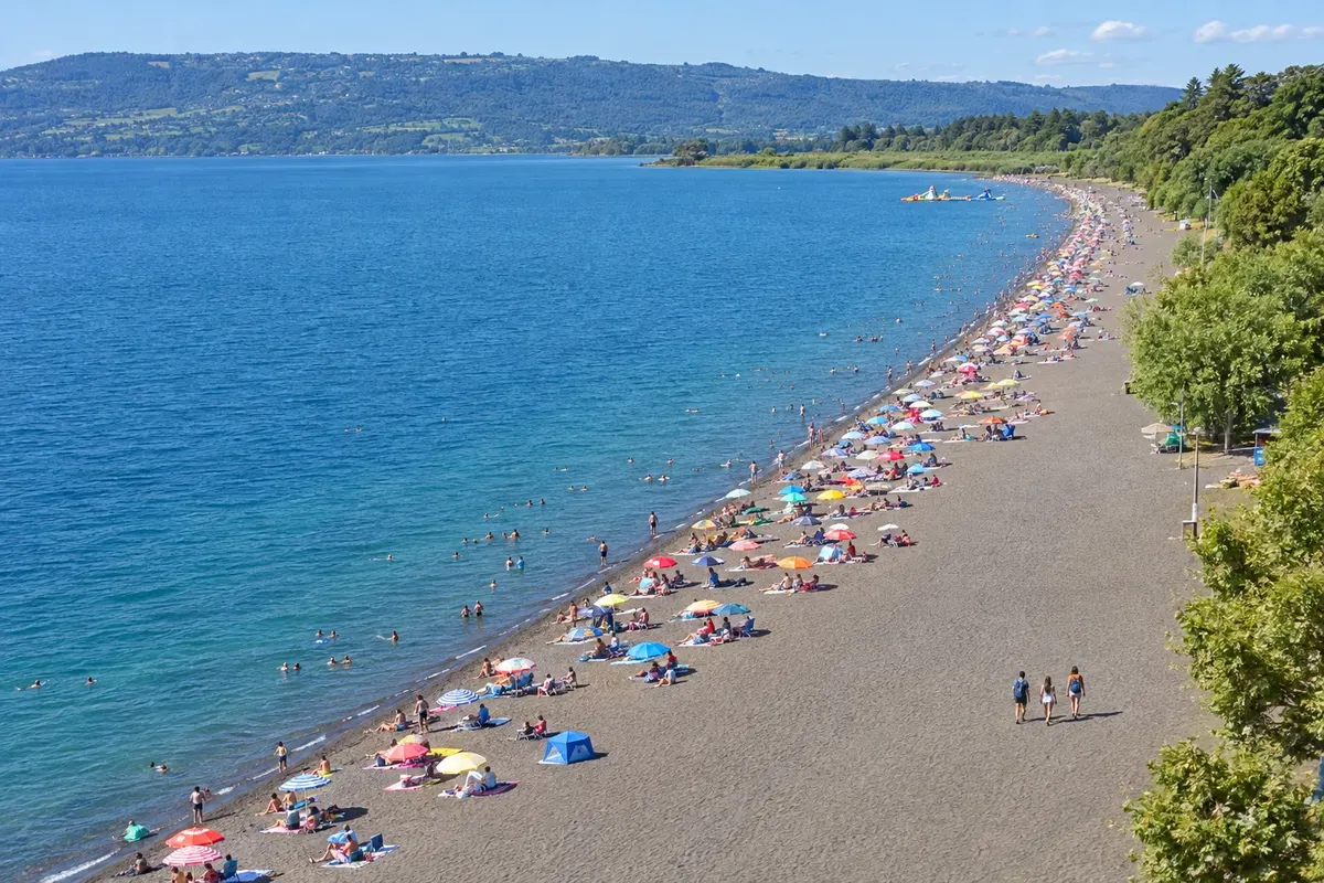
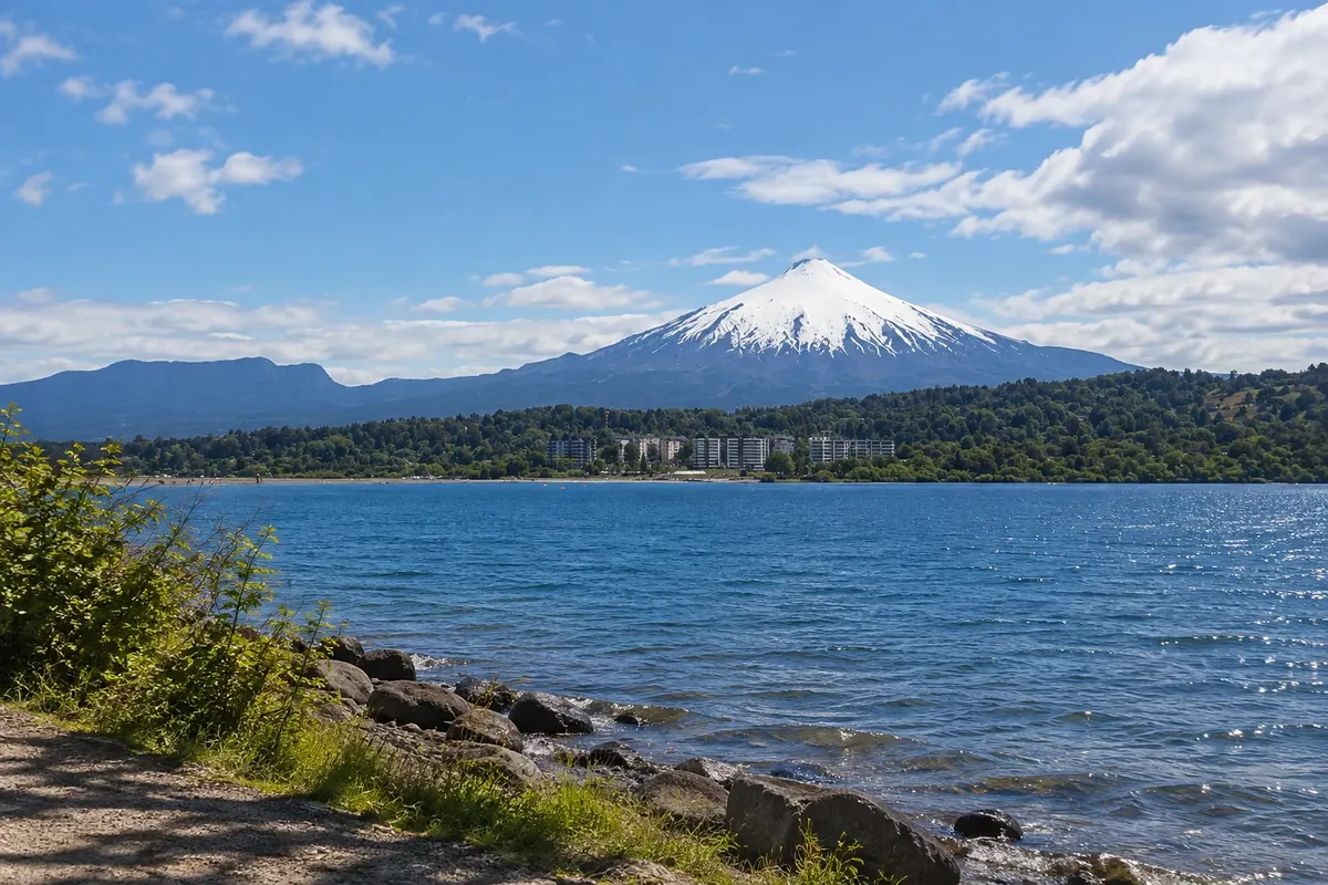
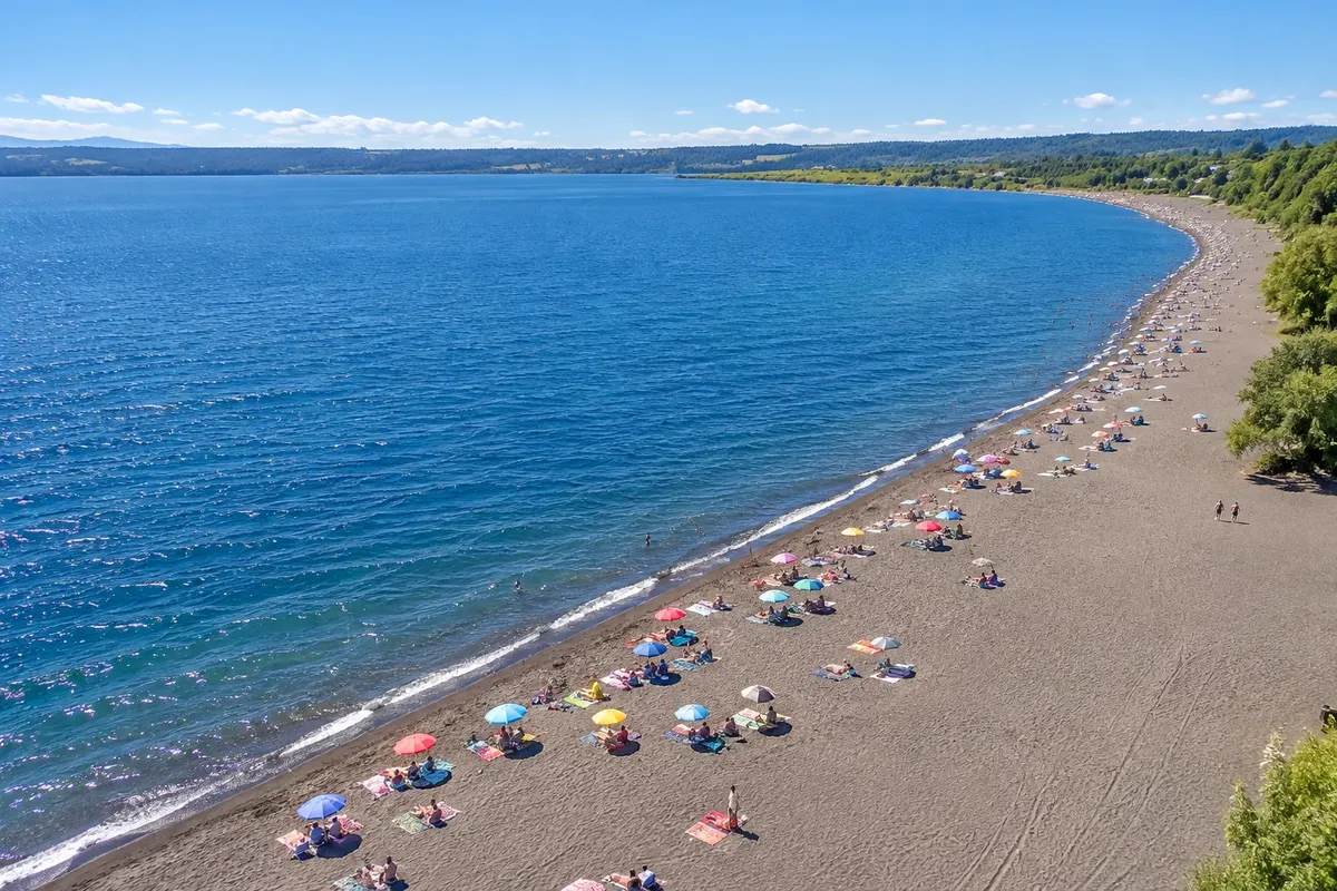
Pucón lies on the east shore of Lake Villarrica, in the Araucanía Region, about 100 km from Temuco. The lake was called Mallalafquén before the arrival of the Spanish; on the west shore is the town of Villarrica. South of Pucón, about 17 km away, is Volcán Villarrica, a snow-capped cone of roughly 2,850 m, one of Chile’s most active volcanoes, which often emits a column of smoke visible from town. Pucón is the base for the region’s adventure sports: trekking, rafting, kayaking, horseback riding, hot springs and, in winter, snow on the volcano’s slope. The walk around town starts in the center, with shops and cafés in wooden houses, and continues to the lakeshore. Playa Grande is the dark-sand beach of volcanic origin next to the center, with the volcano in the background. On the other side of the peninsula is La Poza, a sheltered cove with the pier where boats and kayaks depart. In summer the lake attracts sailors, water-skiers and swimmers.
Kraji na poti: Pucón, Lake Villarrica, Playa Grande, La Poza, Volcán Villarrica.
Vključuje: Self-guided outing. Boats, kayaks and equipment rentals at the lakeshore are paid separately.
Nasvet: Late afternoon is the time to view the volcano from Playa Grande. The lake water is cold even in summer. In January and February the town gets crowded; book tours in advance.
Najboljši čas za obisk: From December to March for the beach and lake sports; in winter, for the snow on the volcano’s slope and the hot springs.
Ascent of Volcán Villarrica with a guide
Odhod: Pucón Guided excursion with an authorized agency (mandatory) around 10 hours Ves dan difficult (requires good physical fitness)
The Villarrica Volcano, at about 2,850 m, lies within Villarrica National Park, roughly 17 km south of Pucón. It is one of Chile’s most active volcanoes, and its crater contains an intermittent lava lake, one of the few known in the world. The ascent is done only with a tour agency and a mountain guide. The day starts early, with transport from Pucón to the base of the climb at the north slope ski-area. From there the ascent is on foot, over snow and ice, using crampons and an ice axe, in several hours of continuous hiking. From the summit, on a clear day, you can see other regional volcanoes such as Lanín and Quetrupillán, and Lake Villarrica. The descent is usually faster. The ascent is not guaranteed: it depends on the volcanic alert level set by Sernageomin, CONAF rules and the weather, and access to the crater is often restricted or suspended. When the volcano is on alert, agencies may offer only hikes to lower points on the slope.
Kraji na poti: Villarrica Volcano, Villarrica National Park, Pucón.
Vključuje: Generally: transport, mountain guide, clothing and technical equipment (helmet, crampons, ice axe). The park entrance fee is paid separately with some operators. Check the current table.
Nasvet: Book with extra days in Pucón, because the departure can be postponed due to weather or volcanic activity. Ask the agency about the alert level before paying. Bring sunscreen, sunglasses and water.
Najboljši čas za obisk: From December to March, when guided ascents usually take place, always subject to volcanic alert level and weather.
Huerquehue National Park: Los Lagos trail among araucarias
Odhod: Pucón Car, tour or local bus to Lago Tinquilco about 8 hours Ves dan moderate (steep climb at the start)
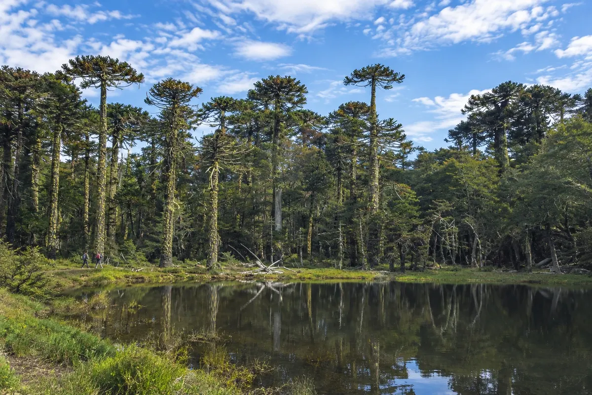
Huerquehue National Park, created in 1967, protects about 12,500 ha of mountains between 720 m and 2,000 m in elevation, with lakes and araucaria forests, the emblematic tree of the Araucanía. It is about 35 km from Pucón, via the Caburgua road and a turn with a final stretch of gravel, roughly a 1-hour drive. The main entrance is beyond Lago Tinquilco, visible from the road. The Los Lagos trail, also called Tres Lagos, is the most popular. It starts at the park gate, climbs through coigüe forest with a steep ascent at the beginning and passes the Nido de Águila and Trufulco waterfalls. At about 1,320 m altitude it reaches Lago Chico, where araucarias begin to appear. From there it continues along a flatter section to Lago Toro and Lago Verde, surrounded by araucaria woodland, with viewpoints to Volcán Villarrica. The route is about 8 km from the gate, and the return is the same way, which takes the whole day. More distant lagoons, such as Huerquehue and Los Patos, are in areas with more difficult access.
Kraji na poti: Huerquehue National Park, Lago Tinquilco, Nido de Águila Waterfall, Lago Chico, Lago Toro, Lago Verde.
Vključuje: Self-guided or with an operator. The park entrance fee is paid separately and must be purchased online in advance. Check the current fee schedule.
Nasvet: Leave early from Pucón: local buses have few departures in the morning. Bring trekking footwear, layered clothing, a rain jacket, water and food; there are no services on the trail.
Najboljši čas za obisk: From November to April, with drier trails. In winter there may be snow at higher elevations and some sections closed.
Ojos del Caburgua: blue pools and waterfalls
Odhod: Pucón Car, bicycle, local bus or tour Približno 2 uri Dopoldne ali popoldne Lahko
The Ojos del Caburgua are pools and small waterfalls of intense blue water in native forest, about 4 km south of Lago Caburgua. The water comes from the lake itself, which drains through an underground channel and reappears there among the rocks. From Pucón, follow about 18 km on the road to Caburgua and, at the stop known as El Cristo, take the roughly 2 km turnoff to the entrance. A short trail with boardwalks and viewpoints circles the pools and falls. The visit is usually brief and often combined on the same day with Lago Caburgua, the hot springs in the Río Liucura valley, or the route to Huerquehue National Park. You can also go by bicycle along the same road.
Kraji na poti: Ojos del Caburgua, Lago Caburgua, Pucón.
Vključuje: Self-guided visit. Entrance may be charged; check the current fee.
Nasvet: Arrive early in summer, when the place gets crowded. The rocks near the water are slippery: wear closed shoes. Swimming in the pools is not recommended.
Najboljši čas za obisk: Year-round. In winter, with more rain, the flows are stronger.
Hot springs near Pucón: Termas Los Pozones and Termas de Huife
Odhod: Pucón Car, local bus or tour transfer Približno 5 ur afternoon and evening Lahko
The Río Liucura valley, northeast of Pucón, hosts several hot springs of volcanic origin. Two are the most well known and lie about 35 km from Pucón via the S-905 road and the paved turnoff to Huife. Termas Los Pozones are the rustic model: outdoor stone pools on the bank of the Río Liucura, with water between 20 °C and 40 °C depending on the pool, and simple changing rooms. Entry is by timed slots of a few hours, and the place operates into the evening. From the parking lot or bus stop there is a short walk down to the pools. Termas de Huife, a little earlier, are a full-service complex: three outdoor pools with water between 38 °C and 40 °C, also on the river bank, a semi-covered hydrotherapy pool, a restaurant and a trail through native forest. Both are often included in excursions that also visit the Ojos del Caburgua.
Kraji na poti: Termas Los Pozones, Termas de Huife, Río Liucura, Pucón.
Vključuje: The hot springs entrance is paid separately, per time slot or per day. On excursions, generally: transport from Pucón. Check the current rates table.
Nasvet: Bring swimwear, a towel, sandals and a change of clothes. At Los Pozones, arrive at the start of your time slot. From Pucón there are buses to the Huife area departing from the Pullman Bus terminal.
Najboljši čas za obisk: All year. In winter, with cold and rain, the hot water is especially appealing; in summer, time slots fill up.
Rafting on the Río Trancura
Odhod: Pucón Rafting tour with an operator Približno 4 ure Dopoldne ali popoldne moderate to difficult, depending on the section
The Trancura River descends from the Andes near Pucón, at the foot of Volcán Villarrica, and is the region’s rafting river. There are two sections. Trancura Bajo, with class III rapids, is the route for beginners and families: the van leaves Pucón along the Caburgua road to the launch point, about 15 km away, and the run covers roughly 13 km of river in about 1 hour 15 minutes. The entire trip, including safety instruction, changing facilities and transport, takes about 4 hours. Trancura Alto has class IV and V rapids, bigger waves and stronger drops, including the well-known Salto de Mariman and Último Suspiro, and is recommended for those with prior experience. The rafts go down with guides, and safety kayaks accompany the group.
Kraji na poti: Río Trancura, Pucón.
Vključuje: Generally: transport from Pucón, full rafting equipment (wetsuit, vest, helmet), safety briefing and guide. Check the current table.
Nasvet: Bring swimwear, a towel and a change of clothes. On Trancura Bajo the minimum age is usually 8 years; on Alto it is higher. Check with the operator.
Najboljši čas za obisk: From October to May. In winter, with heavy rains, normal departures are often suspended.


 Brazilija
 Antarktika
 Argentina
 Bolivija
 Kolumbija
 Ekvator
 Gvajana
 Francoska Gvajana
 Falklandski otoki (Malvini)
 Paragvaj
 Peru
 Surinam
 Urugvaj
 Venezuela
 Nemčija
 Avstrija
 Belgija
 Hrvaška
 Danska
 Slovaška
 Slovenija
 Španija
 Finska
 Francija
 Grčija
 Nizozemska
 Madžarska
 Irska
 Islandija
 Italija
 Luksemburg
 Norveška
 Poljska
 Portugalska
 Združeno kraljestvo
 Češka
 Švedska
 Švica
 Turčija
 Bermudi
 Kanada
 Združene države Amerike
 Grenlandija
 Mehika
 Sveta Peter in Mihael
 Dominikanska republika
 Japonska
 Južnoafriška republika
 Egipt
 Avstralija
 Fidži
 Nova Zelandija
 Papua Nova Gvineja