Christ of Concordia
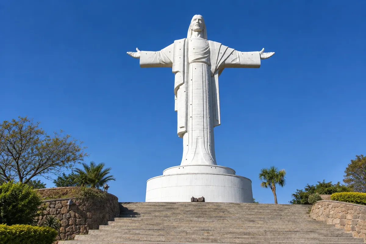
Statue of Christ atop Cerro San Pedro, east of the center, completed in 1994. With its pedestal it exceeds 39 meters in height, at about 2,840 meters altitude. You can reach it by cable car or by staircase.
Antarktika
Cochabamba · Bolivija
City in Bolivia’s central valley, with mild weather year-round, the Cristo de la Concordia on Cerro San Pedro, Plaza 14 de Septiembre and the large La Cancha market.
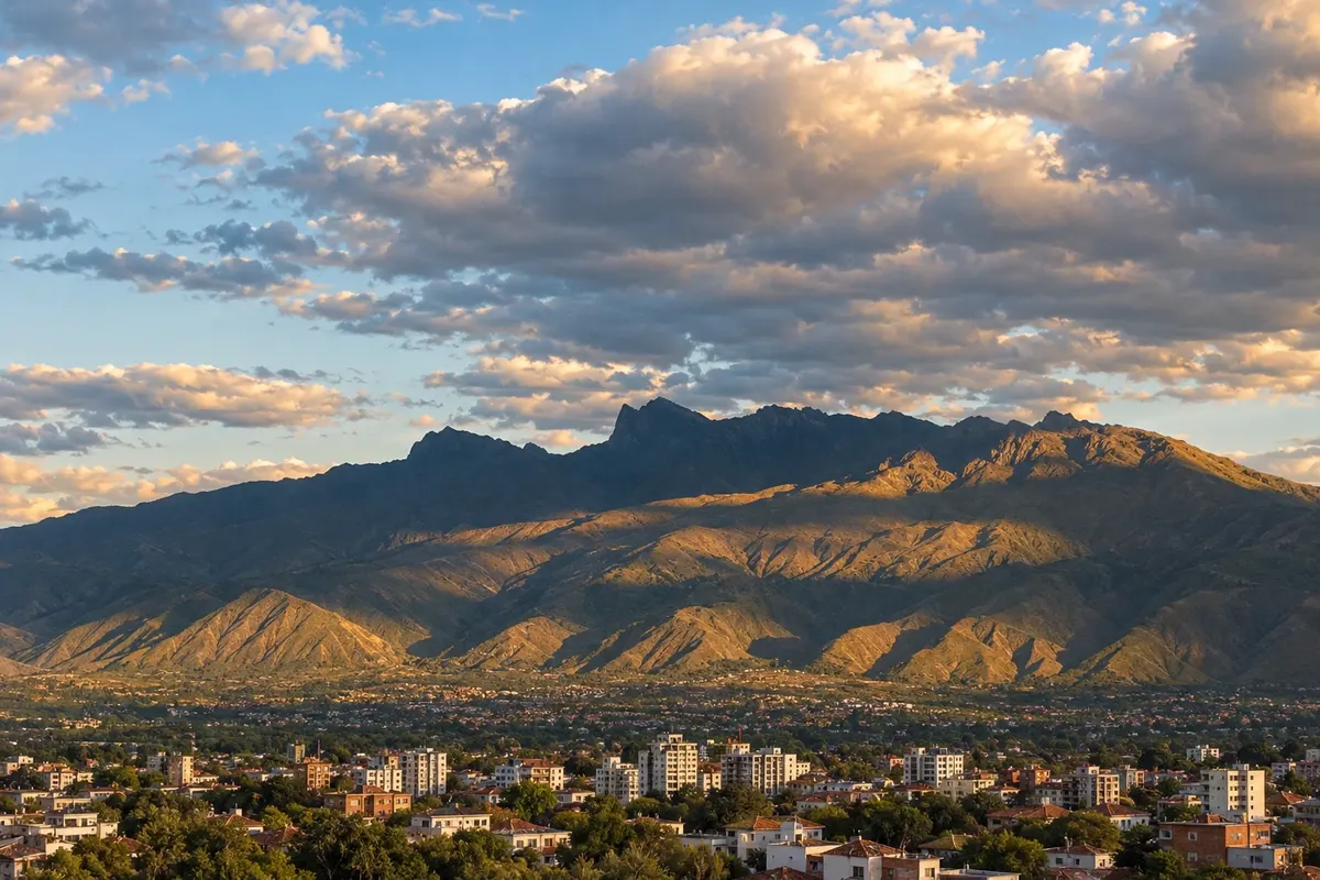
Na fotografiji: Cochabamba valley and Tunari range.
Illustrative images. The pictures in this guide are illustrations based on the real place, not photographs, and may differ from it.
Spoznajte kraj
Cochabamba lies in a wide, fertile valley in central Bolivia, at about 2,570 meters altitude, between the high plateau of La Paz and the lowlands of Santa Cruz. The dry, mild climate for much of the year earned the city the nickname “city of eternal spring.” To the north, the mountains of the Tunari range close the horizon.
The city was founded in 1571 as Villa de Oropesa and refounded in 1574. The historic center is organized around Plaza 14 de Septiembre, which recalls the 1810 uprising, with the metropolitan cathedral and arcaded galleries. A few blocks away are other colonial-period churches.
At the top of Cerro San Pedro, east of the center, the Cristo de la Concordia dominates the landscape. Completed in 1994, the statue is over 30 meters high and can be reached by cable car or by stairs. To the north, in the Queru Queru neighborhood, Palacio Portales shows the house the tin magnate Simón I. Patiño commissioned in the 1920s.
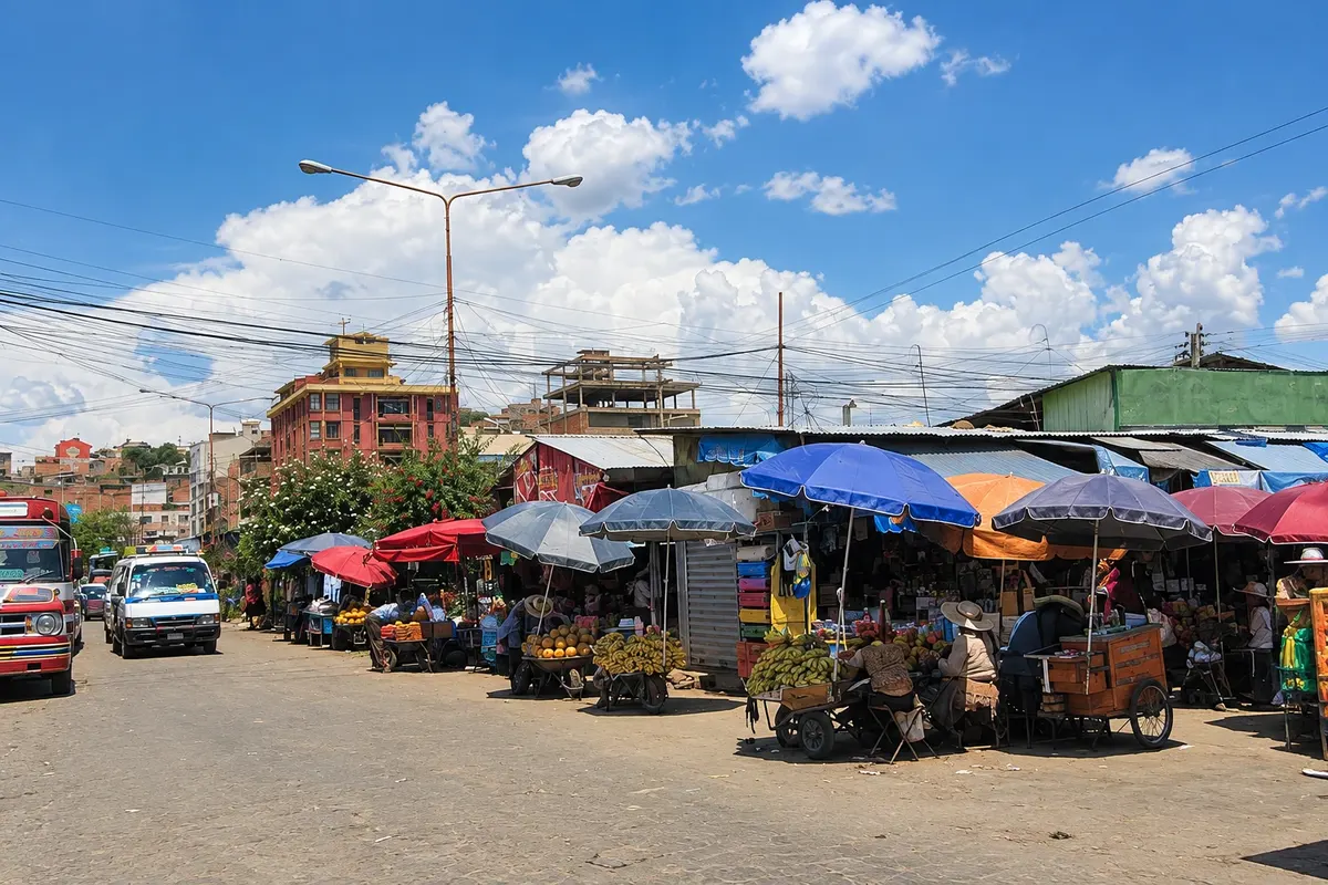
Cochabamba is known nationwide for hearty food and large portions. It is the birthplace of pique macho and silpancho, and the La Cancha market, south of the center, brings together food stalls, handicrafts and clothing in one neighborhood.

V vodniku še ni nastanitev – Cochabamba.
kako do tja · koliko dni · načrt poti · vprašanja
✈ Aeropuerto Internacional Jorge Wilstermann (CBB)· 4 km do cilja (Cochabamba)
Jorge Wilstermann International Airport (CBB) is about 4 km from the center and handles domestic flights from La Paz, Santa Cruz and other cities. Long‑distance buses connect the city with the country’s main cities. Confirm schedules and connections before traveling.
Doživite kraj
Statue of Christ atop Cerro San Pedro, east of the center, completed in 1994. With its pedestal it exceeds 39 meters in height, at about 2,840 meters altitude. You can reach it by cable car or by staircase.
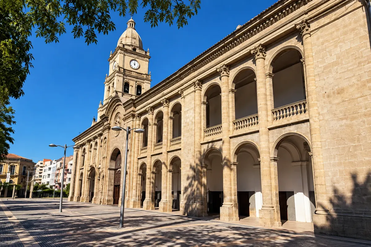
Cathedral on Plaza 14 de Septiembre, the heart of the historic center. The current building dates from the early 18th century, built over a 16th-century church, with a baroque façade featuring Solomonic columns.
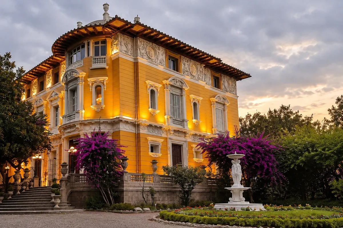
House built from 1915 to 1927 for tin magnate Simón I. Patiño, who never lived there. It contains materials brought from Europe and gardens with statues. It houses a cultural center of the Patiño Foundation.
Large market area south of downtown Cochabamba, with stalls selling food, fruits from the valley, clothing, crafts and household items. It operates every day and gets even busier on Wednesdays and Saturdays.
Pred odhodom
Cochabamba – Cochabamba Capital
Razdalje so približne. Pred potovanjem preverite lete in vozne rede avtobusov, vlakov ali ladij.
Jorge Wilstermann International Airport (CBB) is about 4 km from the center, with domestic flights from La Paz, Santa Cruz and other cities. Long‑distance buses connect Cochabamba with the country’s main cities. Taxis and minibuses run between the airport and the center. Confirm schedules before traveling.
Two days cover the historic center, the climb to the Cristo de la Concordia, Palacio Portales and a morning at La Cancha. With three days you’ll have time for museums and an evening walk along Avenida Ballivián, El Prado.
From May to October, the dry season, days are usually sunny with cool nights between June and August. Rain falls from November to March, heavier from December to February. In September the city celebrates 14 de Septiembre.
The seasons shown are the most usual ones; nature doesn't always follow the calendar.
No. The center is walkable, and taxis and minibuses connect the neighborhoods, the Cristo cable car and Palacio Portales. For the valley and Torotoro, it’s more practical to hire a tour or a car with a driver.
Predlog poti
Pot povezuje znamenitosti na tej strani. Za oglede boste imeli dovolj časa.
Start at Plaza 14 de Septiembre, with its arcaded galleries and the column topped by a condor in the center. Enter the metropolitan cathedral, with its baroque façade, and walk the nearby streets to the colonial churches in the center.
Head north to the Queru Queru neighborhood and take the guided tour of Palacio Portales, the house Simón I. Patiño commissioned and never lived in. Afterwards, stroll the gardens with their statues. Confirm visiting hours before you go.
Take the cable car up Cerro San Pedro to see the valley from above, at the feet of the Cristo de la Concordia. The view reaches the city center, the Alalay lagoon, and the Tunari mountain range to the north.
Return to Avenida Ballivián, the Prado, and look for a Cochabamba restaurant to try pique macho or silpancho, the two dishes that originated in the city.
Check before you go. Opening hours and days change, and places may close for renovations, holidays or events. This itinerary is a suggestion from Cidade Turismo, not a commitment: plan yours by checking directly with each place you intend to visit.
Pred odhodom
In the morning, Plaza 14 de Septiembre and the cathedral; in the afternoon, a guided visit to Palacio Portales; at the end of the day, the cable car up to the Cristo de la Concordia to see the valley from above. At night, a dinner of the city's typical food.
Because of the mild climate of the valley, at about 2,570 meters altitude. Temperatures vary little throughout the year and the dry season, from May to October, has sunny days. On winter nights, from June to August, it gets cool.
The city is known for its hearty food. Pique macho and silpancho originated here, and chicharrón and chicha are also part of the local tradition. La Cancha market is a good place to see the variety of products from the valley.
By cable car from the base of Cerro San Pedro, east of the center, or on foot via a long staircase. There is also a road up to the top. Check the cable car schedules before you go.
At La Cancha market, south of the center. The handicraft stalls are mainly in the La Pampa and San Antonio sectors, alongside textiles, clothing, musical instruments, and kitchenware.
Pred odhodom
Z nekaj načrtovanja boste imeli več časa za uživanje na poti.
From May to October rain is scarce and days are usually sunny, with cooler nights between June and August. The rainy season runs from November to March, with more precipitation between December and February. In September the city celebrates 14 de Septiembre, the date of the 1810 uprising.
The seasons shown are the most usual ones; nature doesn't always follow the calendar.
Two days allow you to see the historic center, go up to the Cristo de la Concordia, visit Palacio Portales and spend a morning at La Cancha. With more time, the city serves as a base for excursions around the valley and for the trip to Torotoro National Park, which requires at least two more days.
The center, around Plaza 14 de Septiembre, puts the churches, museums and La Cancha within walking distance or a short ride. To the north, the residential neighborhoods of Queru Queru and La Recoleta are near Palacio Portales and have many restaurants. Avenida Ballivián, known as El Prado, connects the two areas.
Odnesite svoje odpadke, upoštevajte oznake in podprite lokalne ponudnike. V naravi upoštevajte navodila za obiskovalce.
Odgovori na vaša vprašanja
Two days are usually enough for the historic center, the Cristo de la Concordia, Palacio Portales and the La Cancha market. If you want to visit Torotoro National Park you should add at least two days, since the outbound trip takes several hours.
From May to October, the dry season, days are usually sunny and rain is rare. From November to March is the rainy season, stronger between December and February. Temperatures are mild year‑round, with cool nights in winter, from June to August.
The city sits at about 2,570 meters, well below La Paz and Oruro. Many travelers feel little or no effect, but if you arrive from sea level you should take it easy on the first day, drink water and avoid intense exertion, especially when climbing to the Cristo.
Not for the city. The center is walkable, and taxis and minibuses connect the neighborhoods. For tours around the valley and to Torotoro, it’s more practical to hire a tour or a car with a driver.
Yes. Torotoro National Park, known for dinosaur footprints, canyons and caves, is in the department of Potosí, about 140 km by road. The trip takes several hours and the visit requires at least two days. Check road conditions before you set out, especially in the rainy season.
Več kot vodnik