History
Jesuit-Guaraní Mission of Santa Ana
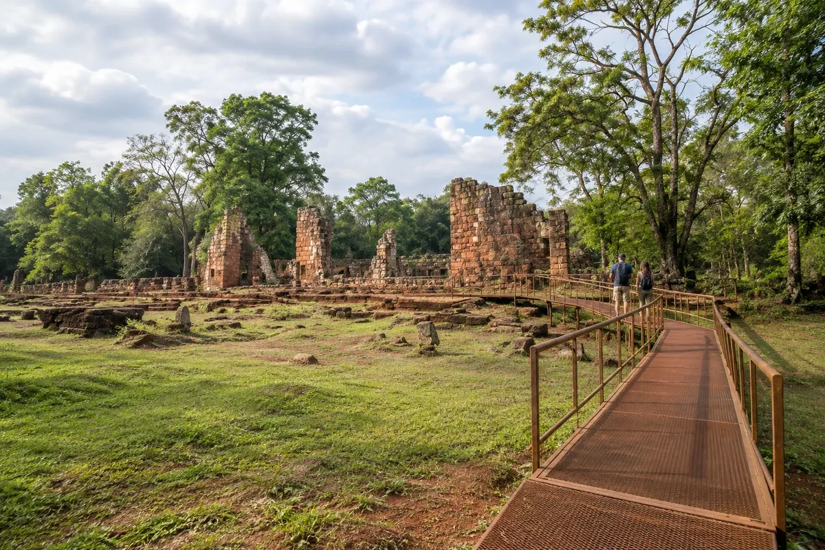
Ruins of the temple and its semicircular stairway, the old garden, walls and water structures, linked by trails in the Conjunto Jesuítico Guaraní de Santa Ana.

 Išči
 Brazilija
 AntarktikaArgentina
 Bolivija
 Čile
 Kolumbija
 Ekvator
 Gvajana
 Francoska Gvajana
 Falklandski otoki (Malvini)
 Paragvaj
 Peru
 Surinam
 Urugvaj
 Venezuela
 Nemčija
 Avstrija
 Belgija
 Hrvaška
 Danska
 Slovaška
 Slovenija
 Španija
 Finska
 Francija
 Grčija
 Nizozemska
 Madžarska
 Irska
 Islandija
 Italija
 Luksemburg
 Norveška
 Poljska
 Portugalska
 Združeno kraljestvo
 Češka
 Švedska
 Švica
 Turčija
 Bermudi
 Kanada
 Združene države Amerike
 Grenlandija
 Mehika
 Sveta Peter in Mihael
 Dominikanska republika
 JaponskaTurčija
 Južnoafriška republika
 Egipt
 Avstralija
 Fidži
 Nova Zelandija
 Papua Nova Gvineja
Misiones · Argentina
Destinacija: Puerto Iguazú and the Missions.
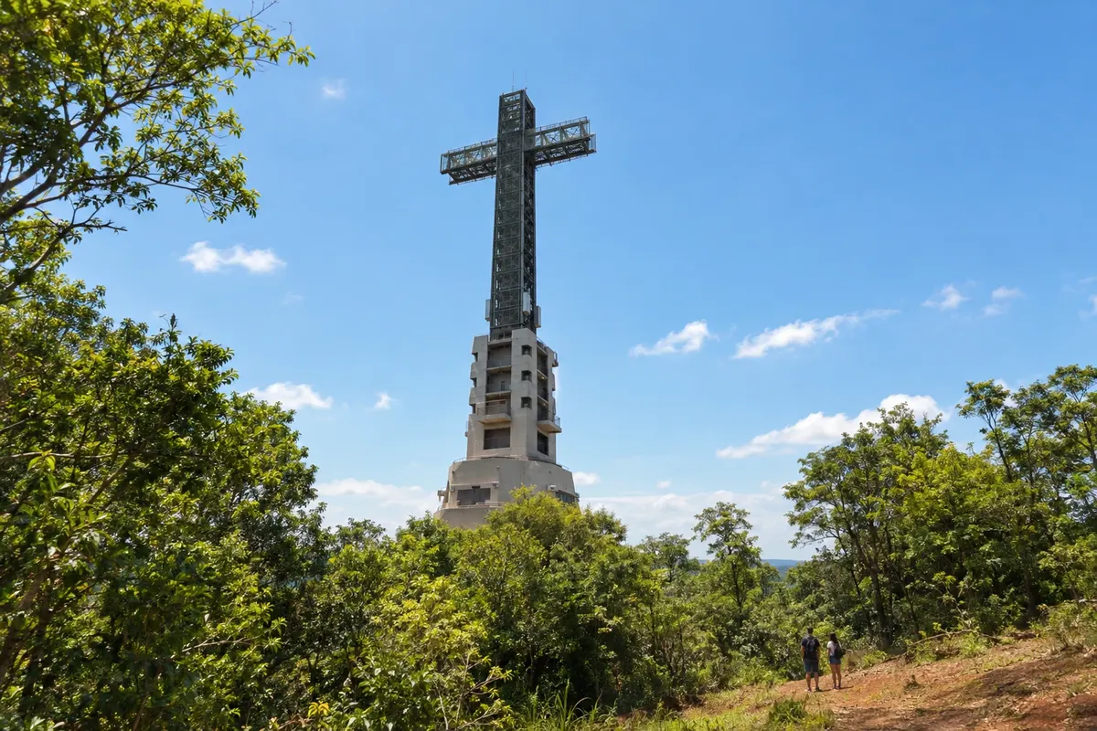
Na fotografiji: Parque Temático de la Cruz
Illustrative images. The pictures in this guide are illustrations based on the real place, not photographs, and may differ from it.
Mesto
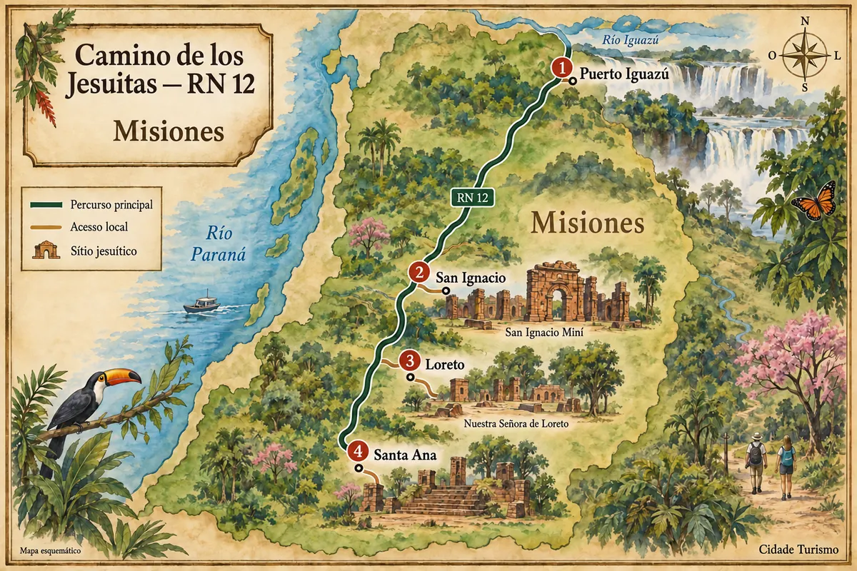
Santa Ana is located in southern Misiones, along the RN12 corridor. On the outskirts of town, the Jesuit-Guaraní complex preserves remains of the temple, a semicircular stairway and structures for cultivation and water management. Paths through the vegetation connect the spaces of the former reduction.
V vodniku še ni nastanitev – Santa Ana.
kako do tja · koliko dni · načrt poti · vprašanja
Doživite kraj
Ruins of the temple and its semicircular stairway, the old garden, walls and water structures, linked by trails in the Conjunto Jesuítico Guaraní de Santa Ana.
Pred odhodom
Santa Ana – Misiones Destinacija Puerto Iguazú and the Missions
Razdalje so približne. Pred potovanjem preverite lete in vozne rede avtobusov, vlakov ali ladij.
Santa Ana is also on the road route from Puerto Iguazú to southern Misiones. The historic complex has a local access point from the highway.
Set aside a day for Santa Ana: one period for the town center and another for the reduction, with time to walk the trails and examine the old garden and its water structures.
June, July and August usually have lower temperatures than December, January and February. The climate is humid, with rain possible in any month; light clothing and footwear suitable for trails are recommended.
The seasons shown are the most usual ones; nature doesn't always follow the calendar.
A car or hired transport makes it easier to get from the town center to the reduction and to travel along RN12. Exploration of the archaeological site is done on foot, via the visitor paths among the remains.
Predlog poti
Pot povezuje znamenitosti na tej strani. Za oglede boste imeli dovolj časa.
Walk through the urban core along the avenues San Martín and Manuel Belgrano before heading to the historic complex.
Begin at the interpretation center and visit the remains of the temple and its semicircular stairway.
Follow the paths to the old garden and observe the walls, the pond and the channels that remain on the site.
Return to the urban area and your accommodation. Meals and services in the small town are separate from the historical walk.
Check before you go. Opening hours and days change, and places may close for renovations, holidays or events. This itinerary is a suggestion from Cidade Turismo, not a commitment: plan yours by checking directly with each place you intend to visit.
Pred odhodom
The temple's semicircular stairway and the garden structures show solutions for changes in level and water management, with channels and a pond.
The complex is on the outskirts of town and has local access via RN12. From the center, arrange transport for the entrance and allow time to walk around the site.
The complex has an interpretation center and specialized guides. Confirm visiting options before you go.
The site brings together remains of the temple, living areas, cultivation spaces and water structures. The trails help relate these sectors of the former reduction.
Poti – in Argentina
From Puerto Iguazú to the complexes of San Ignacio Miní, Nuestra Señora de Loreto and Santa Ana along the axis of National Route 12.
Več kot vodnik