

Geographic marker
Cape Agulhas (southernmost tip of Africa)
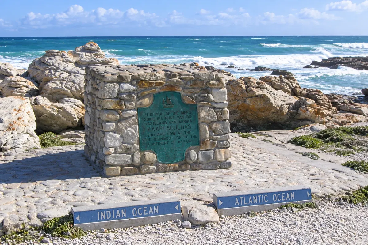
Marker at Cape Agulhas, in Agulhas National Park, indicating Africa's southernmost point and the conventional boundary between the Atlantic and Indian Oceans.

 Išči
 Brazilija
 Antarktika
 Argentina
 Bolivija
 Čile
 Kolumbija
 Ekvator
 Gvajana
 Francoska Gvajana
 Falklandski otoki (Malvini)
 Paragvaj
 Peru
 Surinam
 Urugvaj
 Venezuela
 Nemčija
 Avstrija
 Belgija
 Hrvaška
 Danska
 Slovaška
 Slovenija
 Španija
 Finska
 Francija
 Grčija
 Nizozemska
 Madžarska
 Irska
 Islandija
 Italija
 Luksemburg
 Norveška
 Poljska
 Portugalska
 Združeno kraljestvo
 Češka
 Švedska
 Švica
 Turčija
 Bermudi
 Kanada
 Združene države Amerike
 Grenlandija
 Mehika
 Sveta Peter in Mihael
 Dominikanska republika
 JaponskaTurčijaJužnoafriška republika
 Egipt
 Avstralija
 Fidži
 Nova Zelandija
 Papua Nova Gvineja
Cabo Ocidental · Južnoafriška republika
Destinacija: Hermanus and Overberg.
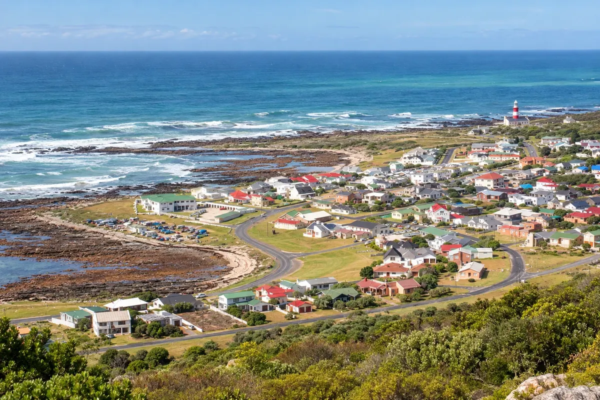
Na fotografiji: L'Agulhas and the coast
Illustrative images. The pictures in this guide are illustrations based on the real place, not photographs, and may differ from it.
Mesto
L'Agulhas is the southernmost village in Africa, next to Cape Agulhas, where the international convention separates the Atlantic from the Indian Ocean. The red-and-white lighthouse from 1849, with a museum, and the marker for the continent's extreme point lie within Agulhas National Park. The village is small, with holiday homes, and nearby is the long Struisbaai beach and its fishing harbor.
V vodniku še ni nastanitev – L'Agulhas.
kako do tja · koliko dni · načrt poti · vprašanja
Doživite kraj
Marker at Cape Agulhas, in Agulhas National Park, indicating Africa's southernmost point and the conventional boundary between the Atlantic and Indian Oceans.
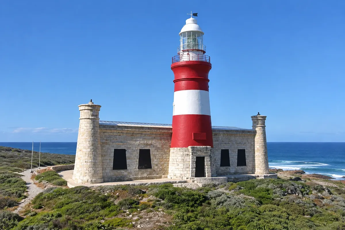
Red-and-white lighthouse first lit in 1849, inspired by the Lighthouse of Alexandria, the country's second-oldest operational lighthouse, with a museum in the keepers' house.
Pred odhodom
L'Agulhas – Western Cape Destinacija Hermanus and Overberg približno 230 km stran (izhodišče: Cape Town)
Razdalje so približne. Pred potovanjem preverite lete in vozne rede avtobusov, vlakov ali ladij.
From Hermanus, the arrival town, it’s about 140 km via the R43, through Stanford and Bredasdorp, in roughly 2 hours. From Cape Town it’s about 230 km via the N2, through Caledon and Bredasdorp, in roughly 3 hours. There is no public transport; go by car or on a tour.
Half a day for the lighthouse, the marker and a walk in the park. Those who stay overnight in the village get the sunrise at the extreme point and Struisbaai beach.
Summer, from December to February, has long days and beach weather at Struisbaai. The wind is strong year-round, and winter is usually cool and wet. From July to November it is common to see whales from the shore.
The seasons shown are the most usual ones; nature doesn't always follow the calendar.
Yes. There is no public transport and distances are large: travel by car or on a tour. People drive on the left.
Predlog poti
Pot povezuje znamenitosti na tej strani. Za oglede boste imeli dovolj časa.
Climb the steps of the 1849 lighthouse and visit the museum in the former keepers' house.
Walk along the boardwalk to the marker of the continent's extreme point, where the Atlantic meets the Indian Ocean.
Head to Struisbaai, 6 km away, for a walk on the long beach and a stroll around the fishing harbor.
Dine in the village, facing the sea.
Check before you go. Opening hours and days change, and places may close for renovations, holidays or events. This itinerary is a suggestion from Cidade Turismo, not a commitment: plan yours by checking directly with each place you intend to visit.
Pred odhodom
At Cape Agulhas, next to the village of L'Agulhas, about 230 km from Cape Town.
By the convention of the International Hydrographic Organization, at Cape Agulhas, not at the Cape of Good Hope.
About 3 hours by car, roughly 230 km via the N2 and passing Bredasdorp.
For those who want to see sunrise or sunset at the extreme point and walk the park at leisure, yes. The village is small and peaceful.
Več kot vodnik


