Senja (Finnsnes)

Troms · Norveška

Senja (Finnsnes)

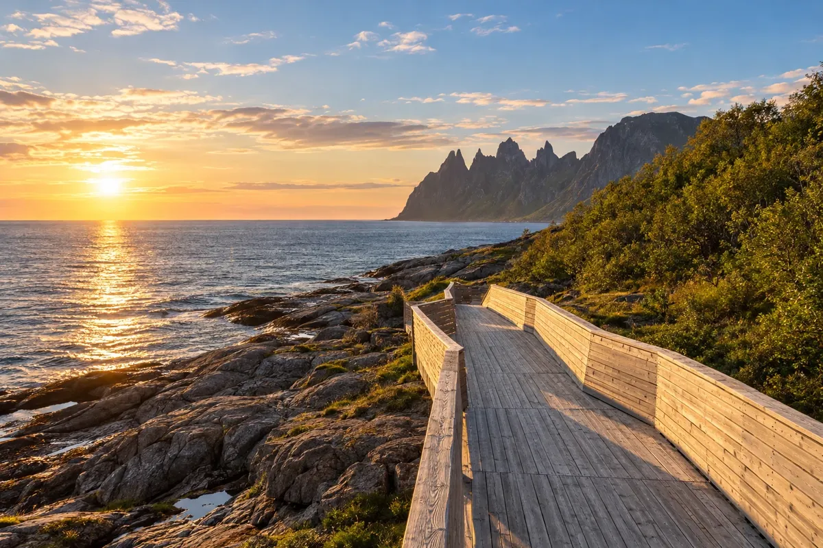
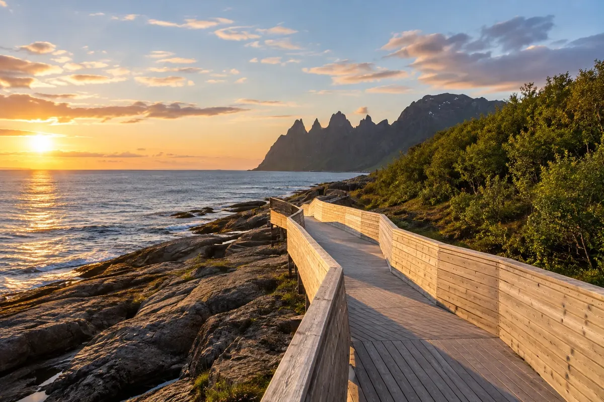
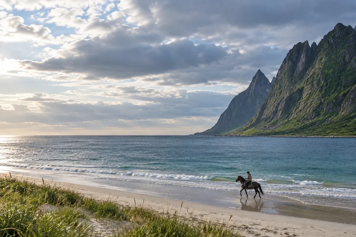
The island's outer coast between fjords and mountains: the walkways of Tungeneset, the Bergsbotn viewing platform and the sand of Ersfjordstranda.

Northern Norway

Na fotografiji: Tungeneset

Illustrative images. The pictures in this guide are illustrations based on the real place, not photographs, and may differ from it.

Na voljo v trgovini Google Play Pošljite svoje fotografije

Spoznajte kraj

Pokrajina, ki jo doživite
v svojem ritmu.

Senja is an island in northern Norway connected to the mainland by the bridge near Finnsnes. The outer coast brings together fjords, villages and mountains that reach the sea. Routes take time: the itinerary follows the shores and crosses valleys.

The scenic route links Botnhamn to Gryllefjord and offers prepared stops for landscape viewing. Tungeneset, Bergsbotn and Ersfjordstranda let you plan a circuit with different coastal views, without treating each viewpoint as a mountain hike.

Finnsnes is a transport base, while staying on the outer coast brings you closer to the viewpoints. Plan transfers in advance, especially when the itinerary depends on a boat.

This destination brings together 1 city: Finnsnes.

Delite: WhatsApp
Delite svoja popotniška doživetja s fotografijami Pošljite fotografije vsakega kraja, ki ste ga obiskali. Največje število fotografij na kraj: 5.

Ena destinacija, več poti

Mesta na tej poti

Začnite v enem mestu ali v načrt poti vključite več mest.

Senja (Finnsnes) – lega
Finnsnes

Obrisi: © Kartverket (CC BY 4.0), meje iz leta 2024, podatki o obali: geoBoundaries. Priredba: Cidade Turismo.

Kako do tja:Senja (Finnsnes)

✈ Bardufoss lufthavn (BDU), kraj: Bardufoss· 45 km do cilja (Finnsnes)

Confirm before booking. Bardufoss is a regional air access; passenger boats connect Tromsø and Finnsnes. The island is accessible by bridge and by ferries with their own schedules.

Doživite kraj

Kaj početi – Senja (Finnsnes)

Tungeneset
Finnsnes · Troms · Razgledišče

Tungeneset

The Tungeneset viewpoint sits on a promontory between Steinsfjord and Ersfjord on Senja's outer coast. A wooden boardwalk follows the rocks and frames views of the sea and the row of Okshornan peaks.

Bergsbotn
Finnsnes · Troms · Razgledišče

Bergsbotn

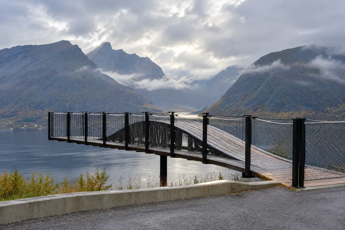
Bergsbotn is an observation platform above the village of the same name on the scenic Senja route. The structure juts out over the slope and frames the Bergsfjord, with the inhabited areas on the shore and the surrounding mountains.

Ersfjordstranda
Finnsnes · Troms · Plaža

Ersfjordstranda

Ersfjordstranda is the light-sand beach at the end of the Ersfjord on Senja's outer coast. The shoreline's arc is surrounded by mountains and is part of the scenic route along this section of the island. The visit can be a short walk along the fjord's edge.

Kaj izbrati pred odhodom

Izleti – Senja (Finnsnes)

Izhodišče, trajanje, potek, vključene storitve in okvirna cena vsakega izleta.

Tungeneset

Odhod: Finnsnes Via the Senja scenic route, departing by road from Finnsnes 30 minutes to 1 hour. during the day depending on the route chosen

The Tungeneset viewpoint occupies a promontory between Steinsfjord and Ersfjord on Senja’s outer coast. A wooden boardwalk runs along the rocks and frames the view out to sea and the sequence of Okshornan peaks. The walk is a stop on the scenic route, with vehicles left in the prepared roadside area. From the boardwalk, the closeness of the water contrasts with the mountains on the opposite shore. The landscape is the focus of the visit; the extent of the view depends on cloud cover.

Kraji na poti: Tungeneset.

Vključuje: Arrange access to the site and transport separately. Guided activities and tickets have their own conditions.

Nasvet: Combine Tungeneset with the other stops on the outer coast, allowing time for the road sections.

Najboljši čas za obisk: From June to September, daytime conditions generally favor scenic stops

Bergsbotn

Odhod: Finnsnes Via the Senja scenic route, departing by road from Finnsnes 30 minutes to 1 hour. during the day depending on the route chosen

Bergsbotn is a viewing platform above the village of the same name, on the Senja scenic route. The structure projects out from the slope and frames Bergsfjord, with inhabited areas on the shore and mountains around it. The platform is 44 meters long and is part of a project that brings architecture closer to the landscape. The path to the end helps you perceive the valley opening without requiring a mountain hike. The spot is a roadside stop, with its own area to park the vehicle.

Kraji na poti: Bergsbotn.

Vključuje: Arrange access to the site and transport separately. Guided activities and tickets have their own conditions.

Nasvet: Combine Bergsbotn with the other stops on the outer coast, allowing for the road sections.

Najboljši čas za obisk: From June to September, daytime conditions generally favor scenic stops

Ersfjordstranda

Odhod: Finnsnes Via the Senja scenic route, departing by road from Finnsnes 30 minutes to 1 hour. during the day depending on the route chosen

Ersfjordstranda is the light-sand beach at the end of the Ersfjord, on Senja’s outer coast. The arc of shoreline is enclosed by mountains and is part of the scenic route that follows this side of the island. The visit can be a short walk along the fjord. The site is reachable by road and has supporting facilities linked to the viewpoint route. The beach is a landscape experience and does not require going into the water. Notice the different stretches of sand, the fjord’s opening and the location of the houses on the shore.

Kraji na poti: Ersfjordstranda.

Vključuje: Arrange access to the site and transport separately. Guided activities and tickets have their own conditions.

Nasvet: Combine Ersfjordstranda with the other stops on the outer coast, allowing for the road sections.

Najboljši čas za obisk: From June to September, daytime conditions generally favor scenic stops

Po dnevih

Senja (Finnsnes) – načrt poti. Število dni: 1, 2in3

Predlogi za načrtovanje poti. Vrstni red dni prilagodite vremenu in razpoložljivosti izletov.

1 dni · Senja in 1 day

ZaTo organize visits by day, allowing time for travel. · Izhodišče:Finnsnes
  1. Dan 1 · Tungeneset / Ersfjordstranda

    Leave Finnsnes for the outer coast and split the day between Tungeneset and Ersfjordstranda. The boardwalk sits on a headland; the beach is at the inner end of the fjord. Allow time for the drive and the return.

2 dni · Senja in 2 days
ZaTo organize visits by day, allowing time for travel. · Izhodišče:Finnsnes
  1. Dan 1 · Tungeneset / Ersfjordstranda

    Leave Finnsnes for the outer coast and split the day between Tungeneset and Ersfjordstranda. The boardwalk sits on a headland; the beach is at the inner end of the fjord. Allow time for the drive and the return.

  2. Dan 2 · Bergsbotn

    Drive the scenic route section to Bergsbotn, observing the fjord from the cliffside platform. Use the rest of the day for travel between villages, avoiding a long hike in the same day.

3 dni · Senja in 3 days
ZaTo organize visits by day, allowing time for travel. · Izhodišče:Finnsnes
  1. Dan 1 · Tungeneset / Ersfjordstranda

    Leave Finnsnes for the outer coast and split the day between Tungeneset and Ersfjordstranda. The boardwalk sits on a headland; the beach is at the inner end of the fjord. Allow time for the drive and the return.

  2. Dan 2 · Bergsbotn

    Drive the scenic route section to Bergsbotn, observing the fjord from the cliffside platform. Use the rest of the day for travel between villages, avoiding a long hike in the same day.

  3. Dan 3 · Tungeneset

    Return to a stretch of coast you want to explore more, such as Tungeneset, or reserve this day for boat transfers. The third day allows for distances and travel conditions in Senja.

Najboljši čas za obisk

Kdaj se odpraviti:Senja (Finnsnes) po mesecih

From June to August there are usually very long days and mild temperatures. The northern lights are typically sought between September and March. In winter the cold tends to persist and days are short.

The seasons shown are the most usual ones; nature doesn't always follow the calendar.

januar Veliko padavin

Winter · plan your travel

The monthly average at the reference station is usually around -4.0 °C. Normal precipitation for the month is about 123 mm, combining rain and snow in water equivalent. Cold tends to be persistent and days are usually short. Prioritize excursions with confirmed access for the period. The northern lights are usually sought between September and March, on dark nights with breaks in the clouds.


februar Zmerne padavine

Winter · plan your travel

The monthly average at the reference station is usually around -4.2 °C. Normal precipitation for the month is about 92 mm, combining rain and snow in water equivalent. Cold tends to be persistent and days are usually short. Prioritize excursions with confirmed access for the period. The northern lights are usually sought between September and March, on dark nights with breaks in the clouds.

marec Zmerne padavine

Spring · plan your travel

The monthly average at the reference station is usually around -2.9 °C. Normal precipitation for the month is about 102 mm, combining rain and snow in water equivalent. Daylight usually increases through the season, while snow tends to remain in the mountains. High-altitude routes follow their own calendars. The northern lights are usually sought between September and March, on dark nights with breaks in the clouds.

april Zmerne padavine

Spring · plan your travel

The monthly average at the reference station is usually around 0.8 °C. Normal precipitation for the month is about 64 mm, combining rain and snow in water equivalent. Daylight usually increases through the season, while snow tends to remain in the mountains. High-altitude routes follow their own calendars.

maj Malo padavin

Spring · long days

The monthly average at the reference station is usually around 5.8 °C. Normal precipitation for the month is about 51 mm, combining rain and snow in water equivalent. Daylight usually increases through the season, while snow tends to remain in the mountains. High-altitude routes follow their own calendars.

junij Malo padavin

Summer · long days

The monthly average at the reference station is usually around 10.1 °C. Normal precipitation for the month is about 54 mm, combining rain and snow in water equivalent. Weather is usually mild and days are often very long. There is greater demand for outdoor excursions; arrange bookings in advance. The period of nightless light typically occurs between May and July, varying with latitude.

julij Zmerne padavine

Summer · long days

The monthly average at the reference station is usually around 13.1 °C. Normal precipitation for the month is about 67 mm, combining rain and snow in water equivalent. Weather is usually mild and days are often very long. There is greater demand for outdoor excursions; arrange bookings in advance. The period of nightless light typically occurs between May and July, varying with latitude.

avgust Zmerne padavine

Summer · long days

The monthly average at the reference station is usually around 12.0 °C. Normal precipitation for the month is about 80 mm, combining rain and snow in water equivalent. Weather is usually mild and days are often very long. There is greater demand for outdoor excursions; arrange bookings in advance.

september Zmerne padavine

Autumn · plan your travel

The monthly average at the reference station is usually around 7.9 °C. Normal precipitation for the month is about 114 mm, combining rain and snow in water equivalent. Temperatures and day length usually fall. Long hikes and transfers through the mountains require planning before departure. The northern lights are usually sought between September and March, on dark nights with breaks in the clouds.

oktober Veliko padavin

Autumn · plan your travel

The monthly average at the reference station is usually around 2.9 °C. Normal precipitation for the month is about 129 mm, combining rain and snow in water equivalent. Temperatures and day length typically fall. Long hikes and mountain travel require planning before you set out. The northern lights are commonly sought between September and March, on dark nights with breaks in the clouds.

november Zmerne padavine

Autumn · plan your travel

The monthly average at the reference station is usually around -0.6 °C. Normal precipitation for the month is about 98 mm, combining rain and snow in water equivalent. Temperatures and day length typically fall. Long hikes and mountain travel require planning before you set out. The northern lights are commonly sought between September and March, on dark nights with breaks in the clouds.

december Zmerne padavine

Winter · plan your travel

The monthly average at the reference station is usually around -2.5 °C. Normal precipitation for the month is about 113 mm, combining rain and snow in water equivalent. Cold tends to be persistent and days are usually short. Prioritize excursions with confirmed access for the period. The northern lights are usually sought between September and March, on dark nights with breaks in the clouds.

Načrtujte pot

Kako do tja:Senja (Finnsnes)

Public transport and reservations

Check train, bus, and ferry connections to Finnsnes for your travel date. Verify each leg and the return connection before combining different services. On ferry routes, confirm the pier and the direction of travel.

Car and local travel

A car makes it easier to travel between the stops on Senja. Without a car, choose excursions or buses that have a confirmed return connection for each leg.

Pred odhodom

Praktične informacije

Z nekaj načrtovanja boste imeli več časa za uživanje na poti.

Kdaj se odpraviti

From June to August there are usually very long days and mild temperatures. The northern lights are typically sought between September and March. In winter the cold tends to persist and days are short.

The seasons shown are the most usual ones; nature doesn't always follow the calendar.

Koliko dni ostati

Three days to arrive and explore the outer coast; four days allow you to spread the routes out and add a planned walk beforehand.

V katerem mestu prenočiti

Finnsnes concentrates transport and services. On the outer coast, the areas of Mefjordvær, Senjahopen and Gryllefjord shorten some road sections.

Spoštujte kraj

Odnesite svoje odpadke, upoštevajte oznake in podprite lokalne ponudnike. V naravi upoštevajte navodila za obiskovalce.

Odgovori na vaša vprašanja

Pogosta vprašanja – Senja (Finnsnes)

How to start a trip to Senja?

Bardufoss is a regional air access; passenger boats connect Tromsø and Finnsnes. The island is accessible by bridge and by ferries with their own schedules.

How much time to reserve for Senja?

Three days to arrive and explore the outer coast; four days allow you to spread the routes out and add a planned walk beforehand.

Where to choose a base in Senja?

Finnsnes concentrates transport and services. On the outer coast, the areas of Mefjordvær, Senjahopen and Gryllefjord shorten some road sections.

Odkrijte druge destinacije Iskanje po zvezni državi in mestu

Več kot vodnik