Molde and the Atlantic Road (Molde)

Møre og Romsdal · Norveška

Molde and the Atlantic Road (Molde)

The city of roses facing 222 peaks of Romsdal and the Estrada do Atlântico, which leaps from islet to islet over eight bridges, with the Storseisundet curve and the village of Bud.

Westfjords

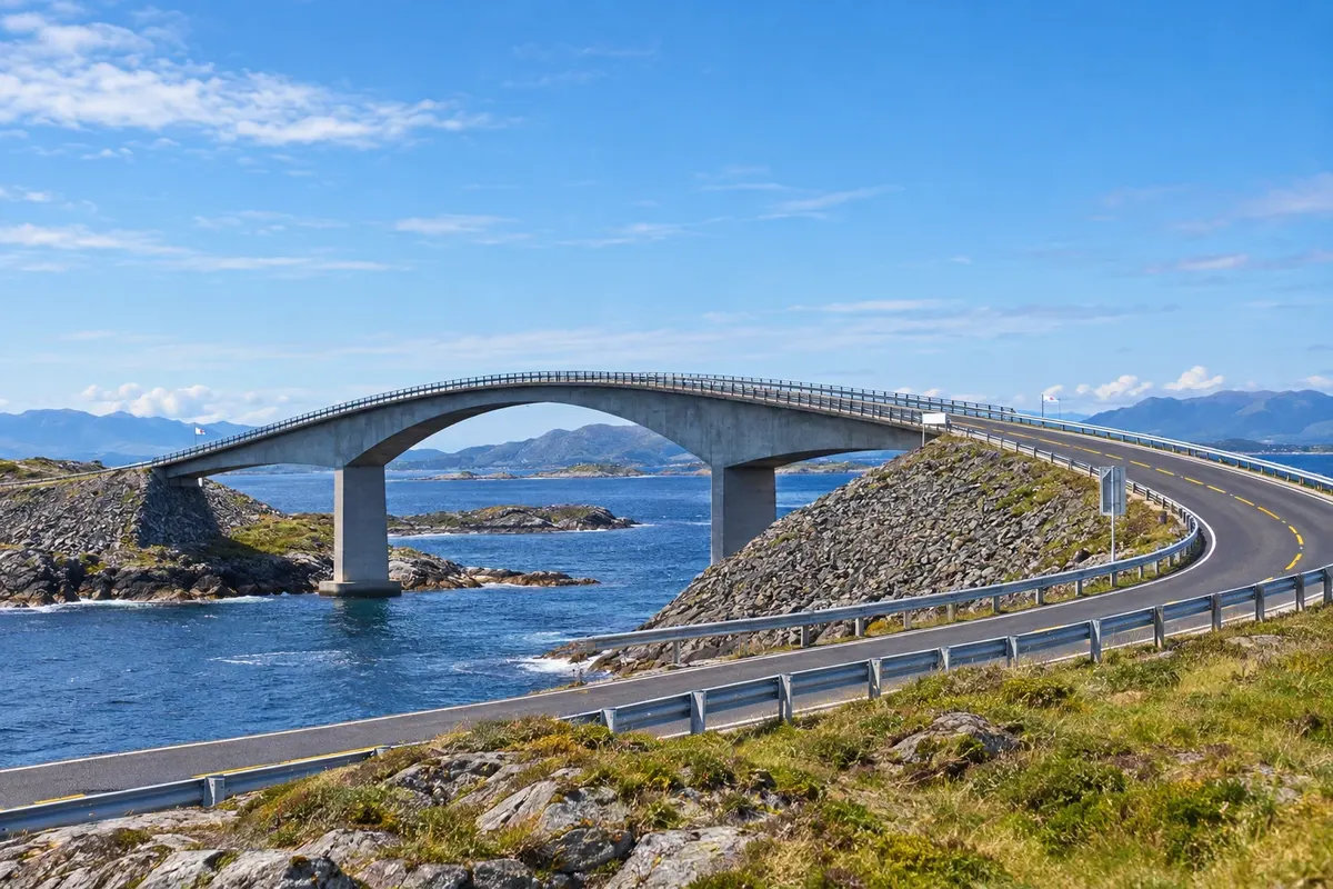
Na fotografiji: Ponte Storseisundet — Atlanterhavsveien

Illustrative images. The pictures in this guide are illustrations based on the real place, not photographs, and may differ from it.

Na voljo v trgovini Google Play Pošljite svoje fotografije

Spoznajte kraj

Pokrajina, ki jo doživite
v svojem ritmu.

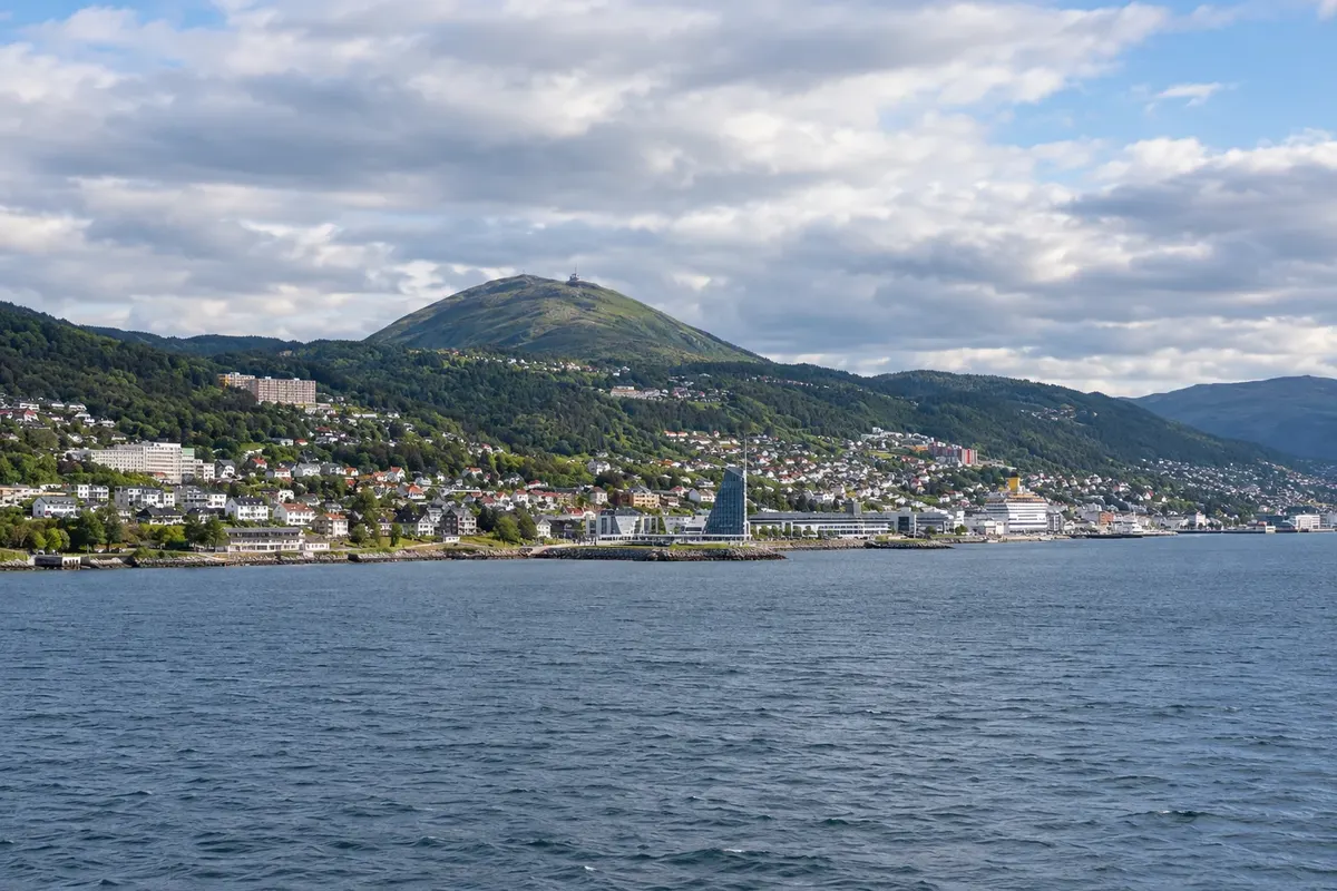
Molde lies on the north shore of the Romsdalsfjord, in the county of Møre e Romsdal, facing a row of mountains that rise on the far side of the fjord. It is the administrative seat, a medium-sized town with a modern centre rebuilt in the mid-20th century, and flowered gardens that earned it the nickname Cidade das Rosas. In July, the Molde Jazz Festival, one of the oldest in Europe, fills the streets.

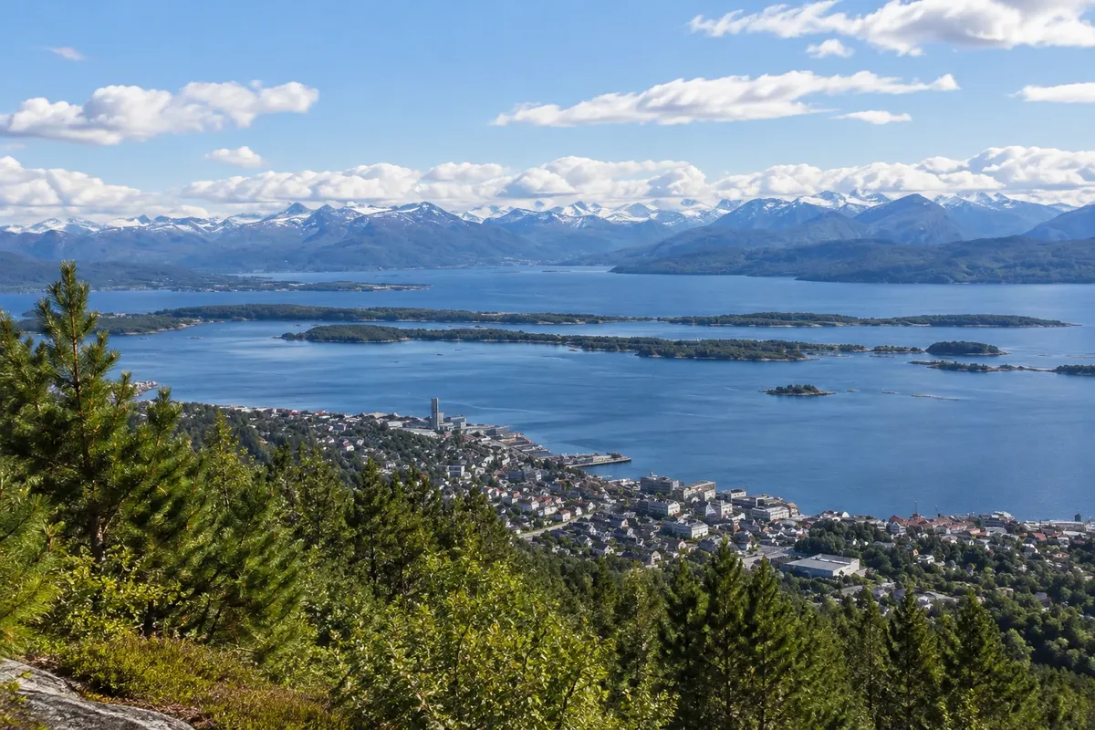
The town's postcard view is the Molde panorama: from the Varden viewpoint on the hill behind the centre you can count 222 peaks around the fjord, many with snow into the summer. To the west of the town, the Museu de Romsdal brings together old houses from the region in an open-air museum. To the north, on the way to the coast, the marble cave Trollkirka contains a waterfall inside the rock.

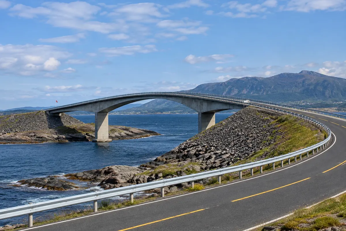
About an hour's drive away, the Atlanterhavsveien, the Estrada do Atlântico, links the coast between Vevang and the island of Averøy via 8.3 km of causeways and eight bridges over islets and reefs, with the open sea on one side. The Storseisundet bridge, tall and curved, is the best-known image. Near the start of the road is Bud, a fishing village on the Hustadvika coast. In the opposite direction, Trollstigen is about an hour and a half from Molde.

The Hurtigruten stops in the town. Winter is usually wet and dark, with storms on the coast that make the Estrada do Atlântico more dramatic; summer is generally mild with very long days.

This destination brings together 1 city: Molde.

Delite: WhatsApp
Delite svoja popotniška doživetja s fotografijami Pošljite fotografije vsakega kraja, ki ste ga obiskali. Največje število fotografij na kraj: 5.

Ena destinacija, več poti

Mesta na tej poti

Začnite v enem mestu ali v načrt poti vključite več mest.

Molde and the Atlantic Road (Molde) – lega
Molde

Obrisi: © Kartverket (CC BY 4.0), meje iz leta 2024, podatki o obali: geoBoundaries. Priredba: Cidade Turismo.

Kako do tja:Molde and the Atlantic Road (Molde)

✈ Molde lufthavn, Årø (MOL), kraj: Årø· 5 km do cilja (Molde)

Confirm before booking. Molde airport is about 5 km from the centre, with domestic flights from Oslo. The Hurtigruten calls at Molde. From Ålesund it's about 1h30 by car, including a ferry; the Estrada do Atlântico is about an hour from Molde.

Doživite kraj

Kaj početi – Molde and the Atlantic Road (Molde)

Atlantic Ocean Road (Atlanterhavsveien)
Molde · Møre og Romsdal · Scenic road

Atlantic Ocean Road (Atlanterhavsveien)

The Estrada do Atlântico: 8.3 km of causeways and eight bridges over islets and reefs between Vevang and Averøy, featuring the curved Storseisundet bridge, viewpoints and the Eldhusøya boardwalk over the sea.

Varden
Molde · Møre og Romsdal · Razgledišče

Varden

The viewpoint on the hill behind Molde, about 400 metres up, with the panorama of 222 Romsdal peaks on the far side of the fjord; access by trail from the town centre or by road.

Romsdal Museum (Romsdalsmuseet)
Molde · Møre og Romsdal · Open-air museum

Romsdal Museum (Romsdalsmuseet)

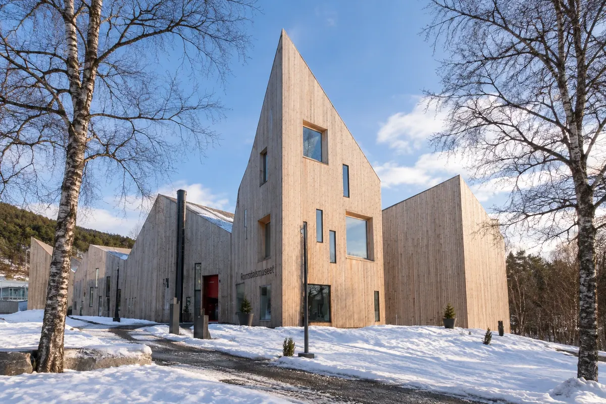
The Museum of Romsdal, in west Molde: dozens of old regional buildings assembled in a park, with a wooden church, a small-town street, folk costumes and summer activities.

Trollkirka (Troll Church)
Molde · Møre og Romsdal · Jama

Trollkirka (Troll Church)

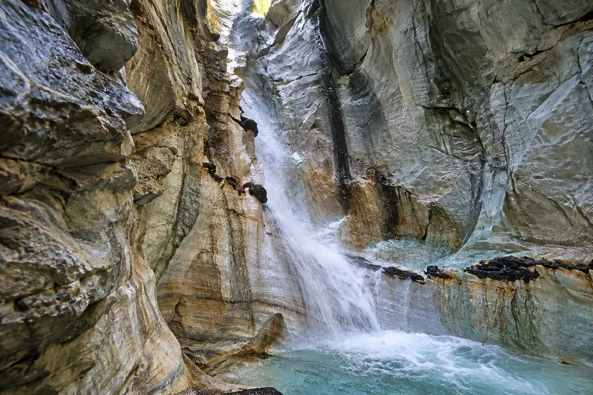
The Church of the Trolls: three marble caves in a slope north of Molde, with a waterfall that falls into one of them; reached by a trail of about one hour from road 64.

Molde and the Atlantic Road (Molde) – prikaži še 1 kraj
Bud
Molde · Møre og Romsdal · Fishing village

Bud

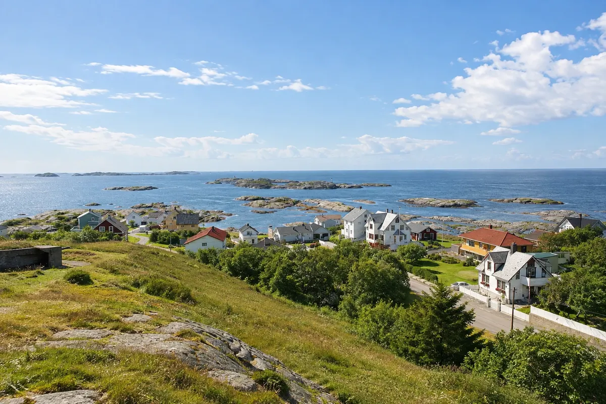
Fishing village on the exposed Hustadvika coast, between Molde and the Estrada do Atlântico, with a harbor, wooden houses, the 1717 church and views of the sea and reefs.

Kaj izbrati pred odhodom

Izleti – Molde and the Atlantic Road (Molde)

Izhodišče, trajanje, potek, vključene storitve in okvirna cena vsakega izleta.

Atlanterhavsveien

Odhod: Molde It’s about a 1-hour drive from Molde via road 64, heading toward Kristiansund. 1 to 2 hours including stops during the day depending on the route chosen

The Atlanterhavsveien, the Atlantic Road, is part of road 64 and links the mainland at Vevang to the island of Averøy, passing a string of islets and reefs at the mouth of Hustadvika, an exposed stretch of sea off the coast of Møre og Romsdal. It is 8.3 km of causeways and eight bridges that rise and fall over the water, with the ocean on one side and islands and mountains on the other. The best-known bridge is Storseisundet, the largest, at about 260 meters and with a curve that, seen from certain angles, seems to end in midair. It’s the image that appears in photos of the road and in car advertisements. The other bridges are smaller, and between them there are stopping areas with parking.

Kraji na poti: Atlanterhavsveien.

Vključuje: Arrange access to the site and transport separately. Guided activities and tickets have their own conditions.

Nasvet: Stop at Eldhusøya and walk the boardwalk before continuing. For the classic Storseisundet photo, use the parking area on the Averøy side. Combine it with Bud and Trollkirka on the same day.

Najboljši čas za obisk: June to August, on clear and calmer days, for the stops and the boardwalk

Varden

Odhod: Molde The trail starts in central Molde, near the city park, and climbs for about 1 to 2 hours, including the uphill walk during the day depending on the route chosen

Varden is the hill behind central Molde, at about 400 meters altitude, and the place from which you see the Moldepanoramaet, Molde’s panorama. From the viewpoint, the view opens onto the Romsdalsfjord and the row of mountains on the other side, where 222 peaks are counted, many with snow into early summer, including those of Romsdal near Åndalsnes. Below you can see the town, the harbor, the fjord islands and, to the west, the sea. There is a restaurant and café at the top, with a terrace, and signs identifying the main peaks. The path also passes lakes and birch woods, used by locals for walks and skiing in winter.

Kraji na poti: Varden.

Vključuje: Arrange access to the site and transport separately. Guided activities and tickets have their own conditions.

Nasvet: Bring a jacket and check the forecast beforehand: the view depends on clear weather. Use the viewpoint signs to identify the peaks.

Najboljši čas za obisk: In clear weather, from May to September

Romsdalsmuseet

Odhod: Molde It lies west of Molde, about a 15-minute walk from the centre From during the day up to 2 hours. during the day depending on the route chosen

Romsdalsmuseet is Molde’s open-air museum, with dozens of old buildings brought from across Romsdal and reconstructed in a hillside park on the west side of town. They include farmhouses, barns, stilted storehouses, a school, fishermen’s houses and a small wooden church, a replica of an older model used for weddings. Part of the site recreates the street of an early 20th-century village, the Bygata, with shops and artisans’ and merchants’ houses, as it was in small coastal towns of that era. The indoor exhibitions display bunad, the region’s folk costumes, tools, furniture and the history of life in the fjord.

Kraji na poti: Romsdalsmuseet.

Vključuje: Arrange access to the site and transport separately. Guided activities and tickets have their own conditions.

Nasvet: Start at the Bygata, the village street, then walk up past the farms. Ask about the folk dance schedule in summer.

Najboljši čas za obisk: From June to August, when the houses are usually open and activities take place

Trollkirka

Odhod: Molde It is beside road 64, about 30 km north of Molde, roughly 30 minutes About 2 to 3 hours round trip, including the visit to the main cave. during the day depending on the route chosen

Trollkirka, the Church of the Trolls, is a group of three marble caves on a slope of the Romsdal peninsula, about 30 km north of Molde, on the way to the Atlantic Road. The name comes from the shape of the main cave, tall like a church nave, and from legends about trolls said to live in the mountains. The trail starts from a parking area by road 64 and climbs through forest and slope for about an hour, with sections of rock and roots. The first cave, the largest, has a waterfall that falls through an opening in the roof and runs over the white marble into a pool. Inside, the floor is stone and water flows continuously, and a flashlight is needed to see the walls.

Kraji na poti: Trollkirka.

Vključuje: Arrange access to the site and transport separately. Guided activities and tickets have their own conditions.

Nasvet: Bring a torch, a jacket and hiking shoes with good grip. Combine it with the Atlantic Road and Bud on the same day.

Najboljši čas za obisk: From June to September, when the trail is usually snow-free

Bud

Odhod: Molde It’s about 50 km from Molde, roughly a 45-minute drive via road 64 and a 1 to 2 hours. during the day depending on the route chosen

Bud is a fishing village on the tip of the Romsdal peninsula, facing the Hustadvika, a stretch of open sea that is shallow and full of reefs, about 50 km from Molde. In the Middle Ages, Bud was one of the main fish trading posts between Bergen and Trondheim. Today’s village is small, with painted wooden houses, a harbour with fishing boats, warehouses and a fish restaurant. The wooden church, dated 1717 and painted white, stands uphill, with the cemetery facing the sea. Paths lead to viewpoints on the coastal rocks, where you can see the sequence of islets and reefs that continues to the Atlantic Road.

Kraji na poti: Bud.

Vključuje: Arrange access to the site and transport separately. Guided activities and tickets have their own conditions.

Nasvet: Do the Molde–Bud–Atlantic Road route along the coastal road, with a stop for fish lunch at the harbor.

Najboljši čas za obisk: June to August, with the harbor busy and long daylight hours

Po dnevih

Molde and the Atlantic Road (Molde) – načrt poti. Število dni: 1, 2in3

Predlogi za načrtovanje poti. Vrstni red dni prilagodite vremenu in razpoložljivosti izletov.

1 dni · Molde and the Atlantic Road in 1 day

ZaTo organize visits by day, allowing time for travel. · Izhodišče:Molde
  1. Dan 1 · Varden / Romsdalsmuseet

    Visit the Romsdalsmuseet and walk up to Varden to relate the town to the fjord and the peaks on the horizon. The ascent can be done as a separate outing depending on the group’s mobility.

2 dni · Molde and the Atlantic Road in 2 days
ZaTo organize visits by day, allowing time for travel. · Izhodišče:Molde
  1. Dan 1 · Varden / Romsdalsmuseet

    Visit the Romsdalsmuseet and walk up to Varden to relate the town to the fjord and the peaks on the horizon. The ascent can be done as a separate outing depending on the group’s mobility.

  2. Dan 2 · Atlanterhavsveien / Bud

    Dedicate a day to the Atlantic Road. Stop at the viewpoints prepared for observing the bridges and combine the route with Bud, without turning the whole roadway into a photo stop.

3 dni · Molde and the Atlantic Road in 3 days
ZaTo organize visits by day, allowing time for travel. · Izhodišče:Molde
  1. Dan 1 · Varden / Romsdalsmuseet

    Visit the Romsdalsmuseet and walk up to Varden to relate the town to the fjord and the peaks on the horizon. The ascent can be done as a separate outing depending on the group’s mobility.

  2. Dan 2 · Atlanterhavsveien / Bud

    Dedicate a day to the Atlantic Road. Stop at the viewpoints prepared for observing the bridges and combine the route with Bud, without turning the whole roadway into a photo stop.

  3. Dan 3 · Trollkirka

    Trollkirka requires a full day of hiking with prior preparation. Check the route, equipment, and local conditions; the cave and the waterfall are not an urban visit near Molde.

Najboljši čas za obisk

Kdaj se odpraviti:Molde and the Atlantic Road (Molde) po mesecih

From June to August days tend to be long, with calmer conditions at the Varden viewpoint and the Estrada do Atlântico; in July, the jazz festival. From October to February, storms on the coast often throw waves over the bridges, visible from afar; in strong winds the road may have restrictions. Check ahead.

The seasons shown are the most usual ones; nature doesn't always follow the calendar.

januar Zmerne padavine

Winter · plan your travel

The monthly average at the reference station is usually around 1.1 °C. Cold tends to be persistent and days are generally short. Prioritize tours with confirmed access for the period.

februar Zmerne padavine

Winter · plan your travel

The monthly average at the reference station is usually around 0.9 °C. Cold tends to be persistent and days are generally short. Prioritize tours with confirmed access for the period.

marec Zmerne padavine

Spring · plan your travel

The monthly average at the reference station is usually around 2.4 °C. Daylight typically increases over the season, while snow often remains on the mountains. High-altitude routes follow their own schedule.

april Zmerne padavine

Spring · plan your travel

The monthly average at the reference station is usually around 5.7 °C. Daylight typically increases over the season, while snow often remains on the mountains. High-altitude routes follow their own schedule.

maj Zmerne padavine

Spring · long days

The monthly average at the reference station is usually around 9.2 °C. Daylight typically increases over the season, while snow often remains on the mountains. High-altitude routes follow their own schedule.

junij Zmerne padavine

Summer · long days

The monthly average at the reference station is usually around 12.5 °C. The weather is typically mild and days are usually very long. There is higher demand for outdoor activities; arrange bookings in advance.

julij Zmerne padavine

Summer · long days

The monthly average at the reference station is usually around 15.4 °C. The weather is typically mild and days are usually very long. There is higher demand for outdoor activities; arrange bookings in advance.

avgust Zmerne padavine

Summer · long days

The monthly average at the reference station is usually around 14.7 °C. The weather is typically mild and days are usually very long. There is higher demand for outdoor activities; arrange bookings in advance.

september Zmerne padavine

Autumn · plan your travel

The monthly average at the reference station is usually around 11.4 °C. Temperatures and day length tend to decrease. Long hikes and travel in the mountains require planning before you set out.

oktober Zmerne padavine

Autumn · plan your travel

The monthly average at the reference station is usually around 6.7 °C. Temperatures and day length tend to fall. Long hikes and mountain travel require planning before you set out.

november Zmerne padavine

Autumn · plan your travel

The monthly average at the reference station is usually around 3.9 °C. Temperatures and day length generally fall. Long hikes and travel through the mountains require planning before departure.

december Zmerne padavine

Winter · plan your travel

The monthly average at the reference station is usually around 1.3 °C. Cold tends to be persistent and days are generally short. Prioritize tours with confirmed access for the period.

Načrtujte pot

Kako do tja:Molde and the Atlantic Road (Molde)

Public transport and reservations

Check train, bus, and boat connections to Molde for your travel date. Verify each leg and the return connection before combining different services. On boat routes, confirm the quay and the direction of travel.

Car and local travel

For the coast, the Atlantic Road and Trollkirka, yes. In central Molde, everything is within walking distance.

Pred odhodom

Praktične informacije

Z nekaj načrtovanja boste imeli več časa za uživanje na poti.

Kdaj se odpraviti

From June to August days tend to be long, with calmer conditions at the Varden viewpoint and the Estrada do Atlântico; in July, the jazz festival. From October to February, storms on the coast often throw waves over the bridges, visible from afar; in strong winds the road may have restrictions. Check ahead.

The seasons shown are the most usual ones; nature doesn't always follow the calendar.

Koliko dni ostati

Two days suffice for Molde, Varden, the Museu de Romsdal and a day on the Estrada do Atlântico, including Bud and Trollkirka. With three days you can add Trollstigen or a trip on the Romsdalsfjord.

V katerem mestu prenočiti

Molde's centre, next to the harbour and the Hurtigruten terminal, has hotels and restaurants within walking distance of the theatre and the gardens. On the coast, Bud, Averøy and the islets of the Estrada do Atlântico offer fisherman's cabins and guesthouses for those who want to sleep by the sea. During the jazz festival in July, book ahead.

Spoštujte kraj

Odnesite svoje odpadke, upoštevajte oznake in podprite lokalne ponudnike. V naravi upoštevajte navodila za obiskovalce.

Odgovori na vaša vprašanja

Pogosta vprašanja – Molde and the Atlantic Road (Molde)

Do I need a car?

For the Estrada do Atlântico, Bud and Trollkirka, yes; there are few buses. In Molde the centre is walkable.

How long does the Estrada do Atlântico take?

The 8.3 km can be driven in a few minutes, but with stops at viewpoints and the Eldhusøya boardwalk allow 1 to 2 hours, plus about an hour round trip from Molde.

Is Trollstigen near Molde?

It's about an hour and a half by car via Åndalsnes. The road usually opens from late May or June until October.

What is the Molde panorama?

The view of the 222 peaks of the Romsdal mountains on the far side of the fjord, seen from the Varden viewpoint.

Does the Hurtigruten stop in Molde?

Yes, on the route between Bergen and the north.

Odkrijte druge destinacije Iskanje po zvezni državi in mestu

Več kot vodnik