Loen and the Jostedalsbreen Glacier (Loen; Olden)

Vestland · Norveška

Loen and the Jostedalsbreen Glacier (Loen; Olden)

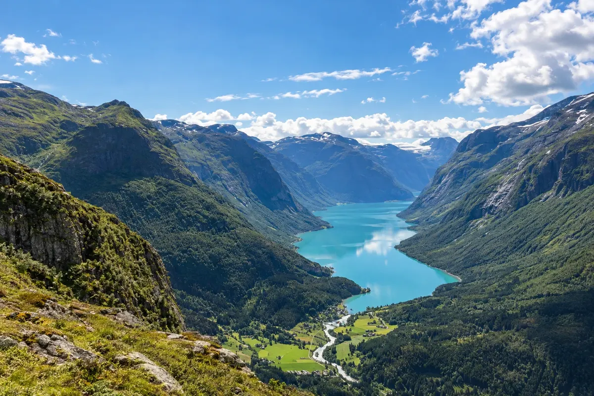
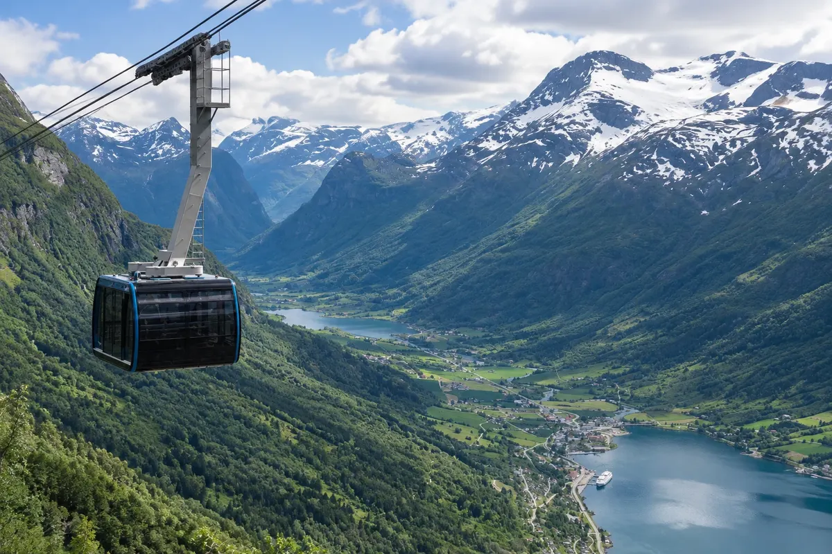
The valleys of Loen and Olden, in the Nordfjord, beneath the Jostedalsbreen glacier: the Loen Skylift cable car to Mount Hoven, the greenish lakes and the Briksdal and Kjenndal glacial tongues.

Westfjords

Na fotografiji: Lovatnet

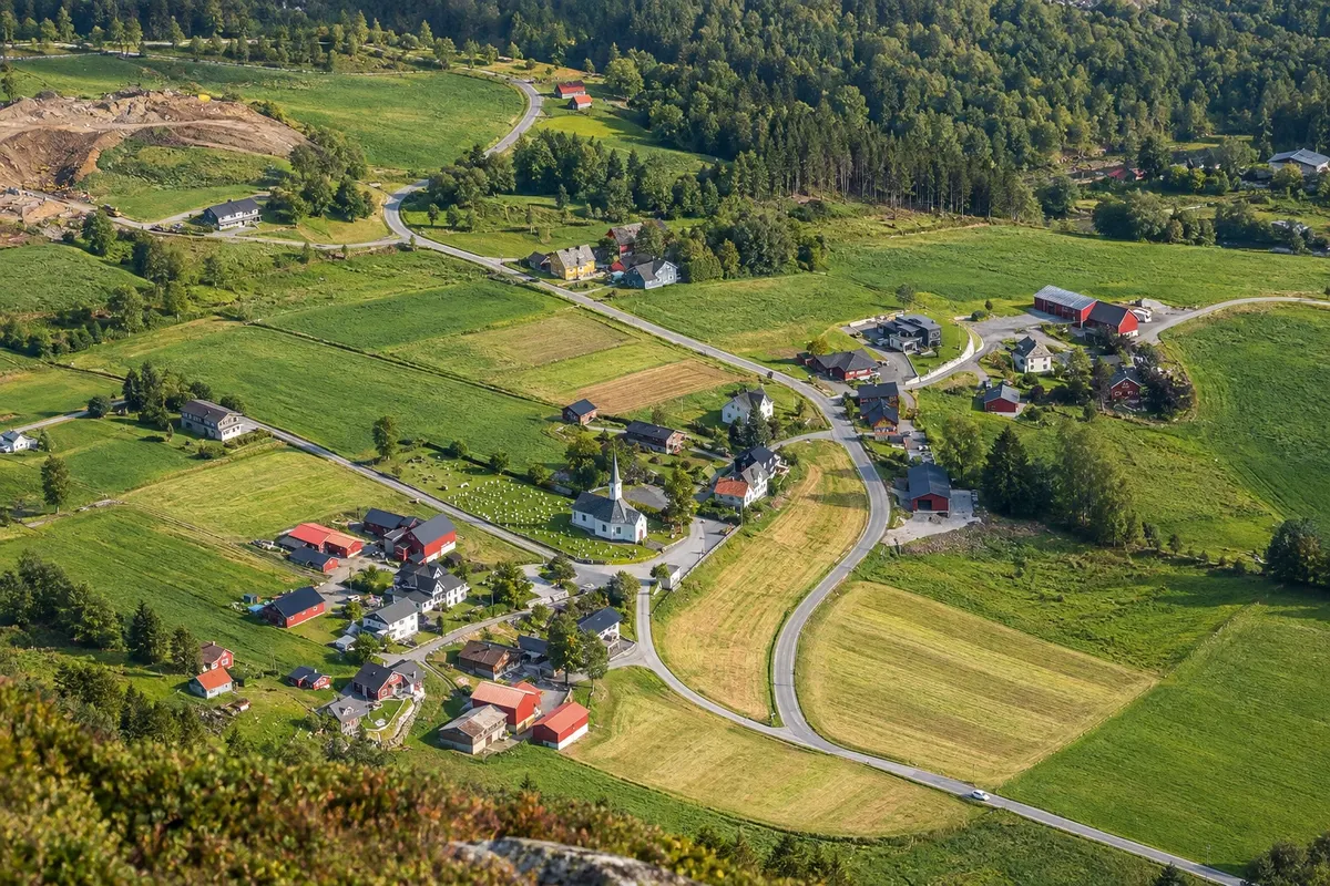
Illustrative images. The pictures in this guide are illustrations based on the real place, not photographs, and may differ from it.

Na voljo v trgovini Google Play Pošljite svoje fotografije

Spoznajte kraj

Pokrajina, ki jo doživite
v svojem ritmu.

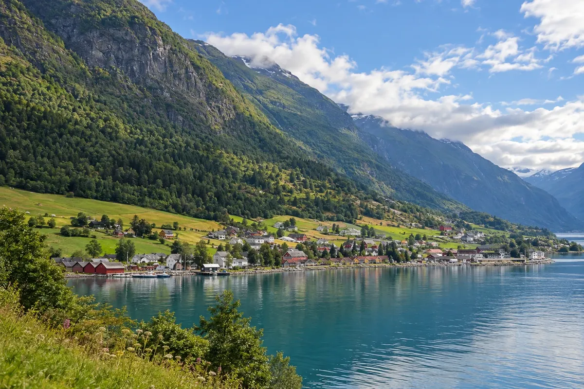
Loen and Olden are two villages at the end of the Innvikfjord, an inner arm of the Nordfjord, in northern Vestland, a few kilometres from each other. From each village a narrow valley climbs southward, with milky green lakes, farms and waterfalls, up to the tongues of the Jostedalsbreen glacier, the largest on the European mainland, which covers the plateau between the Nordfjord and the Sognefjord. The glacier area is a national park.

In Loen, the Loen Skylift cable car rises in a few minutes from the fjord shore to the top of Mount Hoven, at about 1,000 metres, with views over the Nordfjord, the valleys and the snow-covered mountains. The Loen valley, Lodalen, follows the lake Lovatnet up to the Kjenndalsbreen glacier, which descends from the plateau almost to the valley floor. To the east, in Oppstryn, the Jostedalsbreen National Park centre explains the glacier and the landscape.

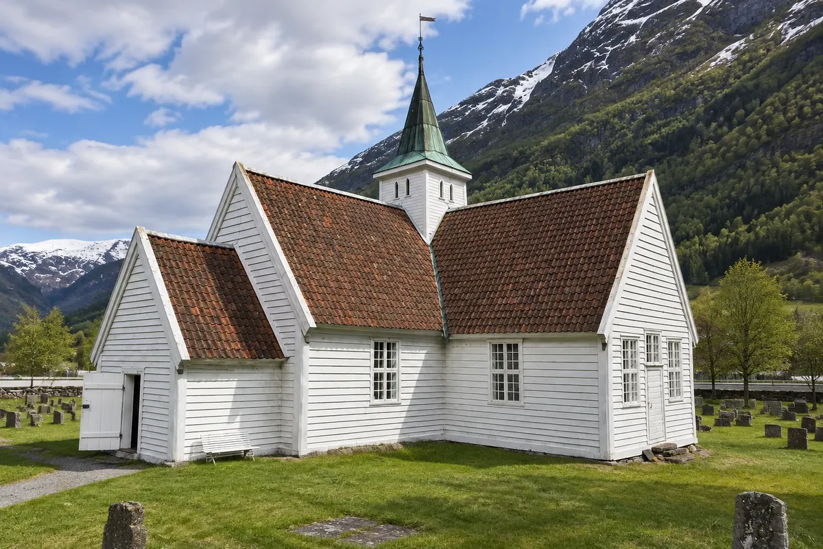
In Olden, the Oldedalen valley runs along the lake Oldevatnet and ends at Briksdal, from where a trail leads to the front of the Briksdalsbreen glacier, one of the country’s most visited glacial tongues. The village has a cruise ship quay and an 18th-century wooden church.

The glaciers have retreated in recent decades: their size changes year to year, and it’s best to follow local guidance and guides. Winter tends to be dark and snowy in the mountains, with fewer services open.

This destination brings together 2 cities: Loen, Olden.

Delite: WhatsApp
Delite svoja popotniška doživetja s fotografijami Pošljite fotografije vsakega kraja, ki ste ga obiskali. Največje število fotografij na kraj: 5.

Ena destinacija, več poti

Mesta na tej poti

Začnite v enem mestu ali v načrt poti vključite več mest.

Loen and the Jostedalsbreen Glacier (Loen; Olden) – lega
LoenOlden

Obrisi: © Kartverket (CC BY 4.0), meje iz leta 2024, podatki o obali: geoBoundaries. Priredba: Cidade Turismo.

Kako do tja:Loen and the Jostedalsbreen Glacier (Loen; Olden)

✈ Sandane lufthavn, Anda (SDN), kraj: Sandane· 60 km do cilja (Loen)

Confirm before buying. The nearest airport is Sandane, with domestic flights, about an hour away; Ålesund is about three hours. From Bergen it’s roughly five and a half hours by car or bus; from Geiranger about 1h30. In summer, cruise ships call at Olden.

Predlagana točka prihoda:Loen

Doživite kraj

Kaj početi – Loen and the Jostedalsbreen Glacier (Loen; Olden)

Briksdal Glacier (Briksdalsbreen)
Olden · Vestland · Glacier

Briksdal Glacier (Briksdalsbreen)

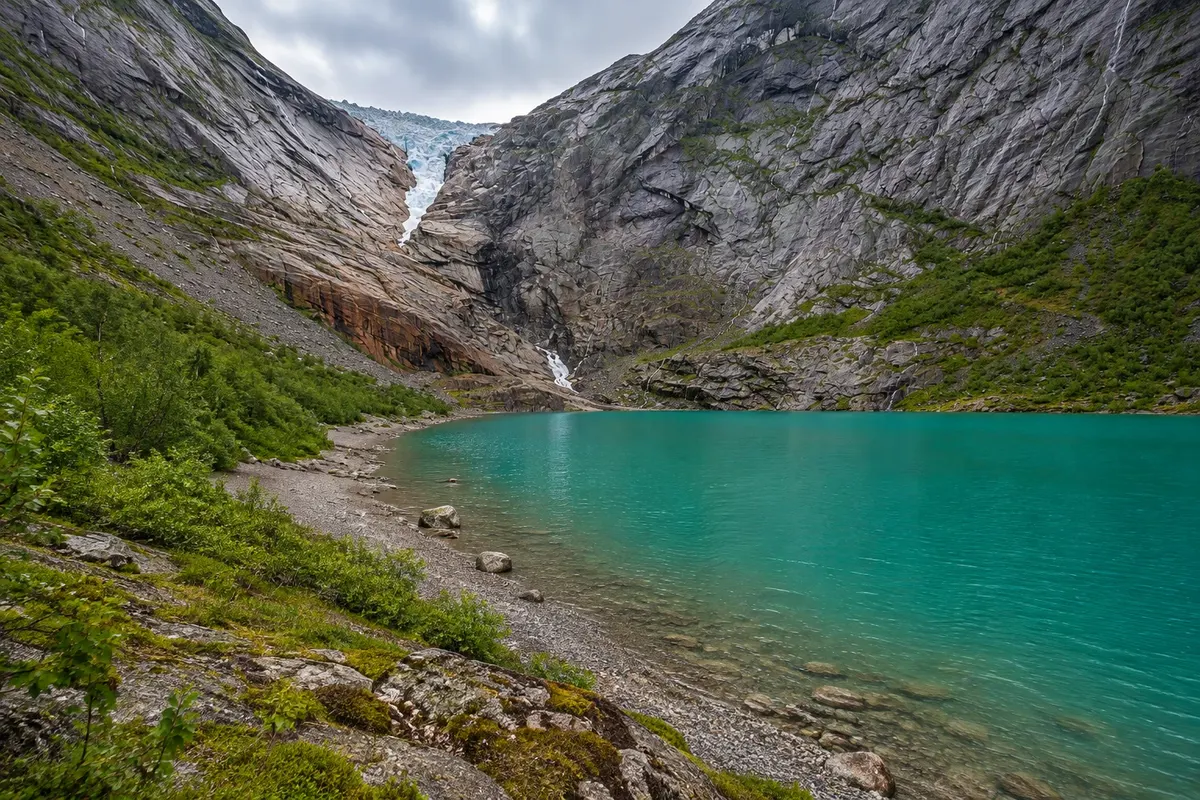
The tongue of the Jostedalsbreen glacier at the end of the Oldedalen valley, descending to a small glacial lake; about a 3 km trail from Briksdal, beside waterfalls, and tourist electric cars in summer.

Loen Skylift
Loen · Vestland · Cable car and viewpoint

Loen Skylift

The cable car that rises from the shore of the Nordfjord in Loen to the top of Mount Hoven, at about 1,000 metres, in a few minutes: restaurant, viewpoints, trails and a via ferrata.

Lovatnet
Loen · Vestland · Jezero

Lovatnet

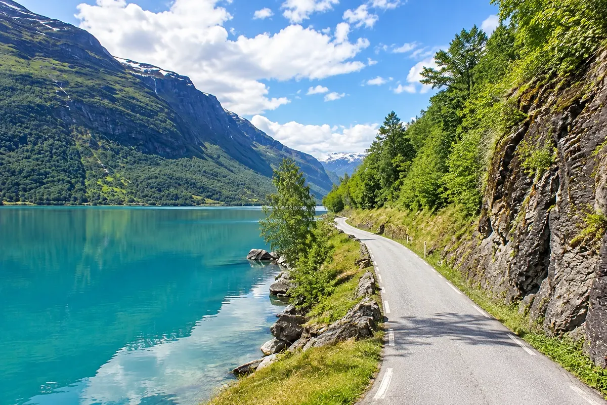
The lake of milky-green water in the Loen valley, about 11 km long between mountains and waterfalls, reached by road and, in summer, by boat all the way to the end of the valley beside the Kjenndalsbreen glacier.

Oldedalen (Olden Valley)
Olden · Vestland · Dolina

Oldedalen (Olden Valley)

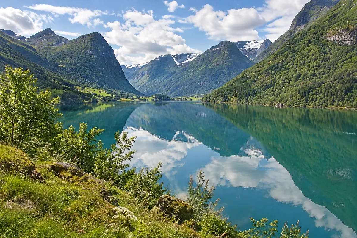
The valley that rises from Olden to Briksdal, with the green Lake Oldevatnet, old farms, waterfalls and the tongues of the Jostedalsbreen glacier appearing high on the mountains.

Loen and the Jostedalsbreen Glacier (Loen; Olden) – prikaži dodatne kraje (3)
Kjenndalsbreen Glacier
Loen · Vestland · Glacier

Kjenndalsbreen Glacier

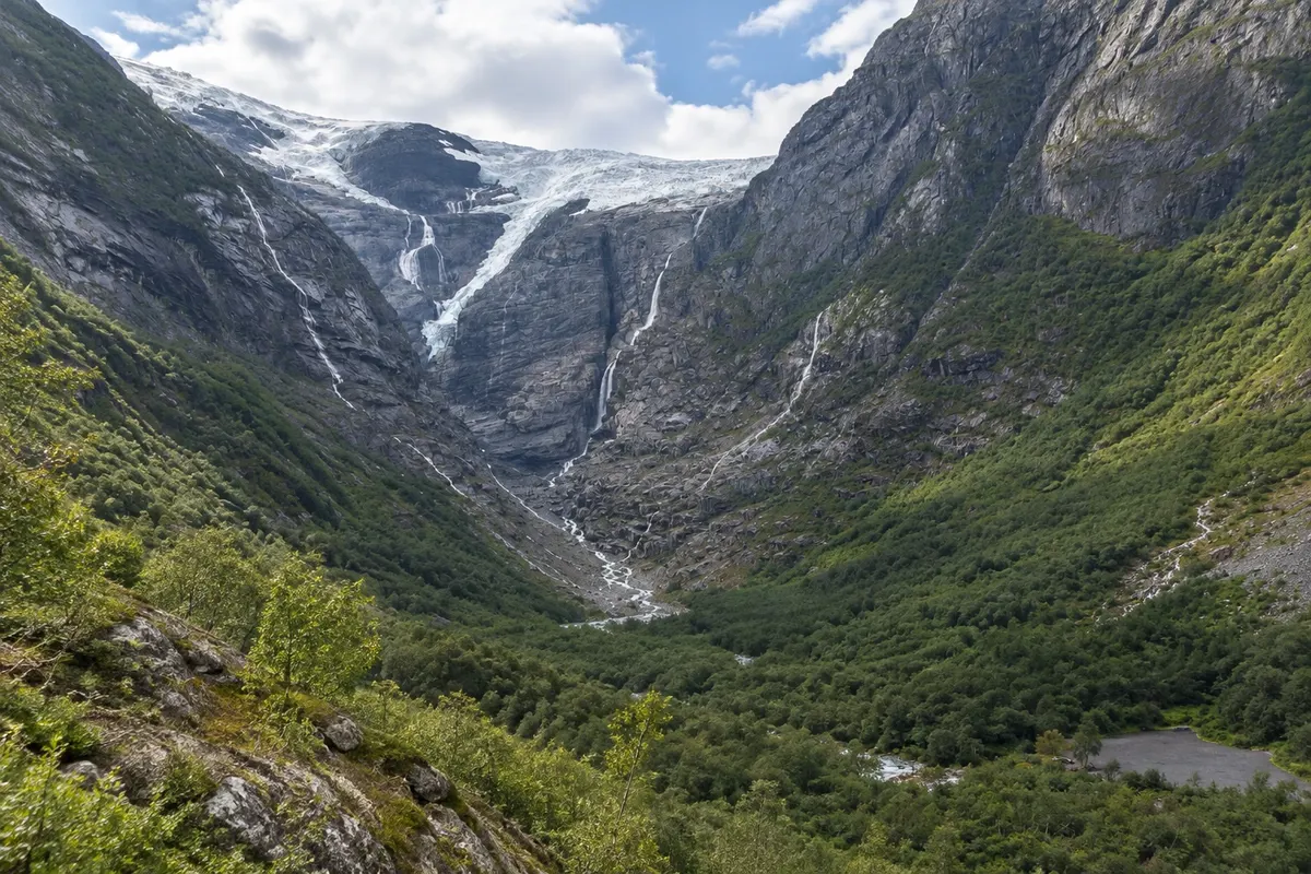
The tongue of the Jostedalsbreen glacier that descends from the plateau to the bottom of the Loen valley at the end of Lovatnet, with meltwater waterfalls and a short walk to a viewpoint in front of the ice.

Olden Old Church (Olden gamle kyrkje)
Olden · Vestland · Cerkev

Olden Old Church (Olden gamle kyrkje)

The wooden church from 1759 in the centre of Olden, with white walls and a painted interior, antique pews and the cemetery facing the fjord, beside the new church.

Jostedalsbreen National Park Centre (Jostedalsbreen)
Loen · Vestland · Visitor centre and museum

Jostedalsbreen National Park Centre (Jostedalsbreen)

The Jostedalsbreen National Park centre in Oppstryn, east of Loen: exhibitions on glacier formation, geology, wildlife and valley life, a panoramic film and a mountain plant garden.

Kaj izbrati pred odhodom

Izleti – Loen and the Jostedalsbreen Glacier (Loen; Olden)

Izhodišče, trajanje, potek, vključene storitve in okvirna cena vsakega izleta.

Loen Skylift

Odhod: Loen The lower station is on the fjord shore, in central Loen, a few minutes away From during the day to 2 hours on the plateau during the day depending on the route chosen

The Loen Skylift is a cable car that leaves from the fjord edge in Loen and climbs almost straight up the slope to the top of Mount Hoven, at about 1,011 meters. The ride takes only a few minutes, on a steep incline, and the cabin passes the rock face with the fjord growing ever more distant below. At the top, the Hoven building houses a restaurant, café and a panoramic terrace with views over the Nordfjord, the villages of Loen and Olden, the valleys rising toward the glaciers and, on clear days, the mountains of the Jostedalsbreen plateau. Platforms and paths lead to viewpoints around the summit.

Kraji na poti: Loen Skylift.

Vključuje: Arrange access to the site and transport separately. Guided activities and tickets have their own conditions.

Nasvet: Bring a jacket: up high it is usually much colder than at the fjord. If you like walking, take the cable car up and do one of the plateau trails before descending.

Najboljši čas za obisk: On a clear day, at any time of year

Lovatnet

Odhod: Loen the road leaves the center of Loen and follows the Lodalen valley along the lake shore 2 to 4 hours to travel the valley to Kjenndalsbreen, with stops. during the day depending on the route chosen

Lovatnet is the lake of the Lodalen valley, which rises from Loen to the south toward the Jostedalsbreen glacier. It is about 11 km long and has a milky-green color due to rock flour carried in suspension by the glacier rivers. Around it, the mountains rise almost straight from the shore, with waterfalls and snow on the peaks well into summer. A narrow road runs along the east shore of the lake, passing farms, small stony beaches and stopping areas. At the valley bottom, after Bødal, the road continues through a toll section to Kjenndalen, where the Kjenndalsbreen glacier is located. Along the way, the side valley of Bødalen leads to another glacier tongue, Bødalsbreen, via a longer trail.

Kraji na poti: Lovatnet.

Vključuje: Arrange access to the site and transport separately. Guided activities and tickets have their own conditions.

Nasvet: Drive slowly: the road is narrow and has pull-out areas. Stop at the stony beaches to see the color of the water up close.

Najboljši čas za obisk: From May to September, when the road to the valley bottom and the boat usually operate

Kjenndalsbreen

Odhod: Loen It is at the bottom of the Lodalen valley, about 20 km from Loen, via the road along the shore From 30 minutes to 1 hour on the valley floor during the day depending on the route chosen

Kjenndalsbreen is a branch of the Jostedalsbreen glacier that descends from the plateau in tiers of blue ice down to the bottom of Kjenndalen valley, at the end of lake Lovatnet, about 20 km from Loen. From the car park, near a small café, a short walk of about 15 to 20 minutes leads to a viewpoint in front of the glacier terminus. The scene features rock walls polished by the ice, meltwater waterfalls falling down both sides, and a grey-green river that flows from the glacier toward the lake. You can see the ice front up close, with crevasses and bluish blocks, and on warm days you can hear the ice cracking.

Kraji na poti: Kjenndalsbreen.

Vključuje: Arrange access to the site and transport separately. Guided activities and tickets have their own conditions.

Nasvet: Combine it with Lovatnet on the same outing. Bring a jacket: near the ice it is colder. Follow the trail markings.

Najboljši čas za obisk: From May to September, when the road to Kjenndalen is usually open

Jostedalsbreen Nasjonalparksenter

Odhod: Loen It is in Oppstryn, by road 15, about 25 km from Loen and 15 km from Stryn, From 1 to during the day. during the day depending on the route chosen

The Jostedalsbreen Nasjonalparksenter is in Oppstryn, on the shore of lake Strynsvatnet, about 25 km from Loen, on the mountain road toward Geiranger and Lom. It is one of the visitor centres for Jostedalsbreen National Park, which protects the largest glacier on continental Europe and the surrounding valleys. The exhibits explain how glaciers form and move, how they carved the valleys and fjords of western Norway and how they are changing with the climate. There are models, rocks and ice samples, panels about the mountain’s animals and plants, and a section on life on valley farms, with winter isolation. A panoramic film shows the glacier from above through the seasons.

Kraji na poti: Jostedalsbreen Nasjonalparksenter.

Vključuje: Arrange access to the site and transport separately. Guided activities and tickets have their own conditions.

Nasvet: Stop here before going to the glaciers: the film and the models explain what you will see at Briksdal and Kjenndal.

Najboljši čas za obisk: From May to September, when the center is usually open

Briksdalsbreen

Odhod: Olden It is at the end of the Oldedalen valley, about 23 km from Olden, roughly 30 minutes 2 to 3 hours round trip from Briksdal. during the day depending on the route chosen

Briksdalsbreen is one of the tongues of the Jostedalsbreen glacier and one of the most visited in Norway. It descends from the plateau between rock walls to a small glacial lake at the end of the Oldedalen valley, about 23 km from Olden. The bluish ice, crevasses and the ice blocks that float in the lake can be seen from the shore. The trail starts in Briksdal, next to a mountain lodge with a café and parking, and is about 3 km each way, with a gentle climb that becomes steeper, taking roughly 45 minutes to 1 hour on the way up. The path runs beside the Kleivafossen waterfall, whose spray reaches the trail, and crosses bridges over the meltwater river. In summer, small electric tour cars, the troll cars, often take visitors for much of the route.

Kraji na poti: Briksdalsbreen.

Vključuje: Arrange access to the site and transport separately. Guided activities and tickets have their own conditions.

Nasvet: Bring a rain jacket: the Kleivafossen waterfall splashes people passing beside it. Do the hike on foot at least on the way down to view the waterfalls at leisure.

Najboljši čas za obisk: From May to September, when the trail is usually snow-free and the electric cars operate

Oldedalen

Odhod: Olden the road leaves the center of Olden and follows the valley to Briksdal, about 23 km 1 to 3 hours, with stops, in addition to the visit to Briksdal. during the day depending on the route chosen

Oldedalen is the valley that runs from Olden, at the head of the Nordfjord, and climbs about 20 km south to Briksdal and the Briksdalsbreen glacier. It is a narrow valley, with mountains over 1,500 meters on both sides and waterfalls descending the slopes, some coming directly from the glacier. Most of the valley is occupied by Lake Oldevatnet, with milky green water, about 10 km long, and by small historic farms along the shores, some with wooden houses and 19th-century barns. The road follows the lake, with stopping areas, stony beaches and bridges over the meltwater rivers.

Kraji na poti: Oldedalen.

Vključuje: Arrange access to the site and transport separately. Guided activities and tickets have their own conditions.

Nasvet: Stop at the stony beaches of Oldevatnet to see the color of the water up close. If you have time, cycle a section of the valley with a bike rented in Olden.

Najboljši čas za obisk: From May to September, with farms and campsites open and waterfalls fullest in May and June


Prikaži še 1 izlet

Olden gamle kyrkje

Odhod: Olden It is in the centre of Olden, a few minutes' walk from the quay and the main road About 20 to 30 minutes. during the day depending on the route chosen

Olden’s old church was built in 1759, in wood, in the centre of the village, near the mouth of the river that flows down from Oldedalen. It is a small single‑nave church with white exterior walls and a dark roof, and it replaced earlier churches on the same site with medieval origins. The interior retains period wooden benches with hinged doors, painted floral decoration and the 18th‑century pulpit and altar. Light enters through small windows, and the church has the feel of a modest village church typical of rural western Norway.

Kraji na poti: Olden gamle kyrkje.

Vključuje: Arrange access to the site and transport separately. Guided activities and tickets have their own conditions.

Nasvet: Combine it with a walk around the village centre and the fjord shore before heading up the valley.

Najboljši čas za obisk: From June to August, when the church is usually open for visits

Po dnevih

Loen and the Jostedalsbreen Glacier (Loen; Olden) – načrt poti. Število dni: 1, 2in3

Predlogi za načrtovanje poti. Vrstni red dni prilagodite vremenu in razpoložljivosti izletov.

1 dni · Loen and the Jostedalsbreen glacier in 1 day

ZaTo organize visits by day, allowing time for travel. · Izhodišče:Loen, Olden
  1. Dan 1 · Loen Skylift / Lovatnet

    Take the Loen Skylift and view the Nordfjord from Hoven. Then walk a stretch along the shore of Lovatnet; the lake lies in another valley and requires driving to reach.

2 dni · Loen and the Jostedalsbreen glacier in 2 days
ZaTo organize visits by day, allowing time for travel. · Izhodišče:Loen, Olden
  1. Dan 1 · Loen Skylift / Lovatnet

    Take the Loen Skylift and view the Nordfjord from Hoven. Then walk a stretch along the shore of Lovatnet; the lake lies in another valley and requires driving to reach.

  2. Dan 2 · Briksdalsbreen / Oldedalen

    Leave Olden via Oldedalen and set aside most of the day for the walk at Briksdal. The ice is retreating over time; the visit follows the landscape and the designated viewing point.

3 dni · Loen and the Jostedalsbreen glacier in 3 days
ZaTo organize visits by day, allowing time for travel. · Izhodišče:Loen, Olden
  1. Dan 1 · Loen Skylift / Lovatnet

    Take the Loen Skylift and view the Nordfjord from Hoven. Then walk a stretch along the shore of Lovatnet; the lake lies in another valley and requires driving to reach.

  2. Dan 2 · Briksdalsbreen / Oldedalen

    Leave Olden via Oldedalen and set aside most of the day for the walk at Briksdal. The ice is retreating over time; the visit follows the landscape and the designated viewing point.

  3. Dan 3 · Kjenndalsbreen / Jostedalsbreen Nasjonalparksenter

    Travel through the Kjenndalen valley to view the glacier from a distance and include the visitor center at Oppstryn. Plan the return via Loen and the leg to the museum before you set out.

Najboljši čas za obisk

Kdaj se odpraviti:Loen and the Jostedalsbreen Glacier (Loen; Olden) po mesecih

From May to September the valleys and trails are usually free of snow, with boats, Briksdal’s electric cars and visitor centres operating; June and July have very long days. Waterfalls usually have more flow in May and June. In winter, the region is quiet, with short days and some services closed.

The seasons shown are the most usual ones; nature doesn't always follow the calendar.

januar Veliko padavin

Winter · plan your travel

The monthly average at the reference station is usually around -0.6 °C. The normal precipitation for the month is about 190 mm, totaling rain and snow in water equivalent. Cold tends to be persistent and days are usually short. Prioritize tours with confirmed access for the period.

februar Veliko padavin

Winter · plan your travel

The monthly average at the reference station is usually around -1.0 °C. The normal precipitation for the month is about 150 mm, totaling rain and snow in water equivalent. Cold tends to be persistent and days are usually short. Prioritize tours with confirmed access for the period.

marec Veliko padavin

Spring · plan your travel

The monthly average at the reference station is usually around 0.7 °C. The normal precipitation for the month is about 165 mm, totaling rain and snow in water equivalent. Daylight tends to increase over the season, while snow usually remains on the mountains. High-altitude routes follow their own schedule.

april Zmerne padavine

Spring · plan your travel

The monthly average at the reference station is usually around 4.5 °C. The normal precipitation for the month is about 87 mm, totaling rain and snow in water equivalent. Daylight tends to increase over the season, while snow usually remains on the mountains. High-altitude routes follow their own schedule.

maj Zmerne padavine

Spring · long days

The monthly average at the reference station is usually around 8.5 °C. The normal precipitation for the month is about 72 mm, totaling rain and snow in water equivalent. Daylight tends to increase over the season, while snow usually remains on the mountains. High-altitude routes follow their own schedule.

junij Zmerne padavine

Summer · long days

The monthly average at the reference station is usually around 12.0 °C. The normal precipitation for the month is about 85 mm, totaling rain and snow in water equivalent. Weather is generally mild and days are usually very long. There is higher demand for outdoor activities; arrange bookings in advance.

julij Zmerne padavine

Summer · long days

The monthly average at the reference station is usually around 14.7 °C. The normal precipitation for the month is about 95 mm, totaling rain and snow in water equivalent. Weather is generally mild and days are usually very long. There is higher demand for outdoor activities; arrange bookings in advance.

avgust Zmerne padavine

Summer · long days

The monthly average in the reference season is usually around 13.6 °C. Normal precipitation for the month is about 109 mm, combining rain and snow in water equivalent. The weather is usually mild and the days are typically very long. There is higher demand for outdoor tours; book reservations in advance.

september Veliko padavin

Autumn · plan your travel

The monthly average in the reference season is usually around 10.1 °C. Normal precipitation for the month is about 151 mm, combining rain and snow in water equivalent. Temperatures and day length tend to fall. Long hikes and mountain transfers require planning before you set out.

oktober Veliko padavin

Autumn · plan your travel

The monthly average at the reference station is usually around 5.1 °C. The normal precipitation for the month is about 170 mm, totaling rain and snow in water equivalent. Temperatures and day length tend to fall. Long hikes and travel in the mountains require planning before you set out.

november Veliko padavin

Autumn · plan your travel

The monthly average at the reference station is usually around 2.0 °C. The normal precipitation for the month is about 181 mm, totaling rain and snow in water equivalent. Temperatures and day length tend to fall. Long hikes and travel in the mountains require planning before you set out.

december Veliko padavin

Winter · plan your travel

The monthly average at the reference station is usually around -0.9 °C. The normal precipitation for the month is about 206 mm, totaling rain and snow in water equivalent. Cold tends to be persistent and days are usually short. Prioritize tours with confirmed access for the period.

Načrtujte pot

Kako do tja:Loen and the Jostedalsbreen Glacier (Loen; Olden)

Public transport and reservations

Check train, bus and ferry connections to Loen for your travel date. Verify each leg and the return connection before combining different services. On ferry routes, confirm the pier and the direction of travel.

Car and local travel

Tips for the Lodalen valley, Oppstryn and Olden. Without a car, the Skylift is located in the centre, and in summer there are usually buses and organised tours.

Pred odhodom

Praktične informacije

Z nekaj načrtovanja boste imeli več časa za uživanje na poti.

Kdaj se odpraviti

From May to September the valleys and trails are usually free of snow, with boats, Briksdal’s electric cars and visitor centres operating; June and July have very long days. Waterfalls usually have more flow in May and June. In winter, the region is quiet, with short days and some services closed.

The seasons shown are the most usual ones; nature doesn't always follow the calendar.

Koliko dni ostati

Two days cover the Loen Skylift, Lovatnet with Kjenndalsbreen and Briksdal in Olden. With three days you can add the national park centre in Oppstryn, the Hoven via ferrata or a guided glacier walk.

V katerem mestu prenočiti

Loen has hotels on the fjord shore and cabins in the valley near the Skylift. Olden has hotels and campsites by the quay and in the Oldedalen valley on the way to Briksdal. Stryn, 10 km away, is the larger village with a supermarket, restaurants and more options. In summer, valley campsites offer lakeside cabins.

Spoštujte kraj

Odnesite svoje odpadke, upoštevajte oznake in podprite lokalne ponudnike. V naravi upoštevajte navodila za obiskovalce.

Odgovori na vaša vprašanja

Pogosta vprašanja – Loen and the Jostedalsbreen Glacier (Loen; Olden)

Do I need a car?

It helps a lot: the valleys, glaciers and the park centre are spread out. In summer there are buses and organized tours, especially on days when cruise ships dock in Olden.

Can you get close to the glaciers?

Yes. Trails lead close to the front of Briksdalsbreen and Kjenndalsbreen. The size of the glaciers changes; follow local instructions and guides.

Can you walk on the glacier?

Only with a guide and proper equipment, on organized tours in summer from the region.

How many days to stay?

Two days for the Skylift, Lovatnet and Briksdal; three for the national park and a guided hike.

Is Loen on the way between Bergen and Geiranger?

Yes. From Loen to Geiranger is about 1h30 by car, via the Strynefjellet mountain road.

Odkrijte druge destinacije Iskanje po zvezni državi in mestu

Več kot vodnik