Lom
Lom, whose central nucleus is called Fossbergom, is a service base by the river Bøvre. The wooden church and the mountain centre are in the village; Galdhøpiggen and Besseggen require separate travel to trailheads for day hikes.
Antarktika
Innlandet · Norveška
Mountains, lakes and high-altitude trails, with Lom as a base for the wooden church, the mountain centre and access to Galdhøpiggen and Besseggen.
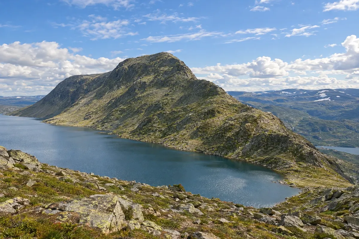
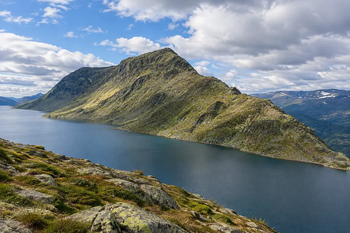
Na fotografiji: Besseggen
Illustrative images. The pictures in this guide are illustrations based on the real place, not photographs, and may differ from it.
Spoznajte kraj
Jotunheimen is a mountainous region in inland Norway. It brings together valleys, lakes, glaciers and routes that require planning on your own, including Galdhøpiggen and Besseggen. The park and its access points do not form a single visit with a central entrance.
Lom serves as a service base on the northern side. In the centre, called Fossbergom, the wooden church and the Norsk fjellsenter present the region's history and landscape. Trailheads are located outside the village and require travel to reach.
Summer usually allows more walking activities, while winter tends to be long and cold, with short days. Allow a day for each long hike and prepare before choosing your route.
This destination brings together 1 city: Lom.
Ena destinacija, več poti
Začnite v enem mestu ali v načrt poti vključite več mest.
Obrisi: © Kartverket (CC BY 4.0), meje iz leta 2024, podatki o obali: geoBoundaries. Priredba: Cidade Turismo.
Confirm before booking. Train to Otta and bus to Lom; check seasonal connections and mountain access.
Doživite kraj
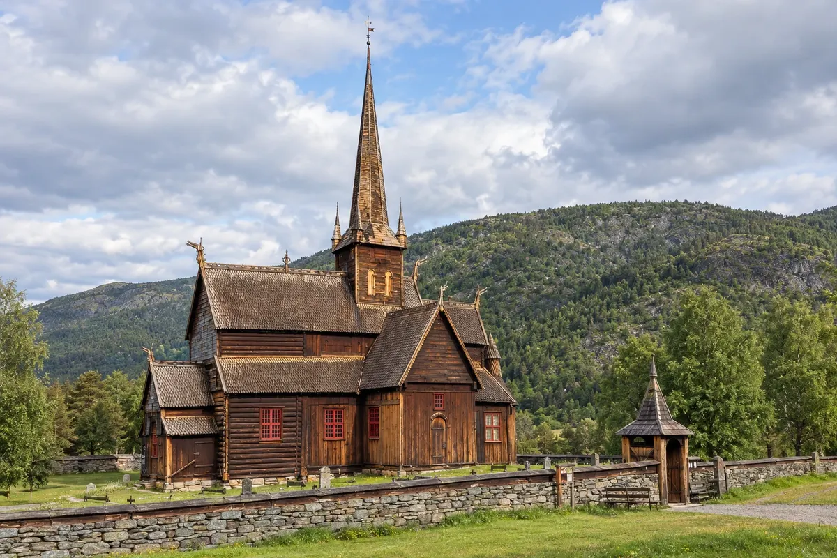
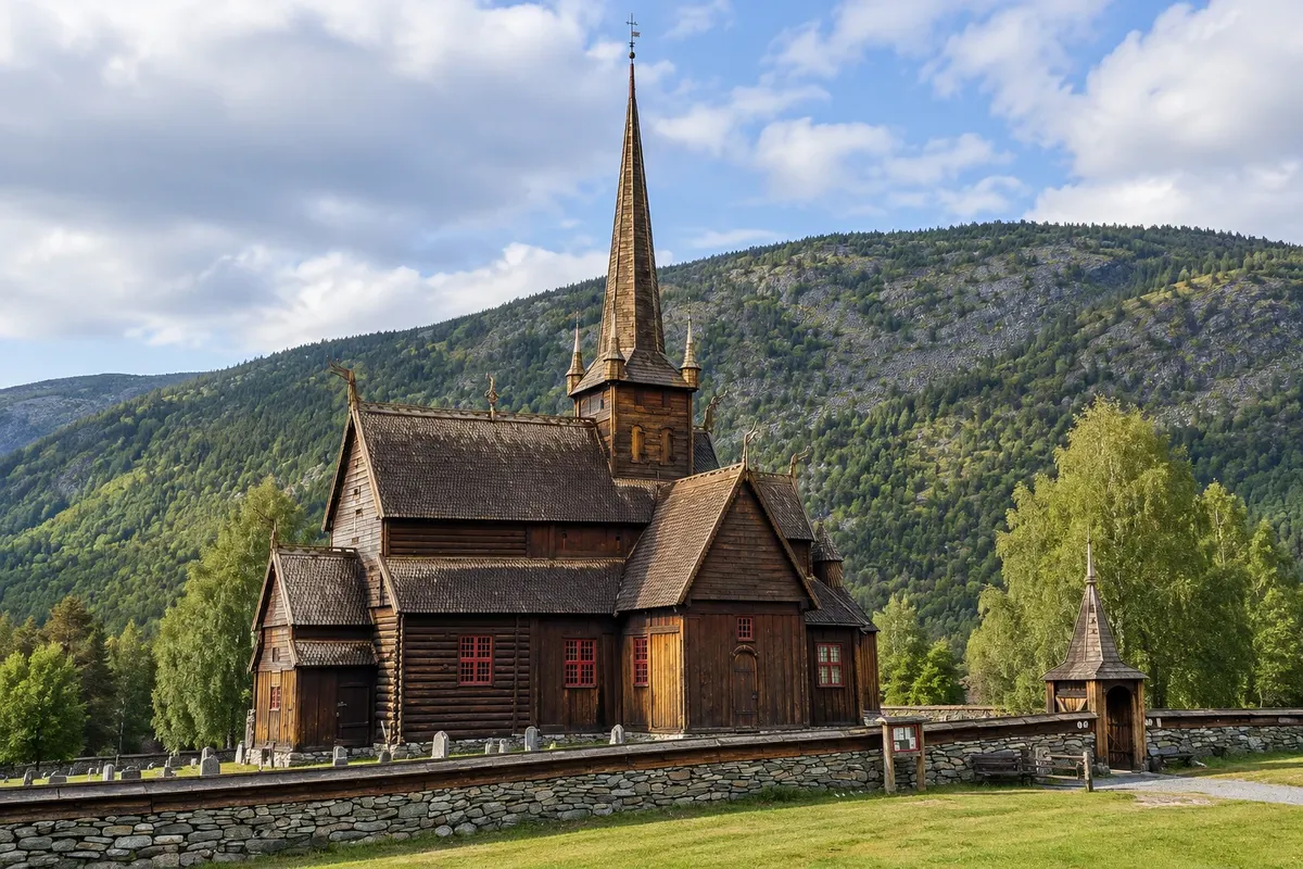
The wooden church of Lom is located in Fossbergom, at the junction of routes leading to the valleys and mountains of Jotunheimen. The medieval structure received additions, and its silhouette features overlapping roofs, a tower and carved wooden finials.
The Norsk fjellsenter presents the relationship between the mountains, the ice and human presence in the Lom region. It serves as a museum and visitor centre for the parks surrounding the village, including Jotunheimen, Breheimen and Reinheimen.
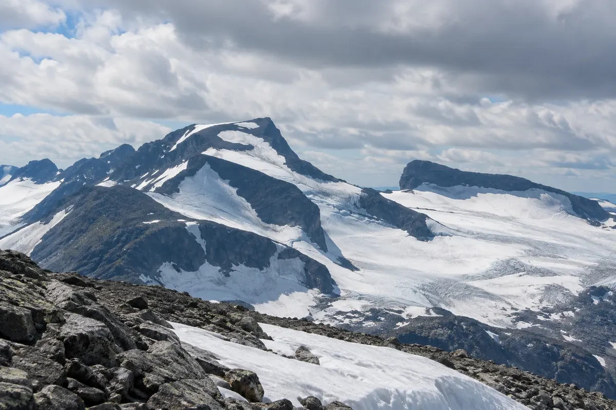
Galdhøpiggen is a summit in Jotunheimen reaching 2,469 metres. The outing is a mountain activity, with a long walk and starting points far from Lom. The landscape includes rock slabs, snow and glacier areas, whose appearance usually changes throughout the year.
Besseggen is the mountain ridge between the lakes Gjende and Bessvatnet in Jotunheimen. The outing combines high-altitude terrain with sections of ascent over rock. The colour difference between the lakes is part of the landscape seen from the route, depending on the light and the day's conditions.
Kaj izbrati pred odhodom
Izhodišče, trajanje, potek, vključene storitve in okvirna cena vsakega izleta.
Lom's wooden church is in Fossbergom, at the junction of routes that head into the valleys and mountains of Jotunheimen. The medieval structure was extended over time, and its silhouette features overlapping roofs, a tower and carved wooden finials. The interior preserves carpentry work and furnishings from different periods. The church remains connected to local religious life; tourist visits should respect ceremonies and areas reserved for worship. Observing the exterior also helps to understand how the building’s parts were joined.
Kraji na poti: Lom stavkyrkje.
Vključuje: Arrange access to the site and transport separately. Guided activities and tickets have their own conditions.
Nasvet: Combine the church visit with the mountain center, on the other side of the main area.
Najboljši čas za obisk: Interior visits are usually concentrated between June and August
The Norsk fjellsenter explains the relationship between the mountains, the ice, and human presence in the Lom region. It serves as a museum and visitor center for the parks surrounding the village, including Jotunheimen, Breheimen, and Reinheimen. The exhibits cover the high-altitude landscape and the history of the people who crossed it. Objects found in the ice help explain movements and activities in the mountains. The visit provides useful context for anyone planning to hike, and it’s also an indoor alternative activity.
Kraji na poti: Norsk fjellsenter.
Vključuje: Arrange access to the site and transport separately. Guided activities and tickets have their own conditions.
Nasvet: Use the visit to choose a route that matches the season and your available time.
Najboljši čas za obisk: The center can be part of your itinerary in any season; check the visiting calendar
Galdhøpiggen is a peak in Jotunheimen that reaches 2,469 meters. The outing is a mountain activity, involving a long hike and starting points that are some distance from Lom. The landscape includes rock slabs, snow and ice areas, whose appearance often changes through the year. Routes depart from different locations and do not have the same duration or terrain. The route via Juvasshytta involves glacier travel with a guide; the Spiterstulen route has a different profile. Choose the option before arranging transport and prepare in advance.
Kraji na poti: Galdhøpiggen.
Vključuje: Arrange access to the site and transport separately. Guided activities and tickets have their own conditions.
Nasvet: Choose the route and whether you will be accompanied before booking transport.
Najboljši čas za obisk: The hiking season usually runs from June to September; prepare in advance.
Besseggen is the mountain ridge between the lakes Gjende and Bessvatnet in Jotunheimen. The walk combines high-altitude terrain with sections of ascent over rock. The difference in color between the lakes is part of the scenery seen from the route, depending on the light and conditions of the day. One way to arrange the crossing is to use the boat between Gjendesheim and Memurubu in one direction. The ticket and the direction of the hike must be decided before you set out. The trail requires appropriate experience, equipment and a dedicated day; prepare in advance.
Kraji na poti: Besseggen.
Vključuje: Arrange access to the site and transport separately. Guided activities and tickets have their own conditions.
Nasvet: Decide the direction of the route and book the boat before arranging the rest of the day.
Najboljši čas za obisk: The hiking and boat season typically runs from June to September; prepare in advance

Po dnevih
Predlogi za načrtovanje poti. Vrstni red dni prilagodite vremenu in razpoložljivosti izletov.
Start at the Fossbergom area, with the wooden church and the exhibits at the Norsk fjellsenter. Both are in the centre of Lom; use this opportunity to arrange transport to the starting points for mountain activities.
Reserve a day for Galdhøpiggen, with the route and guide chosen in advance. Travel to Juvasshytta or Spiterstulen must be added to the hike; the season is usually concentrated between June and September.
Start at the Fossbergom area, with the wooden church and the exhibits at the Norsk fjellsenter. Both are in the centre of Lom; use this opportunity to arrange transport to the starting points for mountain activities.
Reserve a day for Galdhøpiggen, with the route and guide chosen in advance. Travel to Juvasshytta or Spiterstulen must be added to the hike; the season is usually concentrated between June and September.
Set aside a day for Besseggen, starting with travel to the Gjende lake area. Decide the boat and direction of the crossing beforehand; if you depend on public transport you may need to change your overnight base. Prepare before the trail.
Najboljši čas za obisk
From June to September, summer usually favours hiking, with long days and mild temperatures in the valleys. In winter, from December to February, it is usually cold and the days are short.
The seasons shown are the most usual ones; nature doesn't always follow the calendar.
Winter · plan your travel
The monthly average at the reference station is usually around -5.3 °C. Normal monthly precipitation is about 49 mm, combining rain and snow in water equivalent. Cold tends to be persistent and days are usually short. Prioritize outings with confirmed access for the period.
Winter · plan your travel
The monthly average at the reference station is usually around -5.8 °C. Normal monthly precipitation is about 30 mm, combining rain and snow in water equivalent. Cold tends to be persistent and days are usually short. Prioritize outings with confirmed access for the period.
Spring · plan your travel
The monthly average at the reference station is usually around -2.6 °C. Normal monthly precipitation is about 25 mm, combining rain and snow in water equivalent. Daylight tends to increase during the season, while snow usually remains in the mountains. High-altitude routes follow their own calendar.
Spring · plan your travel
The monthly average at the reference station is usually around 0.3 °C. Normal monthly precipitation is about 19 mm, combining rain and snow in water equivalent. Daylight tends to increase during the season, while snow usually remains in the mountains. High-altitude routes follow their own calendar.
Spring · long days
The monthly average in the reference season is usually around 6.1 °C. Normal monthly precipitation is about 25 mm, combining rain and snow as water equivalent. Daylight generally increases through the season, while snow typically remains on the mountains. High-altitude routes follow their own calendar.
Summer · long days
The monthly average in the reference season is usually around 8.7 °C. Normal monthly precipitation is about 40 mm, combining rain and snow as water equivalent. Weather is generally mild and the days are usually very long. There is higher demand for outdoor activities; make reservations in advance.
Summer · long days
The monthly average in the reference season is usually around 12.5 °C. Normal monthly precipitation is about 51 mm, combining rain and snow as water equivalent. Weather is generally mild and the days are usually very long. There is higher demand for outdoor activities; make reservations in advance.
Summer · long days
The monthly average in the reference season is usually around 10.3 °C. Normal monthly precipitation is about 59 mm, combining rain and snow as water equivalent. Weather is generally mild and the days are usually very long. There is higher demand for outdoor activities; make reservations in advance.
Autumn · plan your travel
The monthly average in the reference season is usually around 7.1 °C. Normal monthly precipitation is about 48 mm, combining rain and snow as water equivalent. Temperatures and daylight hours tend to fall. Long hikes and mountain travel require planning before you set out.
Autumn · plan your travel
The monthly average at the reference station is usually around 1.3 °C. Normal monthly precipitation is about 49 mm, combining rain and snow in water equivalent. Temperatures and day length tend to decrease. Long hikes and mountain transfers require planning before you set out.
Autumn · plan your travel
The monthly average at the reference station is usually around -3.8 °C. Normal monthly precipitation is about 50 mm, combining rain and snow in water equivalent. Temperatures and day length tend to decrease. Long hikes and mountain transfers require planning before you set out.
Winter · plan your travel
The monthly average at the reference station is usually around -6.1 °C. Normal monthly precipitation is about 48 mm, combining rain and snow in water equivalent. Cold tends to be persistent and days are usually short. Prioritize outings with confirmed access for the period.
Načrtujte pot
Check train, bus and boat connections to Lom for your travel date. Verify each leg and the return connection before combining different services. On boat routes, confirm the pier and direction of travel.
The town center is walkable. A car helps reach trailheads; in summer there are usually seasonal buses to some bases.
Pred odhodom
Z nekaj načrtovanja boste imeli več časa za uživanje na poti.
From June to September, summer usually favours hiking, with long days and mild temperatures in the valleys. In winter, from December to February, it is usually cold and the days are short.
The seasons shown are the most usual ones; nature doesn't always follow the calendar.
Three days cover Lom centre and two mountain activities, if conditions allow.
Lom centre provides services and transport. Bøverdalen brings you closer to some access points for Galdhøpiggen; the Gjende area is another base for Besseggen.
Odnesite svoje odpadke, upoštevajte oznake in podprite lokalne ponudnike. V naravi upoštevajte navodila za obiskovalce.
Odgovori na vaša vprašanja
Train to Otta and bus to Lom; check connections and seasonal access to the mountains.
Three days cover Lom centre and two mountain activities, if conditions allow.
Lom centre provides services and transport. Bøverdalen brings you closer to some access points for Galdhøpiggen; the Gjende area is another base for Besseggen.
Več kot vodnik