Geiranger and Ålesund

Møre og Romsdal · Norveška

Geiranger and Ålesund

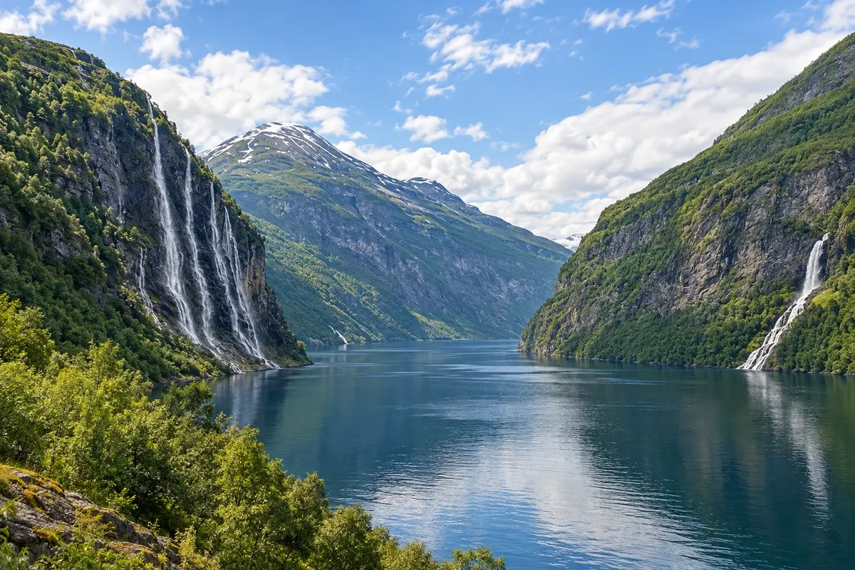
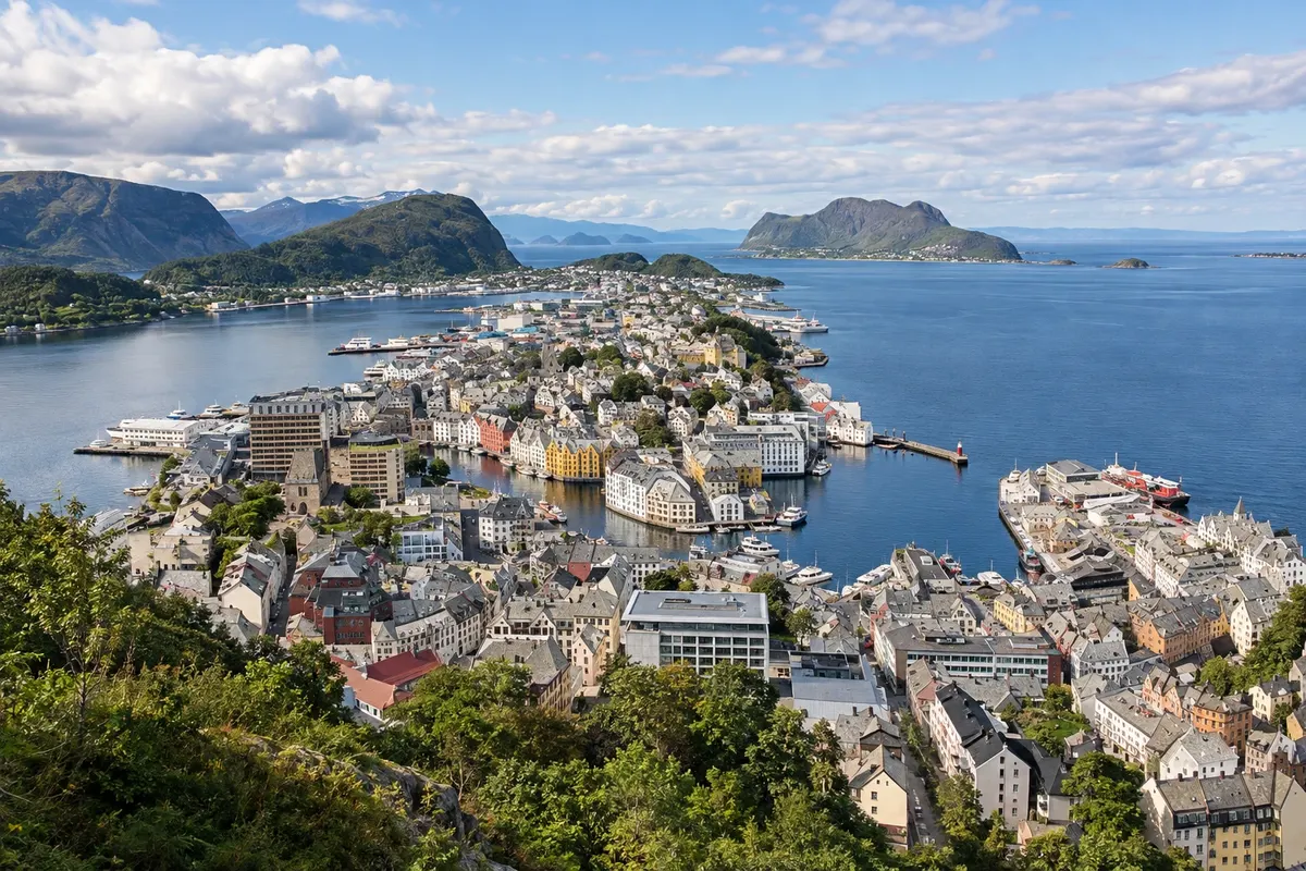
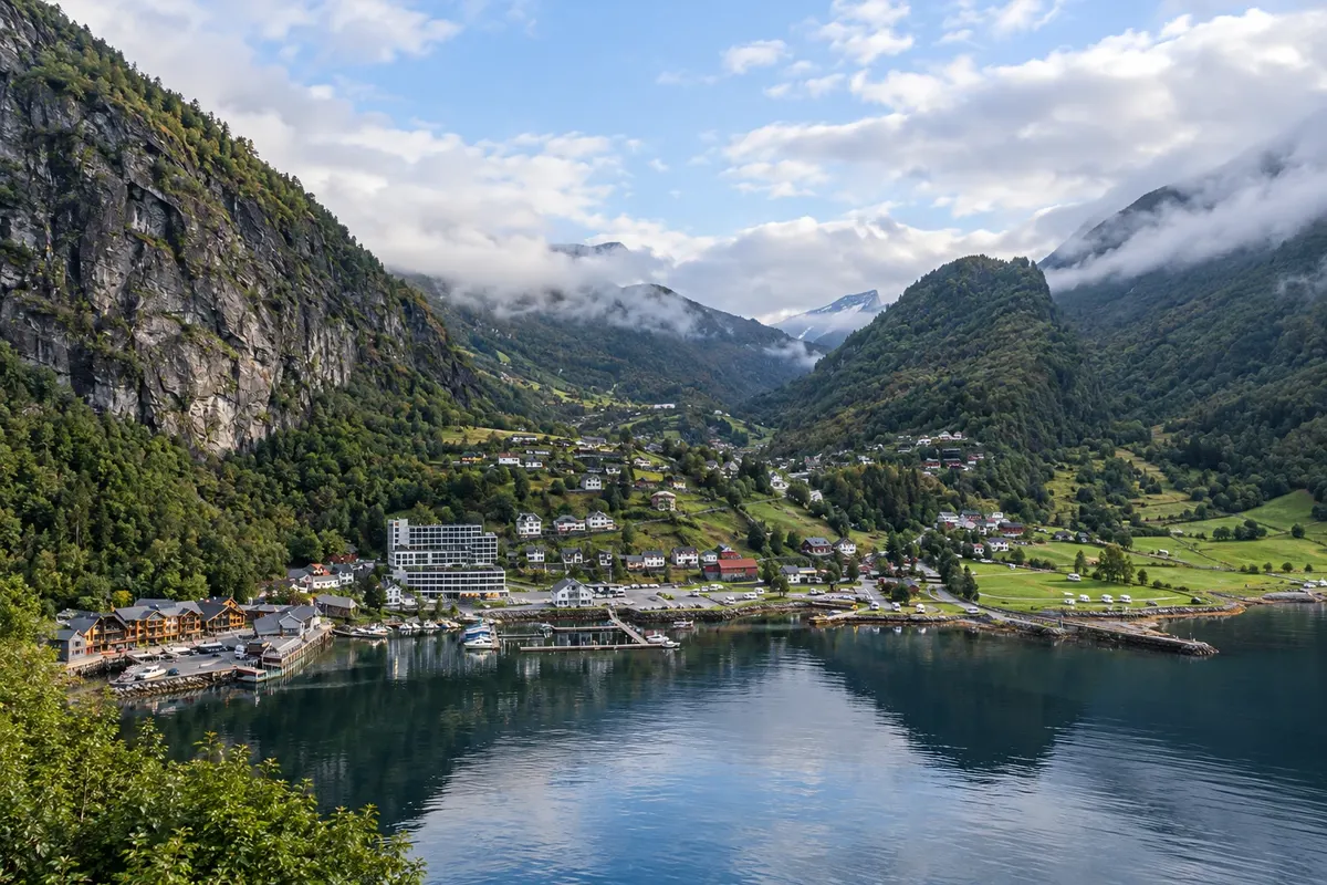
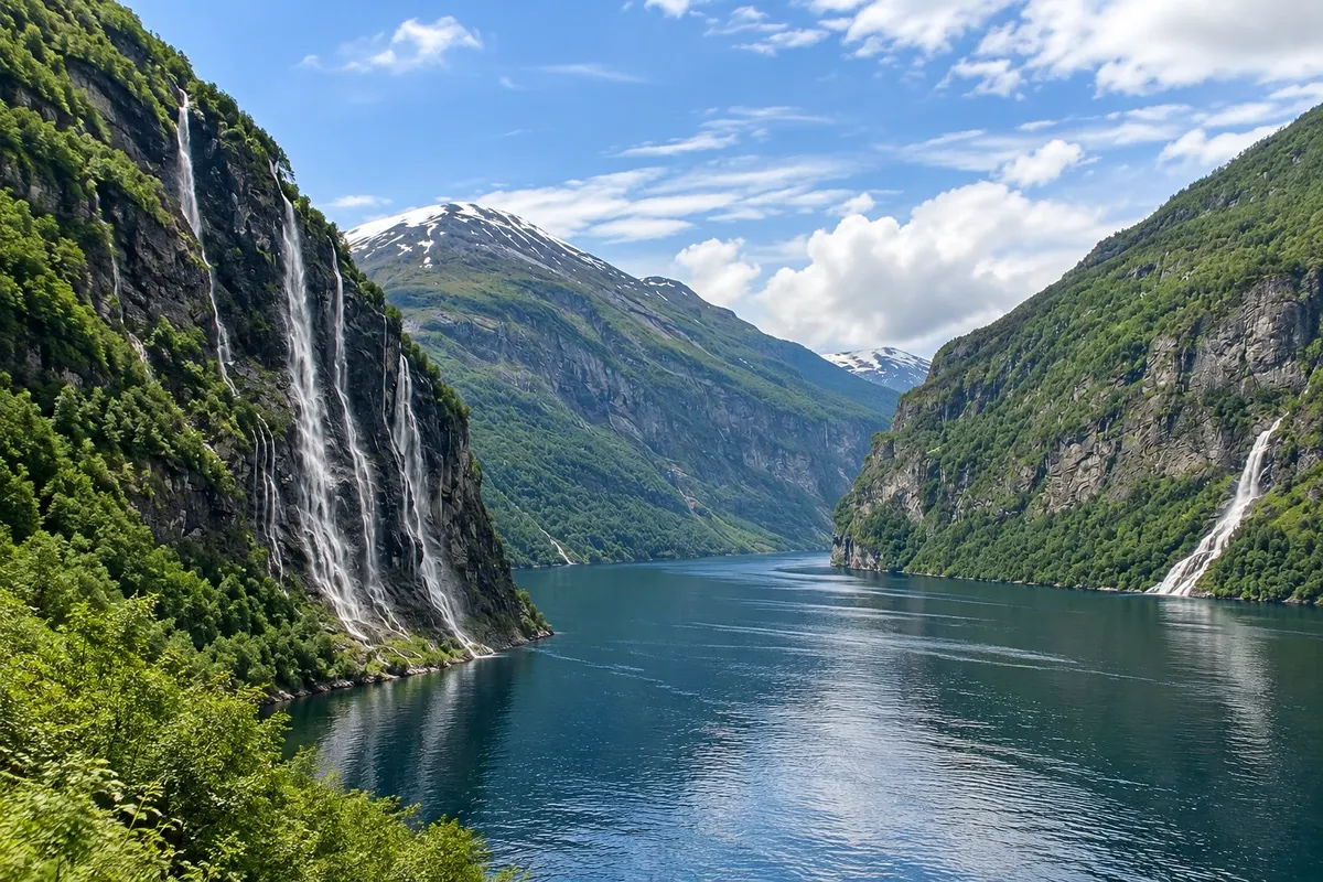
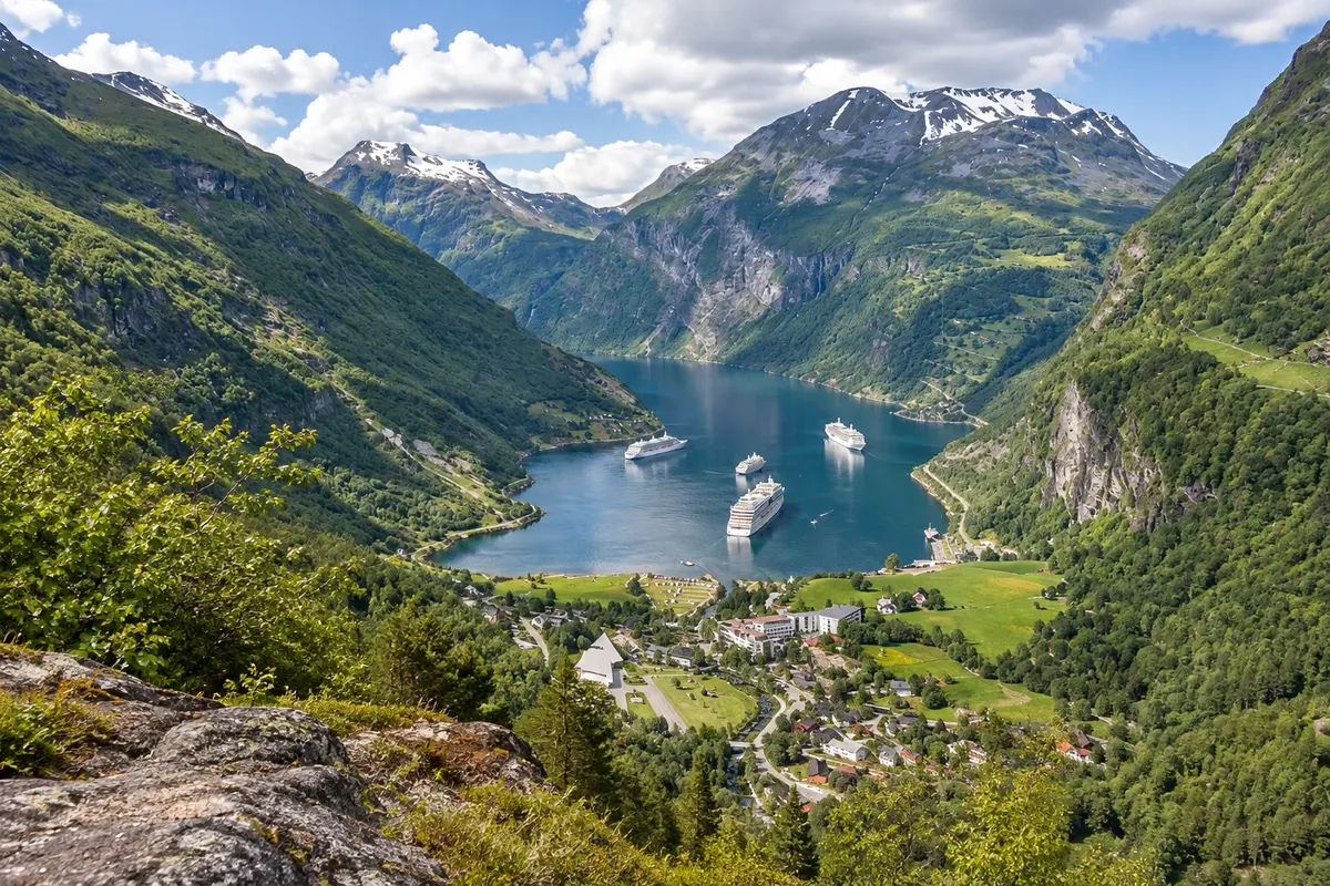
The Geirangerfjord, a World Heritage site, with the Sete Irmãs waterfalls and the viewpoints of Dalsnibba and Flydalsjuvet, and Ålesund, the coastal art nouveau town, with the Aksla viewpoint.

Westfjords

Na fotografiji: Geirangerfjord

Illustrative images. The pictures in this guide are illustrations based on the real place, not photographs, and may differ from it.

Na voljo v trgovini Google Play Pošljite svoje fotografije

Spoznajte kraj

Pokrajina, ki jo doživite
v svojem ritmu.

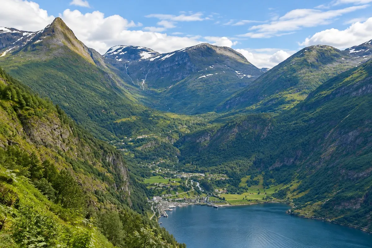
The Geirangerfjord is a narrow arm of the Storfjord, in the county of Møre e Romsdal, about 15 km long between rock walls, waterfalls and abandoned farms on the slopes. Together with the Nærøyfjord, it is a UNESCO World Heritage Site. At its head lies the village of Geiranger, small, with hotels, a quay and the roads that descend in hairpins from the mountains, and from where you can view the fjord from above at the Flydalsjuvet and Dalsnibba viewpoints.

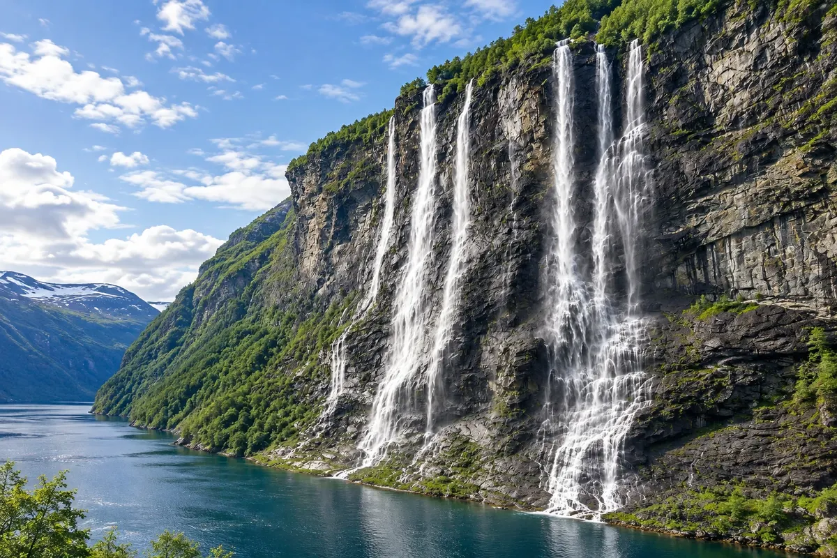
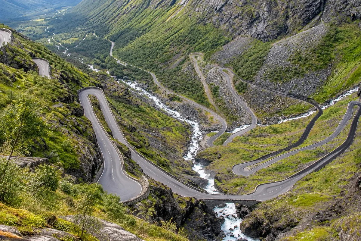
The boat trip through the fjord passes the Sete Irmãs, seven waterfalls side by side, and the Pretendente, the waterfall opposite which, according to legend, tries to woo them. To the north, the Estrada da Águia descends in hairpins down to the fjord, and the Trollstigen, the road with 11 hairpin bends on a steep cliff, is about an hour and a half away via the fjord route. Mountain roads usually close in winter.

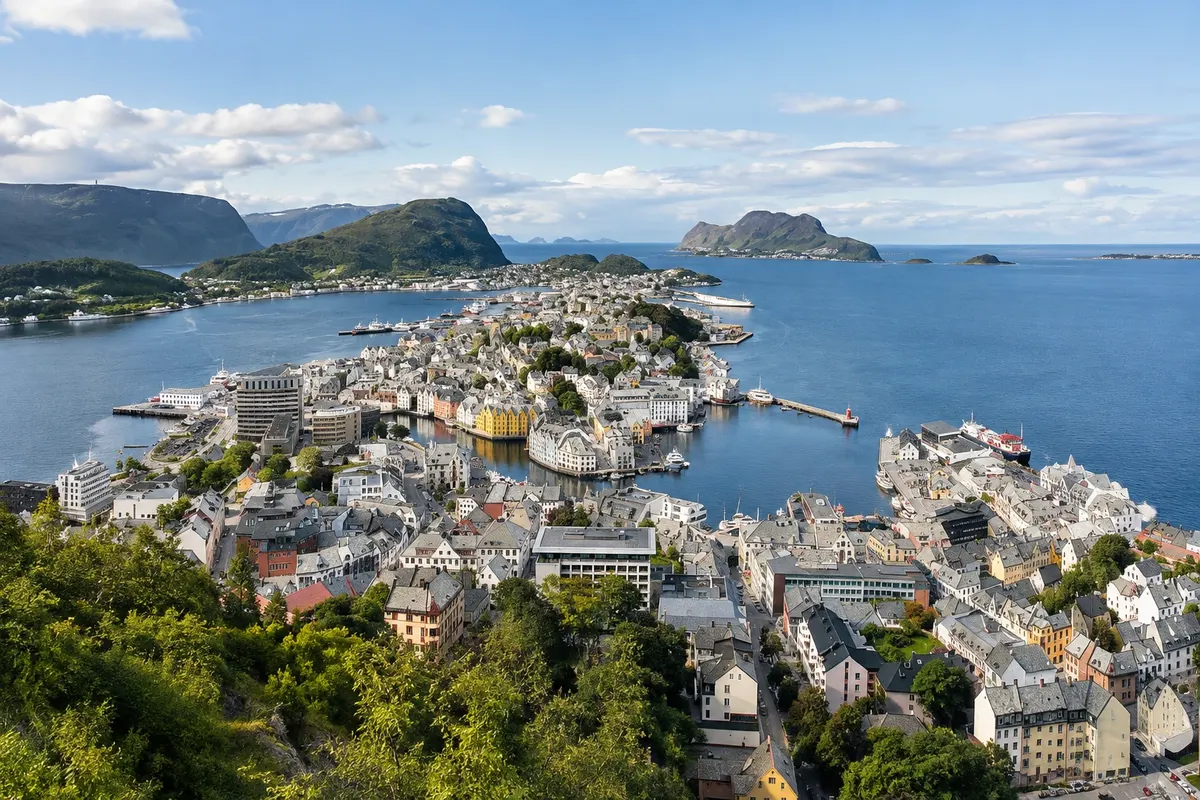
Ålesund is the gateway to the region on the coast, about three hours from Geiranger. The town was destroyed by a fire in 1904 and rebuilt in a few years in the art nouveau style, with towers, stone facades and ornamentation that make the centre a rare ensemble in Europe. From the Aksla viewpoint, at the top of the 418-step stairway, you can see the town spread over the islands, the sea and the Sunnmøre mountains.

In winter Geiranger is quiet and has limited access because of the mountain roads.

This destination brings together 2 cities: Ålesund, Geiranger.

Delite: WhatsApp
Delite svoja popotniška doživetja s fotografijami Pošljite fotografije vsakega kraja, ki ste ga obiskali. Največje število fotografij na kraj: 5.

Ena destinacija, več poti

Mesta na tej poti

Začnite v enem mestu ali v načrt poti vključite več mest.

Geiranger and Ålesund – lega
ÅlesundGeiranger

Obrisi: © Kartverket (CC BY 4.0), meje iz leta 2024, podatki o obali: geoBoundaries. Priredba: Cidade Turismo.

Kako do tja:Geiranger and Ålesund

✈ Ålesund lufthavn, Vigra (AES), kraj: Vigra· 15 km do cilja (Ålesund)

Check before booking. Ålesund Airport, in Vigra, is about 15 km from the centre. To Geiranger, it is about three hours from Ålesund by car or bus, with a ferry crossing, or by boat along the Storfjord in summer. The Hurtigruten links Ålesund with Bergen and points north.

Predlagana točka prihoda:Ålesund

Doživite kraj

Kaj početi – Geiranger and Ålesund

Fjellstua (Aksla viewpoint)
Ålesund · Møre og Romsdal · Razgledišče

Fjellstua (Aksla viewpoint)

The viewpoint at the top of Aksla hill, above Ålesund's center, reached by the 418-step staircase from the city park: views of the islands, the sea and the Sunnmøre mountains.

Geirangerfjord
Geiranger · Møre og Romsdal · Fjord

Geirangerfjord

The narrow arm of the Storfjord that ends at the village of Geiranger: 15 km between rock walls, waterfalls and farms hanging on the slopes. UNESCO World Heritage Site.

Dalsnibba
Geiranger · Møre og Romsdal · Razgledišče

Dalsnibba

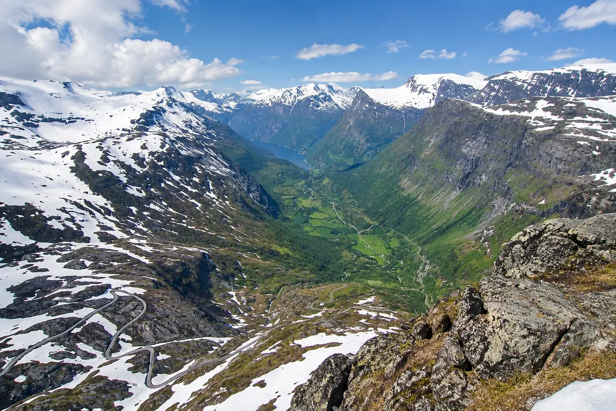
The viewpoint at the top of Mount Dalsnibba, at 1,476 metres above Geiranger: the Geiranger Skywalk platform displays the fjord below, the lakes, the glaciers and the winding road.

Art Nouveau Centre (Jugendstilsenteret)
Ålesund · Møre og Romsdal · Muzej

Art Nouveau Centre (Jugendstilsenteret)

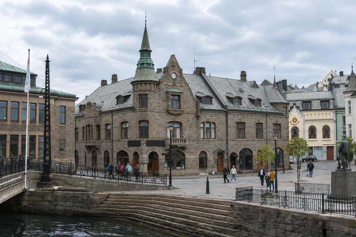
Ålesund's Art Nouveau center, in a former 1907 pharmacy by the Brosundet canal, with original interiors, an exhibition about the 1904 fire and the reconstruction, and the KUBE art museum next door.

Geiranger and Ålesund – prikaži dodatne kraje (7)
Atlanterhavsparken (Atlantic Sea Park)
Ålesund · Møre og Romsdal · Aquarium

Atlanterhavsparken (Atlantic Sea Park)

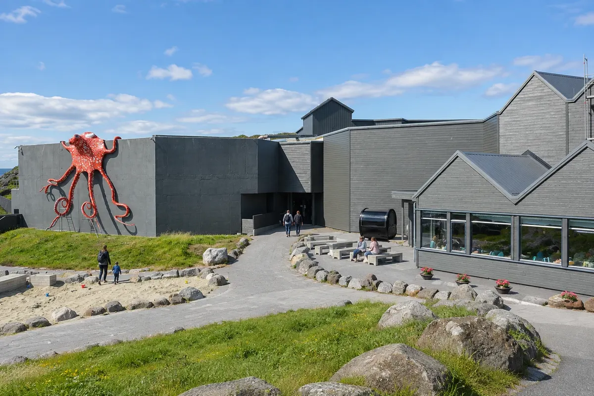
Ålesund's saltwater aquarium, in a cove 3 km from the center, with fish and marine life of the Norwegian coast, a large Atlantic tank, penguins and seaside trails.

Flydalsjuvet Viewpoint
Geiranger · Møre og Romsdal · Razgledišče

Flydalsjuvet Viewpoint

The viewpoint on road 63, above the village of Geiranger, with the classic high view of the fjord and a prominent rock jutting over the valley.

De syv søstrene (Seven Sisters)
Geiranger · Møre og Romsdal · Slap

De syv søstrene (Seven Sisters)

The Seven Sisters: seven waterfalls side by side that drop about 250 meters on the north shore of the Geirangerfjord, opposite the Pretender waterfall and the farm Skageflå.

Sunnmøre Museum
Ålesund · Møre og Romsdal · Open-air museum

Sunnmøre Museum

Open-air museum east of Ålesund centre, with old houses and boats from the Sunnmøre coast, replicas of Viking-age ships and the ruins of the medieval trading town of Borgund.

Ørnesvingen (Eagle Bend)
Geiranger · Møre og Romsdal · Razgledišče

Ørnesvingen (Eagle Bend)

The lookout on the Estrada da Águia, at the final hairpin of the road that descends in 11 turns down to Geiranger, with views of the fjord, the village and the Seven Sisters in the distance.

Trollstigen
Geiranger · Møre og Romsdal · Scenic road and viewpoint

Trollstigen

A Escada dos Trolls: the road that climbs in 11 tight hairpins up a mountain wall between Åndalsnes and Valldal, with the Stigfossen waterfall and viewing platforms at the top.

Norwegian Fjord Centre (Norsk Fjordsenter)
Geiranger · Møre og Romsdal · Visitor centre and museum

Norwegian Fjord Centre (Norsk Fjordsenter)

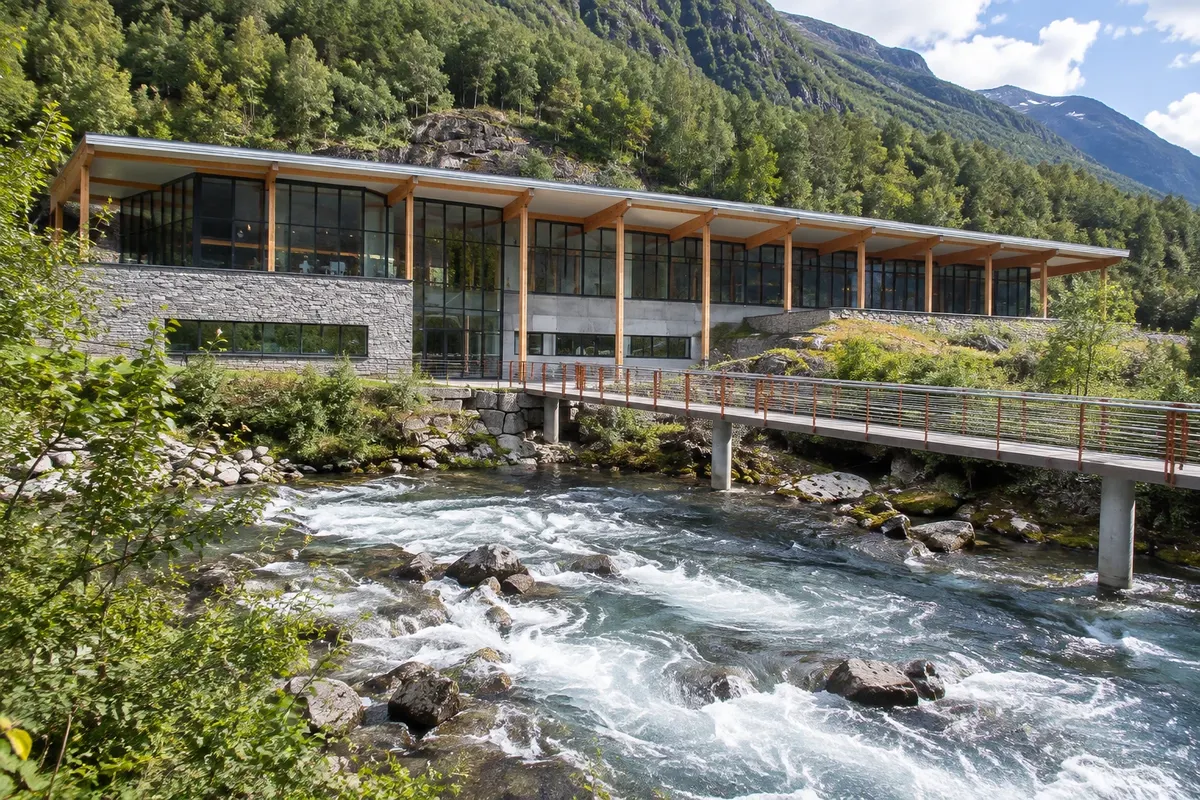
The fjord centre in Geiranger, above the village, with an exhibition about the World Heritage landscape, life on the mountainside farms and avalanches, and the stairway beside the Storfossen waterfall.

Kaj izbrati pred odhodom

Izleti – Geiranger and Ålesund

Izhodišče, trajanje, potek, vključene storitve in okvirna cena vsakega izleta.

Fjellstua

Odhod: Ålesund The staircase begins at Byparken, a 5-minute walk from the town center and the Brosund canal From 45 minutes to during the day, including the ascent via the staircase. during the day depending on the route chosen

Fjellstua is the viewpoint on Aksla hill, located behind Ålesund’s town center, at about 190 meters elevation. From there you can see the whole town spread across the islands of Aspøya, Nørvøya and Heissa, with the channels, the art nouveau downtown roofs, the harbour and, in the distance, the coastal islands and the peaks of the Sunnmøre Alps. The most traditional route is the staircase of 418 steps that starts in the city park, Byparken, near the statue of the Viking Rollo, traditionally named as the founder of Normandy and said to have been born in the region. The climb, amid trees and landings with benches, takes 15–20 minutes. By car, a road rises on the other side up to the parking area at the top.

Kraji na poti: Fjellstua.

Vključuje: Arrange access to the site and transport separately. Guided activities and tickets have their own conditions.

Nasvet: Climb the staircase and descend the same way, watching the town come into view. If you drive, walk down at least once: the landings offer different views.

Najboljši čas za obisk: in the late afternoon and evening, from May to August, when the light often lingers late over the sea

Jugendstilsenteret

Odhod: Ålesund It is on Apotekergata street, at the corner of the Brosundet canal, in central Ålesund From 1 to during the day for the center and the KUBE. during the day depending on the route chosen

The Jugendstilsenteret, the Art Nouveau Centre, tells the story that gave Ålesund its present centre. In January 1904 a fire destroyed almost the entire town, then made up of wooden houses, leaving thousands homeless. The rebuilding was done in stone and brick over about three years by Norwegian architects trained abroad, who used the period style, Art Nouveau, known as jugendstil in northern Europe. The centre occupies the building of the former Svaneapoteket pharmacy, from 1907, at the corner of the Brosundet canal. The ground floor preserves the original pharmacy, with counters, cabinets and bottles, and the pharmacist’s dining room, furnished and painted in the period style. An exhibition with a film shows the fire, the aid that arrived from other countries, including the German emperor Wilhelm II, and the reconstruction.

Kraji na poti: Jugendstilsenteret.

Vključuje: Arrange access to the site and transport separately. Guided activities and tickets have their own conditions.

Nasvet: Visit the center before walking around the town: after the exhibition, the details of the façades are easier to recognize. Look up at the corners of Kongens gate and Apotekergata.

Najboljši čas za obisk: All year round

Atlanterhavsparken

Odhod: Ålesund It is about 3 km west of Ålesund city center. 2 to 3 hours. during the day depending on the route chosen

Atlanterhavsparken is Ålesund’s aquarium, built in an inlet on Hessa island, west of the center, facing the open sea. It displays marine life from the Norwegian coast and the North Atlantic, with water pumped straight from the sea, and is one of the large saltwater aquariums in Scandinavia. The main tank, the Atlantic tank, holds about 4 million liters and recreates the seabed of the coast, with cod, flounder, rays, wolffish and schools of herring. Divers commonly feed the fish at scheduled times. Other tanks show fjord waters, cold-water coral reefs and the tidal area, where children can touch starfish and crabs.

Kraji na poti: Atlanterhavsparken.

Vključuje: Arrange access to the site and transport separately. Guided activities and tickets have their own conditions.

Nasvet: Walk back along the seafront to the center, passing the inlets of Aspøya island. If you are with children, start at the tidal pool area where they can touch the animals.

Najboljši čas za obisk: Open year-round

Sunnmøre Museum

Odhod: Ålesund It is in Borgund, about 5 km east of the center From during the day up to 2 hours. during the day depending on the route chosen

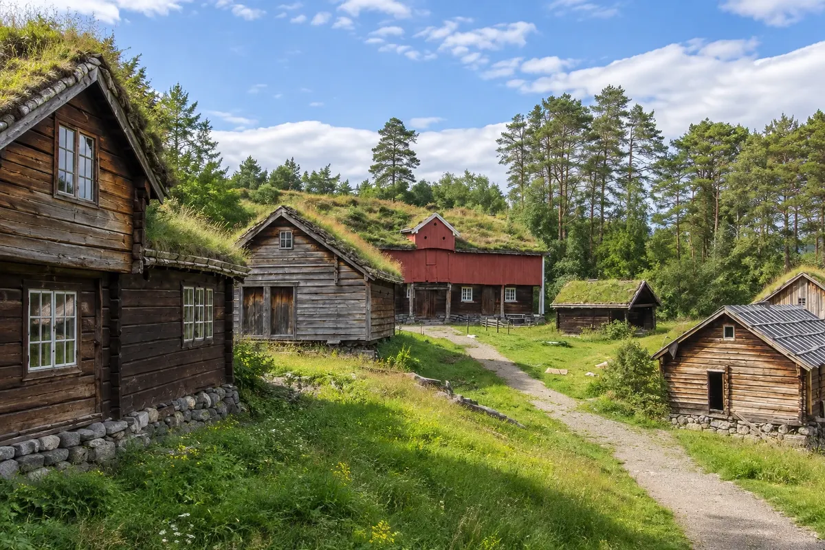
The Sunnmøre Museum is in Borgund, about 5 km east of Ålesund city center, on a fjord inlet. It is an open-air museum with dozens of old houses brought from the Sunnmøre region: log houses, storage buildings on stilts, boat sheds and a school, spread among meadows and paths that descend to the water. The most interesting part for those who enjoy seafaring is the boat collection. The sheds house traditional coastal vessels used for fishing and transport, and replicas of Viking Age ships, such as the Kvalsund boat, found in a peat bog in the region. Some boats usually sail in summer as part of demonstrations.

Kraji na poti: Sunnmøre Museum.

Vključuje: Arrange access to the site and transport separately. Guided activities and tickets have their own conditions.

Nasvet: Go first to the boat sheds and then to the houses. Combine it with Borgund Church, a few minutes away.

Najboljši čas za obisk: From June to August, when the houses are usually open and activities take place

Geirangerfjord

Odhod: Geiranger Boats depart from the Geiranger pier, in the center of the village, and from Hellesylt on the other shore About 1 hour by ferry between Geiranger and Hellesylt during the day depending on the route chosen

The Geirangerfjord is about 15 km long, from Hellesylt at the mouth to the village of Geiranger at the head, and is flanked by mountains rising above 1,400 meters. It was carved by glaciers and later flooded by the sea, and is one of two Norwegian fjords designated a UNESCO World Heritage Site, together with the Nærøyfjord. The most common way to see it is by boat. The ferry between Geiranger and Hellesylt takes about an hour and typically operates from May to September; there are also short boat tours of about 90 minutes that depart from Geiranger, and electric boats. Along the route are the Seven Sisters, the Suitor on the opposite side, and the Bridal Veil, as well as the farms of Skageflå and Knivsflå, clinging to the slopes, abandoned in the 20th century and now maintained by an association.

Kraji na poti: Geirangerfjord.

Vključuje: Arrange access to the site and transport separately. Guided activities and tickets have their own conditions.

Nasvet: If you’re driving, take the ferry between Hellesylt and Geiranger as part of your route rather than a round-trip sightseeing cruise. Stay on the right-hand side when leaving Hellesylt to see the Seven Sisters up close.

Najboljši čas za obisk: From May to September, with the ferry and excursions operating

Dalsnibba

Odhod: Geiranger From Geiranger, follow road 63 south for about 17 km to Lake Djupvatnet. About 1 hour at the top during the day depending on the route chosen

Dalsnibba is the peak at 1,476 meters altitude located south of Geiranger, atop the road that comes from Stryn and Lom. A private toll road, the Nibbevegen, climbs from Lake Djupvatnet in hairpin turns up the mountain to the top, where the Geiranger Skywalk viewing platform sits. From the top, the view drops down to the Geirangerfjord, about 1,400 meters below, passing the valley, the village and the mountain lakes. Surrounding peaks keep snow into summer and there are glaciers. The platform has glass edges and a railing, and there is a café and shop at the top.

Kraji na poti: Dalsnibba.

Vključuje: Arrange access to the site and transport separately. Guided activities and tickets have their own conditions.

Nasvet: Bring a jacket, hat and gloves even in July: it is cold and windy at the top. Stop at Flydalsjuvet on the ascent or descent, which is on the way.

Najboljši čas za obisk: On clear days, from June to September, when the road is usually open.

Prikaži dodatne izlete (5)

Flydalsjuvet

Odhod: Geiranger It’s on road 63, about 4 km from the village of Geiranger, heading toward Dalsnibb 15 to 30 minutes. during the day depending on the route chosen

Flydalsjuvet is the viewpoint on road 63, about 4 km from Geiranger toward Dalsnibba, roughly 300 meters above the fjord. From there you can see the village, the pier and the Geirangerfjord cutting between the mountains — the view that appears in many photos of the region. There are two observation platforms, designed for the National Tourist Routes, with railings and benches, linked by a path. The lower one sits on a protruding rock that juts out over the valley, and it’s where many people take photos. On the higher platform a stone chair, called the Queen’s Chair, commemorates Queen Sonja’s visit to the viewpoint.

Kraji na poti: Flydalsjuvet.

Vključuje: Arrange access to the site and transport separately. Guided activities and tickets have their own conditions.

Nasvet: Use both platforms: the lower one, on the rock, for the classic photo; the upper one for the wider view. Do not go past the railings.

Najboljši čas za obisk: Early morning or late afternoon, to avoid the buses and have the light on the fjord

De syv søstrene

Odhod: Geiranger By the Geiranger–Hellesylt ferry or on boat trips that depart from the village of Geiranger Boats pass by in a few minutes during the day depending on the route chosen

The Seven Sisters are a group of seven waterfalls that run side by side down the rock face on the north shore of the Geirangerfjord, about 6 km from the village. The tallest fall is about 250 meters, and all of them drop almost directly into the water, as white threads. The local name is De syv søstrene; the cliff is also called Knivsflåfossen, after the Knivsflå farm just above. On the opposite side of the fjord, almost opposite, is the Pretender waterfall, Friaren, which is shaped like a bottle. The legend says he tried to court the seven sisters, unsuccessfully, and turned to drinking. Nearby is the Bridal Veil, another thin waterfall that falls onto the rock.

Kraji na poti: De syv søstrene.

Vključuje: Arrange access to the site and transport separately. Guided activities and tickets have their own conditions.

Nasvet: On the ferry, stay on the Seven Sisters side: on the right when leaving Hellesylt, on the left when leaving Geiranger. If you want the view from above, the Skageflå hike is the best option.

Najboljši čas za obisk: from May to July, when the thaw usually fills the seven falls

Ørnesvingen

Odhod: Geiranger It is on road 63, about 7 km from the village of Geiranger, climbing in the direction of E 15 to 30 minutes. during the day depending on the route chosen

Ørnesvingen, the Eagle Bend, is the viewpoint on Ørnevegen, the Eagle Road, a section of road 63 that descends in 11 tight hairpins from the mountain down to the village of Geiranger, coming from the north, from Eidsdal. The viewpoint is at the highest bend, roughly 620 meters above sea level, and features a concrete-and-glass platform that projects over the hillside. From the platform you can see almost the entire Geirangerfjord: the village and quay below, the fjord stretching west between the mountains and, on clear days, the Seven Sisters far away on the north shore. The waterfall that falls beside the platform is part of the ensemble designed for the National Tourist Routes.

Kraji na poti: Ørnesvingen.

Vključuje: Arrange access to the site and transport separately. Guided activities and tickets have their own conditions.

Nasvet: Descend the Eagle Road (Estrada da Águia) leaving Eidsdal to arrive in Geiranger with the fjord ahead. Drive slowly and use the passing areas on the turns to let buses pass.

Najboljši čas za obisk: From May to September, early in the morning or late in the afternoon, with light on the fjord

Trollstigen

Odhod: Geiranger It is about during the day from Geiranger via road 63, with the Eidsdal–Linge ferry 1 to 2 hours at the top, including the viewing platforms and the visitor center during the day depending on the route chosen

Trollstigen is the mountain road that connects the Isterdalen valley, near Åndalsnes, to the plateau that descends toward Valldal and Geiranger. The best‑known section climbs a rock face with 11 tight hairpin turns, grades of about 9%, and the Stigfossen waterfall falling alongside, under a stone bridge. The road opened in 1936 after eight years of construction and is part of the National Tourist Routes. At the top, at roughly 850 m, there is a visitor center with a restaurant and shop, and a path leads to observation platforms of metal and concrete that jut out over the valley. From there you can see the road’s curves below, the waterfall, and the surrounding mountains, with names such as King, Queen and Bishop.

Kraji na poti: Trollstigen.

Vključuje: Arrange access to the site and transport separately. Guided activities and tickets have their own conditions.

Nasvet: Drive the route from south to north, from Geiranger to Åndalsnes, to descend the hairpins with the valley ahead. Stop at the top before descending, and do not stop on the road between the turns.

Najboljši čas za obisk: From June to September, when the road is usually open

Norsk Fjordsenter

Odhod: Geiranger It is on the hillside above Geiranger, about 1 km from the pier From 1 to during the day, with the stairway up to the village. during the day depending on the route chosen

The Norsk Fjordsenter, the Norwegian Fjord Centre, sits on a hillside above the village of Geiranger and serves as a museum and visitors’ centre for the West Norwegian Fjords World Heritage Site. The exhibition explains how glaciers carved the valleys and the sea filled them, and how people lived there over the centuries. One section shows life on the mountainside farms, such as Skageflå and Knivsflå, where families kept goats and farmed on terraces above the fjord, using stairs and ropes to transport children and animals. Another covers rock avalanches and the waves they cause, a key issue for the area, and the tourism that has reached Geiranger since the 19th century with the first ships.

Kraji na poti: Norsk Fjordsenter.

Vključuje: Arrange access to the site and transport separately. Guided activities and tickets have their own conditions.

Nasvet: Climb the stairway by the waterfall and return via the road, or vice versa. See the exhibition before doing the Skageflå trail: it explains what you will see.

Najboljši čas za obisk: From May to September, when it usually has extended hours

Po dnevih

Geiranger and Ålesund – načrt poti. Število dni: 1, 2in3

Predlogi za načrtovanje poti. Vrstni red dni prilagodite vremenu in razpoložljivosti izletov.

1 dni · Geiranger and Ålesund in 1 day

ZaTo organize visits by day, allowing time for travel. · Izhodišče:Ålesund, Geiranger
  1. Dan 1 · Fjellstua / Jugendstilsenteret

    In Ålesund, climb to the Aksla viewpoint and visit the Jugendstilsenteret. The town center façades help you recognize the Art Nouveau details explained in the museum.

2 dni · Geiranger and Ålesund in 2 days
ZaTo organize visits by day, allowing time for travel. · Izhodišče:Ålesund, Geiranger
  1. Dan 1 · Fjellstua / Jugendstilsenteret

    In Ålesund, climb to the Aksla viewpoint and visit the Jugendstilsenteret. The town center façades help you recognize the Art Nouveau details explained in the museum.

  2. Dan 2 · Geirangerfjorden / Norsk Fjordsenter

    This day is based in Geiranger and requires arriving in the village before the activities. Sail the fjord and visit the interpretation center; keep the transfer from Ålesund as a separate block.

3 dni · Geiranger and Ålesund in 3 days
ZaTo organize visits by day, allowing time for travel. · Izhodišče:Ålesund, Geiranger
  1. Dan 1 · Fjellstua / Jugendstilsenteret

    In Ålesund, climb to the Aksla viewpoint and visit the Jugendstilsenteret. The town center façades help you recognize the Art Nouveau details explained in the museum.

  2. Dan 2 · Geirangerfjorden / Norsk Fjordsenter

    This day is based in Geiranger and requires arriving in the village before the activities. Sail the fjord and visit the interpretation center; keep the transfer from Ålesund as a separate block.

  3. Dan 3 · Flydalsjuvet / Ørnesvingen

    Based in Geiranger, choose the viewpoints Flydalsjuvet and Ørnesvingen. The route follows roads on different sides of the village and works best with transport arranged in advance.

Najboljši čas za obisk

Kdaj se odpraviti:Geiranger and Ålesund po mesecih

From June to August the mountain roads, such as Dalsnibba and Trollstigen, are usually open, boats run more frequently and the days are long. The road season typically runs from May or June to October; check before you go. The waterfalls usually have more water in May and June. In winter Geiranger has few services and short days; Ålesund operates year-round.

The seasons shown are the most usual ones; nature doesn't always follow the calendar.

januar Veliko padavin

Winter · plan your travel

The monthly average at the reference station is usually around 3.2 °C. The normal monthly precipitation is about 149 mm, combining rain and snow as water equivalent. Cold tends to be persistent and days are usually short. Prioritize excursions with confirmed access for the period.

februar Veliko padavin

Winter · plan your travel

The monthly average at the reference station is usually around 2.6 °C. The normal monthly precipitation is about 130 mm, combining rain and snow as water equivalent. Cold tends to be persistent and days are usually short. Prioritize excursions with confirmed access for the period.

marec Veliko padavin

Spring · plan your travel

The monthly average at the reference station is usually around 3.8 °C. The normal monthly precipitation is about 128 mm, combining rain and snow as water equivalent. Daylight tends to increase over the season, while snow often remains in the mountains. High-altitude routes follow their own calendar.

april Zmerne padavine

Spring · plan your travel

The monthly average at the reference station is usually around 6.3 °C. The normal monthly precipitation is about 78 mm, combining rain and snow as water equivalent. Daylight tends to increase over the season, while snow often remains in the mountains. High-altitude routes follow their own calendar.

maj Zmerne padavine

Spring · long days

The monthly average at the reference station is usually around 9.2 °C. The normal monthly precipitation is about 75 mm, combining rain and snow as water equivalent. Daylight tends to increase over the season, while snow often remains in the mountains. High-altitude routes follow their own calendar.

junij Zmerne padavine

Summer · long days

The monthly average at the reference station is usually around 12.1 °C. The normal monthly precipitation is about 85 mm, combining rain and snow in water equivalent. The weather is typically mild and the days are usually very long. There is higher demand for outdoor tours; book reservations in advance.

julij Zmerne padavine

Summer · long days

The monthly average at the reference station is usually around 14.5 °C. The normal monthly precipitation is about 84 mm, combining rain and snow in water equivalent. The weather is typically mild and the days are usually very long. There is higher demand for outdoor tours; book reservations in advance.

avgust Veliko padavin

Summer · long days

The monthly average at the reference station is usually around 14.8 °C. The normal monthly precipitation is about 126 mm, combining rain and snow in water equivalent. The weather is typically mild and the days are usually very long. There is higher demand for outdoor tours; book reservations in advance.

september Veliko padavin

Autumn · plan your travel

The monthly average at the reference station is usually around 12.3 °C. The normal monthly precipitation is about 161 mm, combining rain and snow in water equivalent. Temperatures and daylight hours tend to fall. Long hikes and mountain transfers require planning before you set out.

oktober Veliko padavin

Autumn · plan your travel

The monthly average at the reference station is usually around 8.3 °C. The normal monthly precipitation is about 169 mm, combining rain and snow as water equivalent. Temperatures and day length tend to decrease. Long hikes and mountain transfers require planning before departure.

november Veliko padavin

Autumn · plan your travel

The monthly average at the reference station is usually around 5.7 °C. The normal monthly precipitation is about 149 mm, combining rain and snow as water equivalent. Temperatures and day length tend to decrease. Long hikes and mountain transfers require planning before departure.

december Veliko padavin

Winter · plan your travel

The monthly average at the reference station is usually around 3.5 °C. The normal monthly precipitation is about 176 mm, combining rain and snow as water equivalent. Cold tends to be persistent and days are usually short. Prioritize excursions with confirmed access for the period.

Načrtujte pot

Kako do tja:Geiranger and Ålesund

Public transport and reservations

Check train, bus and boat connections to Ålesund for your travel date. Verify each leg and the return connection before combining different services. On boat routes, confirm the pier and the direction of travel.

Car and local travel

Not within the city, which is done on foot and by bus. A car is helpful for Geiranger, the Trollstigen and the coastal islands; without one, there are buses and tours in summer.

Pred odhodom

Praktične informacije

Z nekaj načrtovanja boste imeli več časa za uživanje na poti.

Kdaj se odpraviti

From June to August the mountain roads, such as Dalsnibba and Trollstigen, are usually open, boats run more frequently and the days are long. The road season typically runs from May or June to October; check before you go. The waterfalls usually have more water in May and June. In winter Geiranger has few services and short days; Ålesund operates year-round.

The seasons shown are the most usual ones; nature doesn't always follow the calendar.

Koliko dni ostati

Two days in Ålesund and one in Geiranger, with an overnight in the village, allow you to see the fjord without rushing. With a car, add a day for Trollstigen and the Estrada da Águia. If short on time, people do Geiranger as a day trip from Ålesund, but the journey takes up much of the day.

V katerem mestu prenočiti

In Ålesund, the art nouveau centre around the Brosundet canal has hotels in historic buildings, close to the harbour and Aksla. In Geiranger, hotels and campsites are in the village and on the slopes, and fill up in summer. Hellesylt, at the other end of the fjord, and Valldal, on the way to Trollstigen, offer quieter guesthouses.

Spoštujte kraj

Odnesite svoje odpadke, upoštevajte oznake in podprite lokalne ponudnike. V naravi upoštevajte navodila za obiskovalce.

Odgovori na vaša vprašanja

Pogosta vprašanja – Geiranger and Ålesund

Can you do Geiranger as a day trip from Ålesund?

Yes, by car, bus or tour, but it's about three hours each way. An overnight in the village lets you visit the viewpoints early and see the fjord without the day-trip crowds.

Do I need a car?

A car is very helpful for reaching the viewpoints and Trollstigen. Without one, there are scheduled buses and tours in season, the fjord boats and the Hurtigruten in summer.

When do the mountain roads open?

Dalsnibba road and Trollstigen usually open between May and June and close in October, depending on snow. Check before you go.

Does the Hurtigruten pass by Geiranger?

In the summer season, the ship often diverts via the Geirangerfjord on its northbound route. Confirm dates before booking.

Why does Ålesund have art nouveau buildings?

The town was destroyed by a fire in 1904 and rebuilt between 1904 and 1907 in the period style of art nouveau, known as jugendstil in Norway.

Odkrijte druge destinacije Iskanje po zvezni državi in mestu

Več kot vodnik