Atlanterhavsveien
Odhod: Molde It’s about a 1-hour drive from Molde via road 64, heading toward Kristiansund. 1 to 2 hours including stops during the day depending on the route chosen
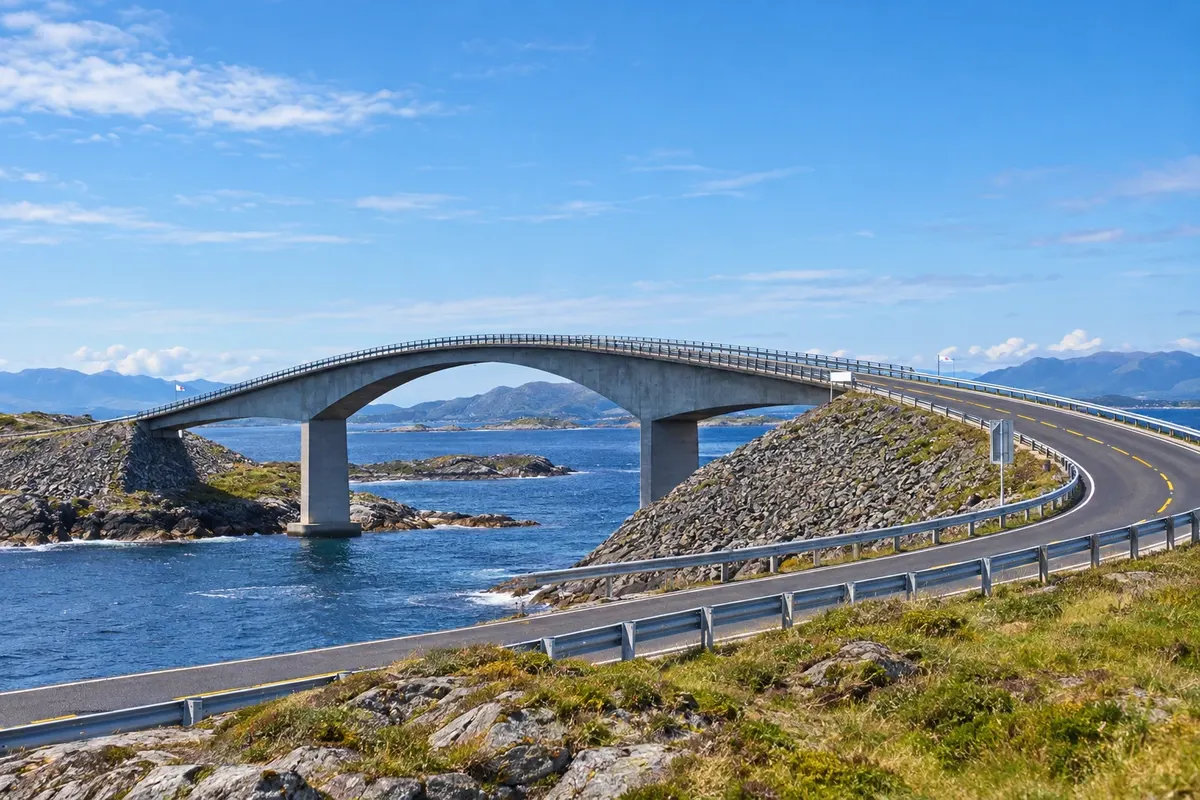
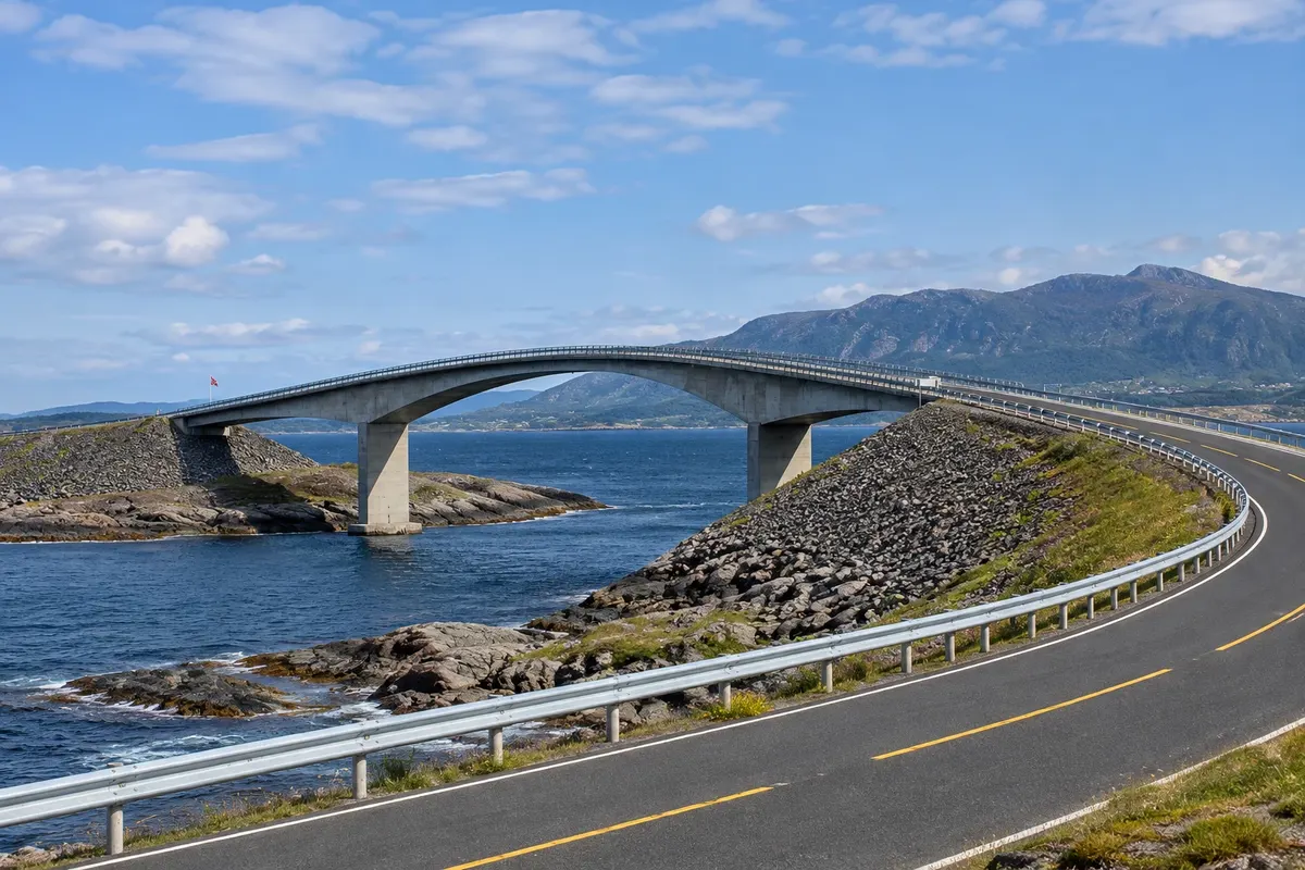
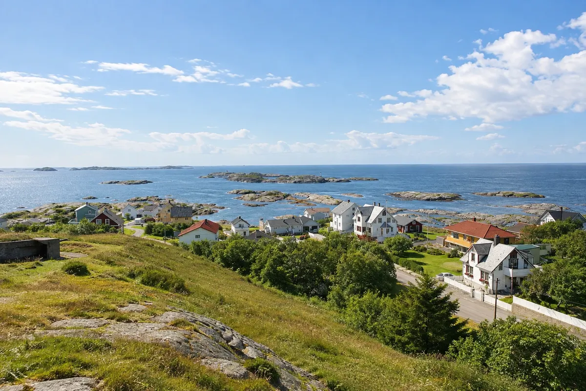
The Atlanterhavsveien, the Atlantic Road, is part of road 64 and links the mainland at Vevang to the island of Averøy, passing a string of islets and reefs at the mouth of Hustadvika, an exposed stretch of sea off the coast of Møre og Romsdal. It is 8.3 km of causeways and eight bridges that rise and fall over the water, with the ocean on one side and islands and mountains on the other.
The best-known bridge is Storseisundet, the largest, at about 260 meters and with a curve that, seen from certain angles, seems to end in midair. It’s the image that appears in photos of the road and in car advertisements. The other bridges are smaller, and between them there are stopping areas with parking.
Kraji na poti: Atlanterhavsveien.
Vključuje: Arrange access to the site and transport separately. Guided activities and tickets have their own conditions.
Nasvet: Stop at Eldhusøya and walk the boardwalk before continuing. For the classic Storseisundet photo, use the parking area on the Averøy side. Combine it with Bud and Trollkirka on the same day.
Najboljši čas za obisk: June to August, on clear and calmer days, for the stops and the boardwalk
Varden
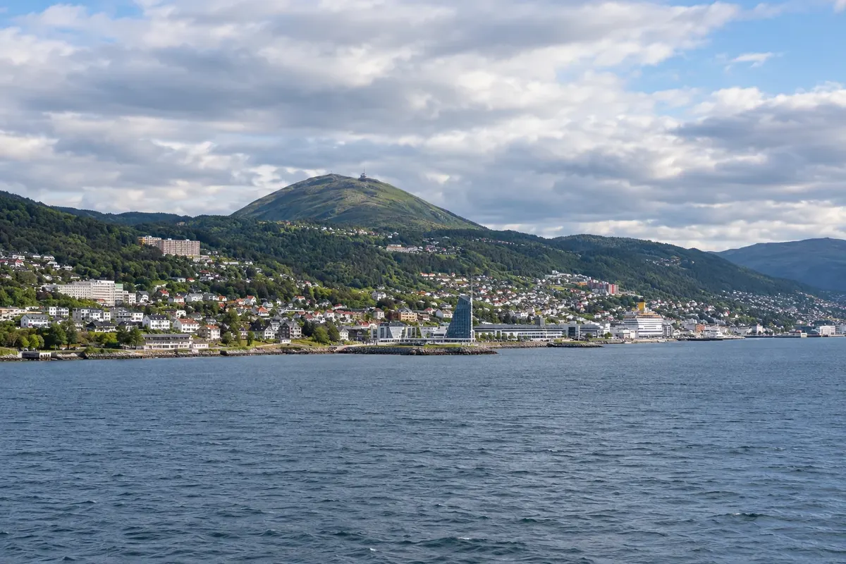
Odhod: Molde The trail starts in central Molde, near the city park, and climbs for about 1 to 2 hours, including the uphill walk during the day depending on the route chosen
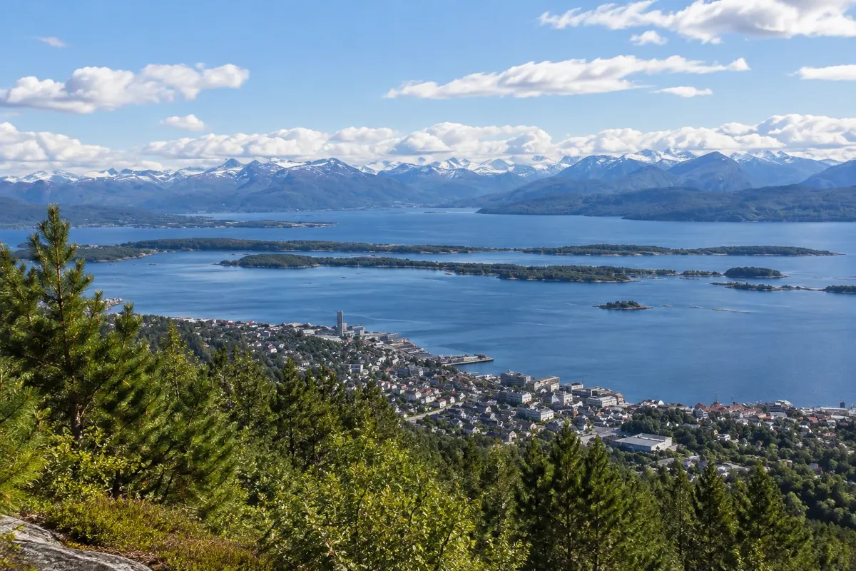
Varden is the hill behind central Molde, at about 400 meters altitude, and the place from which you see the Moldepanoramaet, Molde’s panorama. From the viewpoint, the view opens onto the Romsdalsfjord and the row of mountains on the other side, where 222 peaks are counted, many with snow into early summer, including those of Romsdal near Åndalsnes.
Below you can see the town, the harbor, the fjord islands and, to the west, the sea. There is a restaurant and café at the top, with a terrace, and signs identifying the main peaks. The path also passes lakes and birch woods, used by locals for walks and skiing in winter.
Kraji na poti: Varden.
Vključuje: Arrange access to the site and transport separately. Guided activities and tickets have their own conditions.
Nasvet: Bring a jacket and check the forecast beforehand: the view depends on clear weather. Use the viewpoint signs to identify the peaks.
Najboljši čas za obisk: In clear weather, from May to September
Romsdalsmuseet
Odhod: Molde It lies west of Molde, about a 15-minute walk from the centre From during the day up to 2 hours. during the day depending on the route chosen
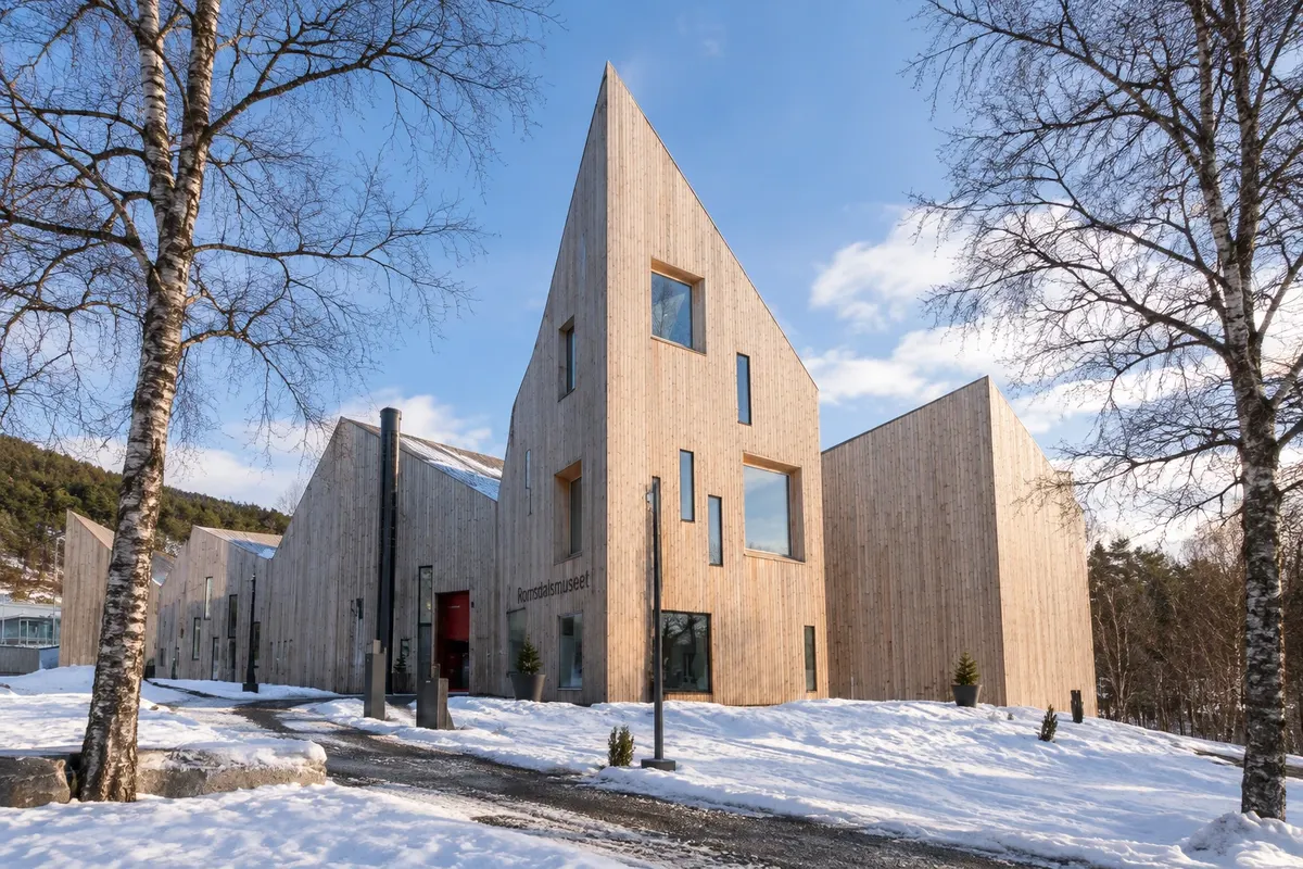
Romsdalsmuseet is Molde’s open-air museum, with dozens of old buildings brought from across Romsdal and reconstructed in a hillside park on the west side of town. They include farmhouses, barns, stilted storehouses, a school, fishermen’s houses and a small wooden church, a replica of an older model used for weddings.
Part of the site recreates the street of an early 20th-century village, the Bygata, with shops and artisans’ and merchants’ houses, as it was in small coastal towns of that era. The indoor exhibitions display bunad, the region’s folk costumes, tools, furniture and the history of life in the fjord.
Kraji na poti: Romsdalsmuseet.
Vključuje: Arrange access to the site and transport separately. Guided activities and tickets have their own conditions.
Nasvet: Start at the Bygata, the village street, then walk up past the farms. Ask about the folk dance schedule in summer.
Najboljši čas za obisk: From June to August, when the houses are usually open and activities take place
Trollkirka
Odhod: Molde It is beside road 64, about 30 km north of Molde, roughly 30 minutes About 2 to 3 hours round trip, including the visit to the main cave. during the day depending on the route chosen
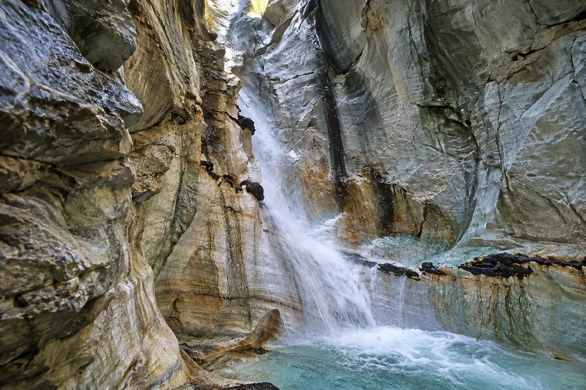
Trollkirka, the Church of the Trolls, is a group of three marble caves on a slope of the Romsdal peninsula, about 30 km north of Molde, on the way to the Atlantic Road. The name comes from the shape of the main cave, tall like a church nave, and from legends about trolls said to live in the mountains.
The trail starts from a parking area by road 64 and climbs through forest and slope for about an hour, with sections of rock and roots. The first cave, the largest, has a waterfall that falls through an opening in the roof and runs over the white marble into a pool. Inside, the floor is stone and water flows continuously, and a flashlight is needed to see the walls.
Kraji na poti: Trollkirka.
Vključuje: Arrange access to the site and transport separately. Guided activities and tickets have their own conditions.
Nasvet: Bring a torch, a jacket and hiking shoes with good grip. Combine it with the Atlantic Road and Bud on the same day.
Najboljši čas za obisk: From June to September, when the trail is usually snow-free
Bud
Odhod: Molde It’s about 50 km from Molde, roughly a 45-minute drive via road 64 and a 1 to 2 hours. during the day depending on the route chosen
Bud is a fishing village on the tip of the Romsdal peninsula, facing the Hustadvika, a stretch of open sea that is shallow and full of reefs, about 50 km from Molde. In the Middle Ages, Bud was one of the main fish trading posts between Bergen and Trondheim.
Today’s village is small, with painted wooden houses, a harbour with fishing boats, warehouses and a fish restaurant. The wooden church, dated 1717 and painted white, stands uphill, with the cemetery facing the sea. Paths lead to viewpoints on the coastal rocks, where you can see the sequence of islets and reefs that continues to the Atlantic Road.
Kraji na poti: Bud.
Vključuje: Arrange access to the site and transport separately. Guided activities and tickets have their own conditions.
Nasvet: Do the Molde–Bud–Atlantic Road route along the coastal road, with a stop for fish lunch at the harbor.
Najboljši čas za obisk: June to August, with the harbor busy and long daylight hours


 Brazilija
 Antarktika
 Argentina
 Bolivija
 Čile
 Kolumbija
 Ekvator
 Gvajana
 Francoska Gvajana
 Falklandski otoki (Malvini)
 Paragvaj
 Peru
 Surinam
 Urugvaj
 Venezuela
 Nemčija
 Avstrija
 Belgija
 Hrvaška
 Danska
 Slovaška
 Slovenija
 Španija
 Finska
 Francija
 Grčija
 Nizozemska
 Madžarska
 Irska
 Islandija
 Italija
 Luksemburg
 Poljska
 Portugalska
 Združeno kraljestvo
 Češka
 Švedska
 Švica
 Turčija
 Bermudi
 Kanada
 Združene države Amerike
 Grenlandija
 Mehika
 Sveta Peter in Mihael
 Dominikanska republika
 Japonska
 Južnoafriška republika
 Egipt
 Avstralija
 Fidži
 Nova Zelandija
 Papua Nova Gvineja